Dellslow, West Virginia
| Dellslow, West Virginia | |
|---|---|
| Unincorporated community | |
 Dellslow, West Virginia  Dellslow, West Virginia | |
| Coordinates: 39°36′25″N 79°53′31″W / 39.60694°N 79.89194°WCoordinates: 39°36′25″N 79°53′31″W / 39.60694°N 79.89194°W | |
| Country | United States |
| State | West Virginia |
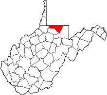
| County | Monongalia |
| Elevation | 978 ft (298 m) |
| Time zone | Eastern (EST) (UTC-5) |
| • Summer (DST) | EDT (UTC-4) |
| ZIP code | 26531 |
| Area code(s) | 304 & 681 |
| GNIS feature ID | 1554284[1] |
Dellslow is an unincorporated community in Monongalia County, West Virginia, United States. Dellslow was established in 1798 and is located along West Virginia Route 7 near the southern border of Brookhaven. Dellslow has a post office with ZIP code 26531.[2]
The community derives its name from Fredelsloh, Germany, the hometown of an early settler.[3]
Climate
The climate in this area has mild differences between highs and lows, and there is adequate rainfall year round. According to the Köppen Climate Classification system, Dellslow has a marine west coast climate, abbreviated "Cfb" on climate maps.[4]
References
- ↑ "US Board on Geographic Names". United States Geological Survey. 2007-10-25. Retrieved 2008-01-31.
- ↑ ZIP Code Lookup
- ↑ Kenny, Hamill (1945). West Virginia Place Names: Their Origin and Meaning, Including the Nomenclature of the Streams and Mountains. Piedmont, WV: The Place Name Press. p. 205.
- ↑ Climate Summary for Dellslow, West Virginia
This article is issued from Wikipedia - version of the 7/28/2016. The text is available under the Creative Commons Attribution/Share Alike but additional terms may apply for the media files.