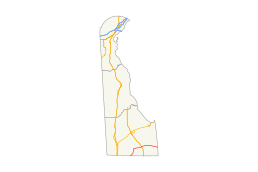
Delaware Route 26
| ||||
|---|---|---|---|---|
 | ||||
| Route information | ||||
| Maintained by DelDOT | ||||
| Length: | 23.15 mi[1] (37.26 km) | |||
| Existed: | 1936[2] – present | |||
| Major junctions | ||||
| West end: |
| |||
|
| ||||
| East end: | Dead end on Atlantic Ocean in Bethany Beach | |||
| Location | ||||
| Counties: | Sussex | |||
| Highway system | ||||
| ||||

Delaware Route 26 (DE 26) is a state highway in Sussex County, Delaware. The route's western terminus is at an intersection with Maryland Route 353 (MD 353) and DE/MD 54 at the Maryland border south of Gumboro and its eastern terminus is at a dead end on the Atlantic Ocean in Bethany Beach, even though signage ends at the DE 1 intersection. The route passes through rural areas of southeastern Sussex County along with the communities of Dagsboro, Millville, Ocean View and Bethany Beach. DE 26 intersects DE 30 and DE 54 in the Gumboro area, U.S. Route 113 (US 113) and DE 20 in Dagsboro, and DE 17 west of Millville. The road was built as a state highway in various stages during the 1920s and 1930s. By 1936, DE 26 was assigned onto its current alignment.
Route description

DE 26 begins at the Maryland border at an intersection where DE/MD 54 runs west along the state line and MD 353 continues south into Maryland. From the state line, DE 26 heads northeast on two-lane undivided Millsboro Highway concurrent with DE 54. The two routes pass through agricultural areas with some woods and homes, intersecting DE 30. At this point, DE 30 turns northeast to form a concurrency with DE 26/DE 54. The road curves north and heads into the residential community of Gumboro, where DE 54 turns to the east. DE 26/DE 30 leaves Gumboro and continues back into areas of farms and forests with occasional residences.[3][4]
In Shaft Ox Corner, DE 26 splits from DE 30 by turning east onto Nine Foot Road. The route continues east through rural land to an intersection with US 113. Past this intersection, the road becomes Clayton Street and enters Dagsboro, passing homes and businesses and crossing Norfolk Southern's Indian River Secondary railroad line. In the center of Dagsboro, DE 26 comes to an intersection with DE 20, at which point it turns south to form a concurrency with DE 20 on Main Street. The two routes curve east and leave town on Vines Creek Road.[3][4]
Upon leaving Dagsboro, the road passes to the south of Prince George's Chapel and DE 20 splits from DE 26 by heading southeast on Armory Road. DE 26 continues east on Vines Creek Road, passing through a mix of farmland and woodland with some residential and commercial development. The route turns southeast and comes to the community of Clarksville, where it turns east onto Atlantic Avenue. Farther along, the road comes to an intersection with the northern terminus of DE 17. After the DE 17 junction, DE 26 continues into Millville and runs through residential and commercial areas. The road continues east through Ocean View before it crosses the Assawoman Canal into Bethany Beach and becomes Garfield Parkway. The road gains a center left-turn lane and intersects DE 54 Alt. before coming to a junction with DE 1, at which point DE 26 signage ends. DE 26 officially continues east on four-lane divided Garfield Parkway through the commercial center of Bethany Beach, ending at a dead end at the Bethany Beach Boardwalk on the Atlantic Ocean.[3][4]
DE 26 has an annual average daily traffic count ranging from a high of 16,225 vehicles at Central Avenue intersection in Ocean View to a low of 3,837 vehicles at the west end of the DE 20 concurrency in Dagsboro.[1] None of DE 26 is part of the National Highway System.[5]
History
By 1920, what is now DE 26 existed as an unimproved county road.[6] The route was upgraded to a state highway between present-day US 113 and Dagsboro and from Millville to just west of the Assawoman Canal by 1924.[7] A year later, the road was completed as a state highway between Gumboro and Mission and between Dagsboro and Vines Creek, with the route between the Maryland border and Gumboro and the incomplete sections between Dagsboro and Bethany Beach proposed as a state highway.[8] The proposed segments were completed by 1931.[9] In 1932, the state highway between Shaft Ox Corner and Dagsboro was completed.[10] DE 26 was assigned to its current alignment between the Maryland border south of Gumboro and Bethany Beach, where it intersected the southern terminus of DE 14 (now part of DE 1), by 1936.[2] In 2014, work began to widen DE 26 between Clarksville and the Assawoman Canal from a two-lane road to a three-lane road with a center left-turn lane and bike lanes in order to reduce traffic congestion. The widening project, which is to cost $57 million, is expected to be finished in 2017.[11]
Major intersections
The entire route is in Sussex County.
| Location | mi[1] | km | Destinations | Notes | |
|---|---|---|---|---|---|
| Gumboro | 0.00 | 0.00 | Maryland state line, western terminus, west end of DE 54 overlap | ||
| 0.83 | 1.34 | West end of DE 30 overlap | |||
| 2.37 | 3.81 | East end of DE 54 ovelap | |||
| Shaft Ox Corner | 5.68 | 9.14 | East end of DE 30 ovelap | ||
| Dagsboro | 11.28 | 18.15 | |||
| 12.09 | 19.46 | West end of DE 20 overlap | |||
| 12.62 | 20.31 | East end of DE 20 overlap | |||
| Millville | 18.83 | 30.30 | |||
| Bethany Beach | |||||
| 22.91 | 36.87 | Eastern terminus of DE 26 signage | |||
| 23.15 | 37.26 | Dead end at Atlantic Ocean | Eastern terminus | ||
1.000 mi = 1.609 km; 1.000 km = 0.621 mi
| |||||
See also
 U.S. Roads portal
 Delaware portal
References
- 1 2 3 Staff (2011). "Traffic Count and Mileage Report: Interstate, Delaware, and US Routes" (PDF). Delaware Department of Transportation. Retrieved May 17, 2012.
- 1 2 Delaware State Highway Department; The National Survey Co. (1936). Official Road Map of the State of Delaware (PDF) (Map) (1936–37 ed.). Dover: Delaware State Highway Department. Retrieved November 24, 2015.
- 1 2 3 Delaware Department of Transportation (2008). Delaware Official Transportation Map (PDF) (Map). Dover: Delaware Department of Transportation. Retrieved November 24, 2015.
- 1 2 3 Google (August 25, 2010). "overview of Delaware Route 26" (Map). Google Maps. Google. Retrieved August 25, 2010.
- ↑ National Highway System: Delaware (PDF) (Map). Federal Highway Administration. 2010. Retrieved February 10, 2012.
- ↑ Delaware State Highway Department (1920). Official Road Map (PDF) (Map). Dover: Delaware State Highway Department. Retrieved November 24, 2015.
- ↑ Delaware State Highway Department (1924). Official Road Map (PDF) (Map). Dover: Delaware State Highway Department. Retrieved November 24, 2015.
- ↑ Delaware State Highway Department (1925). Official Road Map (PDF) (Map). Dover: Delaware State Highway Department. Retrieved November 24, 2015.
- ↑ Delaware State Highway Department (1931). Official Road Map of the State of Delaware (PDF) (Map). Dover: Delaware State Highway Department. Retrieved November 24, 2015.
- ↑ "Annual Report of the State Highway Department" (PDF) (1932 ed.). Dover, Delaware: Delaware State Highway Department. December 31, 1932: 31. Retrieved November 19, 2014.
- ↑ "Construction Underway on Three-Year SR 26 Improvements Project". State of Delaware. March 13, 2014. Retrieved October 25, 2014.
External links
 Media related to Delaware Route 26 at Wikimedia Commons