U.S. Route 113
| |||||||
|---|---|---|---|---|---|---|---|
|
A map of Maryland and Delaware showing major roads with US 113 in red | |||||||
| Route information | |||||||
| Auxiliary route of US 13 | |||||||
| Maintained by MDSHA and DelDOT | |||||||
| Length: | 74.75 mi[1][2][3] (120.30 km) | ||||||
| Existed: | 1926[4] – present | ||||||
| Tourist routes: |
| ||||||
| Major junctions | |||||||
| South end: |
| ||||||
|
| |||||||
| North end: |
| ||||||
| Location | |||||||
| States: | Maryland, Delaware | ||||||
| Counties: |
MD: Worcester DE: Sussex, Kent | ||||||
| Highway system | |||||||
| |||||||

_map.svg.png)
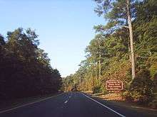
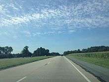
U.S. Route 113 (US 113) is a spur of US 13 in the U.S. states of Maryland and Delaware. The U.S. Highway runs 74.75 miles (120.30 km) from US 13 in Pocomoke City, Maryland north to Delaware Route 1 (DE 1) in Milford, Delaware. In conjunction with DE 1, US 113 is one of two major north–south highways on the Delmarva Peninsula (with US 13) that connect Dover with Pocomoke City and the Eastern Shore of Virginia. The U.S. Highway is the primary north–south highway in Worcester County, Maryland, where it connects Pocomoke City with Snow Hill and Berlin. US 113 is one of three major north–south highways in Sussex County, Delaware, where it connects Selbyville and Georgetown with Milford. While US 113 does not pass through Ocean City or the Delaware beaches, the U.S. Highway intersects several highways that serve the Atlantic Ocean resorts, including US 50, Maryland Route 90 (MD 90), US 9, and DE 1. US 113 is a four-lane divided highway for its whole length except for between Snow Hill and Berlin, where it is a two-lane undivided road.
US 113 follows the corridor of a post road established in the late 18th century to connect the aforementioned towns on the Delmarva Peninsula with Wilmington and Philadelphia. The highway was improved as an all-weather road in the 1910s. In Maryland, the post road was designated one of the original state roads established by the Maryland State Roads Commission (MDSRC) in 1909. In Delaware, the highway was the Selbyville–Dover portion of the DuPont Highway, a roadway whose construction was a grand philanthropic measure of Thomas Coleman DuPont. The DuPont Highway, which was started by DuPont's company and finished by the Delaware State Highway Department (DSHD), spurred economic growth in the tourism and agriculture sectors in southern Delaware. The economic growth resulted in heavy traffic; US 113 was widened in both states in the early 1930s and again in the late 1940s. Bypasses of Dover and Pocomoke City were built in the mid-1930s; the bypassed section of highway in Dover became US 113 Alternate.
Expansion of US 113 to a divided highway began in the 1950s in Dover. Much of the remainder of the U.S. Highway in Delaware was expanded in the 1960s; the final section of two-lane US 113 in that state was expanded in the mid-1990s. The Berlin bypass became the first section of US 113 in Maryland to be expanded to a divided highway in the mid-1950s. In the early 1970s, US 113 between Pocomoke City and Snow Hill was expanded to a divided highway and the Snow Hill bypass was constructed, replacing what would become US 113 Business. The U.S. Highway between Berlin and the Delaware state line was expanded to a divided highway around 2000. The Maryland State Highway Administration (MDSHA) is upgrading the last remaining two-lane portions of US 113 between Snow Hill and Berlin to a four-lane divided highway. US 113's northern terminus was moved to Milford in 2004 after the U.S. Highway was superseded by DE 1 from Milford to Dover. The Delaware Department of Transportation (DelDOT) plans to upgrade US 113 to a freeway from Selbyville to Ellendale; a freeway bypass of Milford was cancelled in 2008 because of community opposition.
Route description
US 113 has a length of 37.49 miles (60.33 km) in Maryland. Known as Worcester Highway, the highway runs from its southern terminus in Pocomoke City north to the Delaware state line via Snow Hill and Berlin in Worcester County.[1][5] In Delaware, US 113 is named Dupont Boulevard and extends 37.26 miles (59.96 km) from the Maryland state line at Selbyville north to its northern terminus in Milford via Georgetown in Sussex County and a small portion of Kent County.[2][3][5] All of US 113 is part of the National Highway System.[6][7]
Pocomoke City to Snow Hill
US 113 begins in Pocomoke City at an intersection with US 13 (Ocean Highway), the main highway of the Delmarva Peninsula that connects Wilmington and Dover with Salisbury and Norfolk. Old Virginia Road (unsigned MD 250A), a section of old alignment of US 113, continues west to US 13 Business (Market Street). US 13 Business heads north through the Pocomoke City Historic District, which preserves buildings from Pocomoke City's late 19th century and early 20th century heyday as a river port and station on the main rail line of the Delmarva Peninsula.[8] Just north of US 13, US 113 intersects American Legion Drive (unsigned MD 359B), which leads to MD 359 (Bypass Road), another section of the old alignment of the U.S. Highway.[1][5] The U.S. Route leaves the Pocomoke City area after intersecting MD 756 (Old Snow Hill Road), the original alignment of US 113.[1][5]
US 113 heads northeast as a four-lane divided highway. The U.S. Highway parallels the east bank of the Pocomoke River at a distance of about 1 mile (1.6 km); the highway crosses many streams that drain into the river, including Pilchard Creek, Bachelors Branch, Mataponi Creek, Corkers Creek, and Hardship Branch. US 113 passes through Pocomoke State Forest, which preserves bald cypress swamps and loblolly pine stands along the Maryland Scenic and Wild River, and by the Shad Landing unit of Pocomoke River State Park.[9] About 1 mile (1.6 km) north of the entrance to the state park, US 113 Business (Market Street) splits to the northeast to directly serve the town of Snow Hill, which is the county seat of Worcester County. US 113 Business passes through the Snow Hill Historic District, which contains several museums and preserves colonial era buildings of the river port at the head of navigation of the Pocomoke River.[10] US 113 bypasses the town to the east and intersects MD 12 (Snow Hill Road), which connects Snow Hill with Salisbury and Stockton, and MD 365 (Public Landing Road). The MD 365 junction is a superstreet intersection, in which MD 365 traffic must turn right, use U-turn ramps along US 113, and turn right again to continue on MD 365. After the intersection with MD 365, the highway turns north, reduces to a two-lane highway, and crosses Purnell Branch of the Pocomoke River. US 113 crosses the Snow Hill Line of the Maryland and Delaware Railroad at grade and turns northeast again as the highway receives the other end of US 113 Business.[1][5]
Snow Hill to Berlin
Between Snow Hill and Berlin, US 113 is a two-lane road currently being reconstructed as a four-lane divided highway from the Berlin end. As of October 2010, the highway is under construction from Massey Branch of Marshall Creek to Goody Hill Road between Newark and Ironshire, where the highway presently expands to a divided highway.[11] The U.S. Highway traverses Five Mile Branch of the Pocomoke River before the highway veers away from that river and passes into the Atlantic Ocean watershed. Further north, US 113 crosses Massey Branch and Poplartown Branch of Beaverdam Creek, which flow into Newport Bay. The U.S. Highway parallels and then intersects the Snow Hill Line at grade and passes by the communities of Newark and Ironshire, which are served by sections of old alignment named Newark Road and Shire Drive, respectively. Newark is home to the Queponco Railway Station, a preserved Pennsylvania Railroad station. Ironshire contains the historic home Simpson's Grove.[1][5]
US 113 passes the historic plantation home Merry Sherwood before reaching the intersection with MD 818 (Main Street) just south of Berlin. MD 818, the old alignment of US 113, heads north through the Berlin Commercial District, which contains several museums and preserves buildings from the late 19th century when Berlin was at the intersection of two railroad lines.[12] US 113 bypasses Berlin to the east, where the highway intersects MD 376 (Assateague Road) and MD 346 (Old Ocean City Boulevard), the old alignment of US 50, and passes the historic home Caleb's Discovery. The U.S. Route intersects US 50, which connects Ocean City with Salisbury and the Chesapeake Bay Bridge, at a cloverleaf interchange just south of the northern end of MD 818, which the highway meets while it parallels the Snow Hill Line.[1][5]
Berlin to Selbyville
North of Berlin, US 113 is a four-lane divided highway that crosses several creeks that come together to form the St. Martin River, which empties into Isle of Wight Bay, a lagoon on the west side of Ocean City. The first of three sections of old alignment of US 113 north of Berlin, MD 575 (Worcester Highway), splits to the northeast toward Friendship at a right-in/right-out interchange with the northbound direction. The U.S. Highway leaves the railroad track and meets MD 90 (Ocean City Expressway) at a partial cloverleaf interchange; MD 90 connects the northern part of Ocean City with US 50 west of Berlin. US 113 continues north to its interchange with the northern end of MD 575 and MD 589 (Racetrack Road), which leads to Ocean Pines and Ocean Downs, a harness racing track with a slot machine casino that opened in January 2011.[13] The exit ramp from northbound US 113 intersects MD 575 a short distance south of its intersection with MD 589. Another segment of old alignment serves properties and St. Martin's Episcopal Church between the exit and entrance ramps from southbound US 113.[14] A third section of old alignment parallels the southbound side of the divided highway through Showell. US 113 intersects MD 367 (Bishopville Road) in Bishop, crosses the Snow Hill Line at grade at an oblique angle, and intersects the east end of MD 610 (Whaleyville Road) before the highway enters Delaware.[1][5]
Selbyville to Georgetown
US 113 enters Sussex County to the east of the Great Cypress Swamp in the town of Selbyville, where the highway intersects DE 54 (Cemetery Road/Cypress Road), which heads east to Fenwick Island. Between Selbyville and Georgetown, the U.S. Highway passes to the west of several towns formed where the original post road crossed streams that flow into the Indian River, such as Frankford on Vines Creek. US 113 intersects DE 26 (Clayton Street/Nine Foot Road), which heads east to Bethany Beach, in Dagsboro, which was settled at the site of a gristmill on Pepper Creek and is home to Prince George's Chapel.[15] The route crosses several branches of the Indian River before intersecting DE 20 (Dagsboro Road), which joins the U.S. Highway in a concurrency. The two highways parallel Delaware Avenue, the old alignment of DE 20, as they pass through the fringe of Millsboro, which was founded at the head of navigation of the Indian River. US 113 intersects DE 24 and DE 30 (Washington Street/Laurel Road) on the west side of town. After crossing Betts Pond, DE 20 splits to the northwest as Hardscrabble Road as US 113 itself turns northwest toward the hamlet of Stockley.[2][5]
North of Stockley, US 113 intersects DE 24 Alternate (Speedway Road) adjacent to Georgetown Speedway on its way to Georgetown, which was founded as a more central county seat for Sussex County in 1791.[16] South of the town, the U.S. Highway passes west of the Sussex Correctional Institution before it meets the south end of Bedford Street, which is marked US 9 Truck/DE 404 Truck. The truck routes, which bypass the downtown area of Georgetown, join US 113 in a concurrency. US 9 Truck ends at the intersection with US 9 (County Seat Highway/Market Street) on the west side of Georgetown. Along with DE 404, US 9 heads east toward Delaware Coastal Airport, the original county seat of Lewes, Rehoboth Beach, and Dewey Beach. North of the center of town, US 113 intersects DE 404 and DE 18 (Seashore Highway), which head west toward Bridgeville and the Chesapeake Bay Bridge. At this intersection, DE 404 Truck ends. The U.S. Highway meets the other end of Bedford Street before it leaves the Georgetown area.[2][5]
Georgetown to Milford
Between Georgetown and Milford, US 113 heads north through a forested area that surrounds the Ellendale Swamp, which forms the eastern edge of the Nanticoke River watershed. The U.S. Highway crosses Gravelly Branch and passes through several units of Redden State Forest, which was established as a hunting preserve by the Pennsylvania Railroad in the early 20th century.[17] North of the swamp area, US 113 passes to the west of Ellendale, which flourished in the late 19th century as a railroad town at the junction of perpendicular rail lines at its Railroad Square.[18] Ellendale is connected to the U.S. Route by DE 16 (Beach Highway), which passes through Milton, home of the Dogfish Head Brewery, on its way to the Delaware beaches.[19] Just north of DE 16 on the northbound side of the highway is Teddy's Tavern, which was built in 1923 as the Blue Hen Garage to service travelers on the DuPont Highway.[20] North of Ellendale, US 113 enters the Delaware Bay watershed; the highway crosses Cedar Creek and passes to the west of Lincoln.[2][5]
US 113 reaches its northern terminus in Milford, a city founded in the early 19th century at the head of navigation of the Mispillion River that was once a shipbuilding center.[21] The U.S. Highway intersects DE 36 (Lakeview Avenue) on the southwest side of town before crossing the river into Kent County between two of its impoundments, Silver Lake to the east and Haven Lake to the west. US 113 meets Norfolk Southern Railway's Indian River Secondary railroad track at grade and intersects DE 14 (Front Street/Milford Harrington Highway). On the north side of Milford, the U.S. Route intersects DE 1 Business (Walnut Street) at an oblique angle. DE 1 Business joins US 113 in a short concurrency that ends when both the state business loop and the U.S. Highway reach their respective northern termini at a partial interchange with DE 1. There is no direct access from northbound US 113 to southbound DE 1 or from northbound DE 1 to southbound US 113.[2][5]
History
US 113 was included in the original report laying out the U.S. Highway System in 1925.[22] US 113 was only marked between US 213 in Berlin and US 13 in Dover on the November 1926 map laying out the U.S. Route system.[4] By 1927, the highway was also marked as US 113 on the Pocomoke City to Berlin portion.[23]
Predecessor roads
The original highway along much of the US 113 corridor was a post road established in the late 18th century that connected Horn Town on the Eastern Shore of Virginia with Snow Hill, Berlin, Selbyville, Georgetown, Milford, and Dover, ultimately leading to Wilmington and Philadelphia.[24] In Maryland, the post road followed what is now MD 12 from the Virginia state line through Stockton to Snow Hill. A separate road connected Pocomoke City and Snow Hill; that highway, as well as the portion of the post road from Snow Hill through Berlin to Bishop, followed the alignment along which US 113 would be marked in the early 20th century. By 1898, the dirt road from Pocomoke City to Berlin via Snow Hill was the main thoroughfare of Worcester County.[25] North of Bishop, the post road followed the Old Stage Road north to the Delaware state line.[26]
In Delaware, the Dover–Milford portion of the post road followed the King's Highway established in the late 17th century to connect Dover with Lewes, the original county seat of Sussex County. South of Milford, the post road followed a stage road from Dover to Dagsboro constructed to connect the new county seat of Georgetown with Dover in the 1790s. A 1796 act of the Delaware General Assembly called for the surveying of a straighter 30-foot (9.1 m) wide clear path in Sussex County from Milford through Georgetown and Dagsboro to the Maryland state line, a highway that became known as the State Road by the mid-19th century.[27] The path of the State Road remains as a series of unnumbered highways that generally parallel US 113 to the east through all of the towns from Selbyville to Milford. From Main Street in Selbyville, the highway followed Pepper Road to Frankford's Main Street, Clayton Avenue to Dagsboro's Main Street, and Iron Branch Road to State Street in Millsboro. The State Road continued along Fox Run Drive and Bethesda Road to Stockley, then Zoar Road to Georgetown, through which the highway followed Bedford Street. The post road used the present alignment of US 113 to Redden before traversing Old State Road through Ellendale and Lincoln to Milford, where the highway passed through town as Walnut Street. From Milford to Dover, the State Road was mostly overlaid by US 113. The two exceptions were through Frederica, where the State Road used Market Street, and between Milford and Frederica, where the State Road followed Jenkins Pond Road, Reynolds Road, Pritchett Road, and Milford Neck Road.[26]
Maryland state roads

When MDSRC was established in 1908, their first major project was to connect all of Maryland's county seats with all-weather roads. The highway between Pocomoke City and Berlin via Snow Hill was chosen as one of the original state roads in 1909. Sections of paved highway existed north of Snow Hill, from Ironshire to Berlin, and from Berlin to the northern terminus of present MD 818 by 1910.[28] The highway was paved from Snow Hill to Newark in 1911; the Newark–Berlin section was under construction that year and completed in 1912. Construction on the Pocomoke City – Snow Hill road was started from the Pocomoke City end in 1911 and completed in 1914.[29][30] The highway was paved with a 12-to-14-foot (3.7 to 4.3 m) wide macadam surface except for the final section between Betheden Church Road and Hardship Branch, which was paved with 14-foot (4.3 m) wide concrete.[30] The highway between Berlin and the Delaware state line was constructed as a 15-foot (4.6 m) wide concrete road from the northern end of the existing paved road in Berlin to Showell in 1917 and 1918. The road from Showell to the Delaware state line was constructed along a new alignment to connect with the southern end of the DuPont Highway by 1921.[31][32]
The first improvements to US 113 in Maryland were the widening of 5 miles (8.0 km) of the Snow Hill – Berlin road with the addition of a pair of 2-foot (0.61 m) wide macadam shoulders in 1926.[33] By the end of 1930, the widening of the Snow Hill – Berlin road to 18 feet (5.5 m) in width was completed. The Berlin–Delaware state line road was widened to a 20-foot (6.1 m) width around 1930. Widening of the Pocomoke City – Snow Hill road began in 1929.[34] The first bypass of Pocomoke City was completed in 1936. This bypass, which was built with a 20-foot (6.1 m) wide concrete surface following present day MD 359 and unsigned MD 250A, replaced Old Snow Hill Road, which was redesignated MD 756.[35][36] In 1934, MDSRC recommended widening the entirety of US 113 from 15 to 18 feet (4.6 to 5.5 m) to 20 feet (6.1 m).[37] However, further widening of US 113 did not occur until after World War II. The U.S. Highway was widened from Snow Hill to the Delaware state line starting in 1947 and from Pocomoke City to Snow Hill beginning in 1949.[38] Widening was completed on all of US 113 in Maryland by 1953.[39]
DuPont Highway
The portion of US 113 in Delaware was constructed on a new alignment as the Selbyville–Dover portion of the DuPont Highway. This highway was the brainchild of Thomas Coleman DuPont, who offered to fund and construct a modern highway from Selbyville to Wilmington as a philanthropic measure. Inspired by the great boulevards of Europe and cognizant of the need for a main north–south highway as the backbone of a well laid out system of roads in Delaware, DuPont envisioned a 200-foot (61 m) right-of-way that contained a 40-foot (12 m) wide high-speed automobile highway in the center, surrounded by dual trolley tracks, roadways for heavy vehicle traffic, unpaved roadways for horses above buried utility lines, and sidewalks at the outer edge of the right-of-way. The construction costs of the road would be recovered by trolley franchises and utility line rentals. After sections of the highway were built, they would be turned over without charge to the state, which would maintain the road.[40]
Despite these grand visions, in the end the DuPont Highway was constructed in Sussex County as a 14-foot (4.3 m) wide concrete roadway on the proposed 200-foot (61 m) right-of-way.[41] The Delaware General Assembly passed the Boulevard Corporation Act of 1911, which authorized the formation of Coleman DuPont Road, Inc. to acquire land and construct a highway the length of the state. Construction of the first section of the highway began near Selbyville on September 18, 1911.[42] By 1912, construction was interrupted by litigation challenging both the constitutionality of the law establishing the road building corporation and the need for DuPont to acquire such a large right-of-way.[41] DuPont offered to make concessions, such as agreeing to pay up to five times the assessed value of a farmer's land five years after the road's completion and reducing the width of the corridor of land to be acquired to 100 feet (30 m).[43] Construction on the highway resumed in 1915 after the litigation had taken its course.[42] The first two sections of the highway, from Selbyville to Georgetown and from Georgetown to a point 6 miles (9.7 km) south of Milford, were completed on May 24, 1917.[42] Despite DuPont's grand boulevard not coming to fruition, his highway was innovative as one of the earliest roads to be constructed on a new alignment that passed close to towns but did not pass directly through them, a development that was more convenient for through traffic and less disruptive to a town's residents.[44] Up to that point, the use of bypasses had been limited to the railroads.[45]

On July 20, 1918, DuPont reached an agreement with the state of Delaware for the newly formed DSHD to construct the remaining sections of the highway. DuPont would dissolve Coleman DuPont Road, Inc. and finance the remainder of construction up to $44,000-per-mile ($27,000-per-kilometer), $690,000-per-mile ($430,000-per-kilometer) in 2016 dollars.[46] The highway department would complete the road to Milford along the lines designed by DuPont's company. The DuPont Highway north of Milford would be both designed and constructed by DSHD, which decided on a 60-foot (18 m) wide right-of-way for future sections of the highway.[44] The portions from north of Ellendale to north of Milford, from Frederica to Little Heaven, and through Rising Sun were completed by 1920.[47] All other portions of the DuPont Highway between Ellendale and Dover were under construction in 1920 and completed by 1923, the same year the last section of the entire Selbyville–Wilmington highway was completed near Odessa.[22]
The DuPont Highway was a boon to southern Delaware, which had formerly been economically isolated from the large cities of the northeast. In conjunction with the rise of the automobile, the highway spurred the growth of the Delaware beaches by greatly improving access to the coast for tourists from northern Delaware and adjacent portions of the Northeast megalopolis. Southern Delaware also developed into a major truck farming region due to having much greater access to urban markets. No longer fully reliant on the railroads to transport their goods, farmers in Sussex and Kent counties could market their fruits, vegetables, and broiler chickens directly to consumers in the north.[48]
By the end of the 1920s, the 14-foot (4.3 m) wide roadway was inadequate for traffic, so US 113 was widened to 18-foot (5.5 m) in width with the addition of 4-foot (1.2 m) wide concrete shoulders, then resurfaced with asphalt. The highway was widened from Selbyville to Georgetown in 1930, Georgetown to Milford in 1931, and Milford to Dover in 1933.[49] After World War II, US 113 was widened to 22 feet (6.7 m) with the addition of another 4-foot (1.2 m) wide concrete shoulder and asphalt resurfacing. The U.S. Highway was expanded between Georgetown and Ellendale starting in 1946. The sections from Selbyville to Dagsboro, from Dagsboro to Georgetown, and from Milford to Little Heaven were expanded beginning in 1947. The post-war widening of US 113 from Selbyville to the Dover Bypass in Little Heaven was completed with work on the U.S. Highway's Ellendale–Milford segment in 1949.[50]
Dover bypass and expansion
In 1931, DSHD began construction on the first bypass of Dover. Much of the bypass would use Bay Road, the existing highway from modern DE 8 (North Little Creek Road) in Dover to Kitts Hummock on Delaware Bay. Two sections of new highway were planned from DE 8 to North State Street north of downtown Dover, and from the DuPont Highway in Little Heaven north to Bay Road at what is now DE 1's interchange with DE 9 (Bayside Drive) at the southern end of Dover Air Force Base.[51] The new highway between Little Heaven and Bay Road would cross the St. Jones River at a site called Barkers Landing. Between December 1931 and the end of 1933, DSHD constructed a causeway across 3,150 feet (960 m) of the marsh on the east bank of the river, a process that required multiple applications of fill dirt and dynamite to create a stable surface for a modern highway.[52] A Scherzer rolling lift bascule bridge was constructed across the St. Jones River in 1934. Bay Road was widened and the new sections of highway were built with 20-foot (6.1 m) wide concrete pavement starting in 1934.[51] US 113 was relocated to the Dover Bypass north to US 13 (North State Street) when the new highway opened for Memorial Day in 1935.[53] DuPont Highway between Little Heaven and Dover and State Street in Dover were designated US 113 Alternate.[54]
The first section of US 113 to be expanded to a divided highway was in Dover. The highway from North State Street north of downtown Dover to the modern intersection of US 13 and Bay Road was expanded to a divided highway as part of the same project completed in April 1952 to construct a southern bypass of Dover for US 13 between South State Street south of Dover and Bay Road. US 113's course did not change, as it was co-signed with US 13 on the expanded portion of Bay Road.[55][56] US 113's northern terminus was rolled back from North State Street to where US 13 meets Bay Road in 1966; this was approved by the American Association of State Highway and Transportation Officials (AASHTO) in 1974.[57][58] The Bay Road divided highway was extended south along US 113 to the southern end of Dover Air Force Base in 1959.[59] US 113 between Little Heaven and Dover Air Force Base was expanded to a divided highway in 1984 and 1985; this project included replacing the two-lane drawbridge over the St. Jones River with a four-lane girder bridge.[60][61]
The first segment of the original DuPont Highway to be expanded to a divided highway was from north of Milford to south of Frederica in 1959.[59] The divided highway was extended around Milford south to near Lincoln between 1962 and 1964.[62][63] The four-lane divided Frederica bypass was constructed in 1965; DE 12 was later extended north from Frederica to the bypass along old US 113 (Frederica Road).[2][64] US 113 was expanded to a divided highway from the Maryland state line to Dagsboro between 1965 and 1967.[62][65] The divided highway was extended north to Stockley in 1968 and Georgetown in 1969.[62][66][67] The US 113–DE 1 interchange in Milford was built concurrent with the completion of the Milford Bypass in 1971.[68][69] US 113 between Frederica and Little Heaven was expanded in 1975.[70][71] The final stretch of two-lane US 113 in Delaware was eliminated by 1996 when the Georgetown–Ellendale section was widened to a four-lane divided highway.[72]
Maryland expansion
The first portion of divided highway in Maryland was the Berlin bypass, which was constructed between 1954 and 1956. The divided highway extended from Hayes Landing Road north of Ironshire to Deer Park Drive north of Berlin. The old alignment of the U.S. Highway through Berlin became MD 818. US 113 also bypassed Newark and Ironshire in 1956; the relocated highway was constructed as the first carriageway of a future divided highway.[73][74] US 113's interchange with US 50 was built in 1976.[75][76] The next section of US 113 to become a divided highway was between Pocomoke City and Snow Hill. The highway was expanded from Pilchard Creek to just west of Hardship Branch in 1971.[77] The divided highway was extended north to the southern end of the Snow Hill bypass in 1973.[78] The divided highway was extended south to US 13 in Pocomoke City along a new alignment in 1974.[79] The two-lane Snow Hill bypass was constructed from south of Snow Hill to MD 12 in 1973; the bypass was completed to its northern end in 1975.[78][80] The bypassed portion of US 113 in Snow Hill was designated MD 394 in 1977 and then US 113 Business in 1997.[75][81]
MDSHA conducted its first study on expanding US 113 north of Berlin to a divided highway in the early 1970s. While US 113 was not expanded at that time, preparations for a future expansion were started, including acquisition of right-of-way along the proposed route and the partial construction of an interchange with MD 90 in 1976 when that two-lane freeway was constructed.[75][82] A second planning study was conducted in the late 1980s; this study recommended intersection improvements instead of constructing a divided highway. The local group County Residents Action for Safer Highways (CRASH) formed in response to the significantly higher accident rates along the two-lane sections of US 113 compared to the state average. The high accident rate, which included 42 fatal accidents between 1980 and 1997, led CRASH to rally community support and intensely lobby MDSHA to expand US 113 to four lanes. MDSHA responded in 1995 by initiating the US 113 Planning Study, which recommended expanding US 113 to a divided highway from Berlin to the Delaware state line and from Snow Hill to Berlin.[83]

US 113 was reconstructed from Berlin to the Delaware state line in three sections starting in 1998. The first section was constructed on a new alignment from north of MD 818 to south of MD 589 to quell objections from residents of Friendship over the divided highway passing through their community.[83] This segment, which included the finishing of the MD 90 interchange 24 years after it was first laid out, was completed in 2000.[84] The second segment of US 113 reconstruction, from south of MD 589 to Jarvis Road, included two relocations from the old highway to reduce impacts to St. Martin's Episcopal Church and the community of Showell.[83] The second section, including the interchange with MD 589, was completed in 2002.[85] The divided highway was completed to the Delaware state line when the second carriageway was added along the existing alignment north of Jarvis Road in 2003.[86] Sections of old alignment of US 113 north of Berlin were designated MD 575.[84]
Following the expansion of US 113 from Berlin to the Delaware state line, MDSHA turned its attention toward the remaining 17 miles (27 km) of two-lane highway in Maryland between the southern end of the Snow Hill Bypass and Hayes Landing Road north of Ironshire.[86] In 2006, MDSHA began construction on a five-phase, long-term project to expand US 113 between Snow Hill and Berlin to a four-lane divided highway.[87] Phase 1, which covered 4.0 miles (6.4 km) of the Snow Hill bypass from the southern terminus of US 113 Business to just north of MD 365, was completed in 2007.[88] Phase 2 was divided into two sub-phases. Phase 2A covered the 2.5 miles (4.0 km) of US 113 from Goody Hill Road south of Ironshire to Hayes Landing Road and was completed in 2009.[89] Phase 2B, which covered the 1.8 miles (2.9 km) of highway between Massey Branch just north of Newark and Goody Hill Road, began in summer 2009 and was complete at the end of 2011.[90] Phase 3 involves the 4.4 miles (7.1 km) of roadway between Five Mile Branch Road north of Snow Hill and Massey Branch; construction began in fall 2015 and is expected to be finished in spring 2017.[91] Phase 4 includes the 4.5-mile (7.2 km) section of US 113 between the north end of Phase 1 near MD 365 north to the south end of Phase 3 at Five Mile Branch Road north of Snow Hill, which will complete US 113 as a four-lane divided highway from Pocomoke City to Milford.[92] Phase 5 will be the construction of an interchange between US 113 and MD 12 in Snow Hill.[93] The interchange will be a dumbbell interchange, a variation on the diamond interchange with roundabouts replacing the two intersections of the ramps with the crossroad.[94] On June 25, 2015, Governor Larry Hogan announced that state funding would be allocated to finish widening US 113 in Maryland, among other projects across the state.[95] In 2015, a superstreet intersection was constructed at MD 365 in Snow Hill.[96]
Delaware truncation and freeway
DE 1 was assigned to the Milford Bypass and the coastal highway south from Milford to the Maryland state line in Fenwick Island in 1974.[79] DE 1 was co-signed with DE 14 through the Delaware beach communities until 1977 when DE 14 was truncated at Milford.[75] The DE 1 designation was extended north in 1988 along US 113 from Milford to Dover and continuing north along US 13 toward Christiana to connect the coastal highway portion of DE 1 with the "Relief Route" (now the Korean War Veterans Memorial Highway) to which DE 1 was to be assigned between Dover Air Force Base and Christiana.[97] The Dover–Smyrna portion of the DE 1 freeway was completed between the east side of Dover and Dover Air Force Base in 1993. As a result, US 113 traffic had to use Exit 95, the interchange for DE 10 at the north gate of Dover Air Force Base, to continue north or south on the U.S. Highway.[98][99] In 2001, US 113 and DE 1 were upgraded to a freeway from the southern end of Dover Air Force Base to Exit 95.[100] US 113 was rolled back to Milford in favor of the sole designation of DE 1 between the Milford and Dover areas in 2004. This was approved by AASHTO in their annual 2003 meeting along with the removal of the US 113 Alternate designation.[101] DelDOT had submitted for the truncation of US 113 at the spring 2003 AASHTO meeting but it was denied because they did not submit for the removal of US 113 Alternate.[102] Bay Road became an unnumbered highway between Exit 95 at Dover Air Force Base and the old northern terminus of US 113 at US 13 in Dover.[103]

In 2001, the DelDOT conducted a feasibility study for a future north–south limited access highway in Sussex County. The Sussex County North–South Transportation Study explored routes along and between the US 13, US 113, and DE 1 corridors. The study took into account local, long distance, and seasonal traffic patterns; environmental, agricultural, and developmental impacts; connections with arterial highways; and the ability to build the limited-access highway in usable sections. The study recommended routing the limited-access highway along the US 113 corridor, using as much of the current US 113 route as possible.[104] For its standing US 113 North/South Study, DelDOT has split the corridor into four areas: Millsboro–South, Georgetown, Ellendale, and Milford.[105]
The Milford area study has been dormant since July 2007 due to community opposition to DelDOT's proposed alternatives through Lincoln and Milford.[106] After studying various options that included upgrading the current alignment and constructing bypass routes to the west and east of Milford, DelDOT decided to move forward with a pair of eastern bypass alternatives. Both alternatives head east from US 113's current alignment west of Lincoln to meet DE 1 at an interchange south of the latter highway's interchange with the south end of DE 1 Business. On June 15, 2007, DelDOT announced it would move forward with plans to build the bypass despite the majority of the department's advisory group of community representatives opposing the bypass, far below the required 75 percent for consensus to have been achieved.[107] On July 1, 2007, in response to DelDOT overriding its advisory group, the Delaware General Assembly passed Senate Bill 155, which prohibited DelDOT from proceeding with the US 113 North/South Improvements Project in the Milford and Lincoln areas and directed DelDOT to continue to work to achieve consensus on an acceptable bypass route.[106] Citing a lack of community consensus, DelDOT abandoned its plans for the US 113 bypass of Milford in January 2008.[108]
As of March 2012, the Millsboro–South, Georgetown, and Ellendale area studies are in varying stages of progress.[105] In the Georgetown and Ellendale areas, DelDOT has decided to upgrade the current alignment. The environmental assessments for the Georgetown and Ellendale areas are complete.[109][110] In addition, the Ellendale assessment has been approved by the Federal Highway Administration, so design work will proceed when funds become available.[110] DelDOT has suggested a preferred alternative for the Millsboro–South area that would follow US 113's present alignment through Selbyville, then bypass Frankford, Dagsboro, and Millsboro to the east before rejoining the present course north of Millsboro.[111] However, amid growing opposition to the preferred alternative through the Millsboro area and a revelation that DelDOT is paying a pair of developers each month to not build on the path of the proposed bypass, Governor Jack Markell suspended further planning work on US 113 in Sussex County in January 2011. Markell indicated the project could resume if Sussex County legislators and DelDOT come up with a revised plan for the Millsboro–South area.[112] In May 2011, Sussex County legislators proposed the U.S. Highway be upgraded fully along its current alignment, with the addition of a northeast bypass of Millsboro to connect US 113 and DE 24 that could be constructed mostly through state-owned land.[113]
Junction list
| State | County | Location | mi [1] [2][3] | km | Destinations | Notes |
|---|---|---|---|---|---|---|
| Maryland | Worcester | Pocomoke City | 0.00 | 0.00 | Southern terminus of US 113; MD 250A is unsigned and is old alignment of US 113 | |
| 0.25 | 0.40 | Unsigned MD 359B; MD 359 is old alignment of US 113 | ||||
| 1.27 | 2.04 | Old alignment of US 113 | ||||
| Snow Hill | 9.60 | 15.45 | ||||
| 11.82 | 19.02 | |||||
| 13.01 | 20.94 | Superstreet intersection | ||||
| 14.12 | 22.72 | |||||
| Berlin | 27.24 | 43.84 | Old alignment of US 113 | |||
| 28.08 | 45.19 | |||||
| 28.88 | 46.48 | Old alignment of US 50 | ||||
| 29.41 | 47.33 | Cloverleaf interchange | ||||
| 29.84 | 48.02 | Old alignment of US 113 | ||||
| Friendship | 30.47 | 49.04 | Right-in/right-out interchange northbound; old alignment of US 113 | |||
| 31.88 | 51.31 | Partial cloverleaf interchange | ||||
| Showell | 32.86 | 52.88 | Diamond interchange | |||
| Bishop | 35.68 | 57.42 | ||||
| 36.61 | 58.92 | Hammond Road is unsigned MD 575L | ||||
| 37.49 0.00 | 60.33 0.00 | Maryland–Delaware state line | ||||
| Delaware | Sussex | Selbyville | 0.84 | 1.35 | ||
| Dagsboro | 6.58 | 10.59 | ||||
| Millsboro | 8.58 | 13.81 | South end of concurrency with DE 20 | |||
| 10.17 | 16.37 | |||||
| 11.70 | 18.83 | North end of concurrency with DE 20 | ||||
| Stockley | ||||||
| Georgetown | 17.28 | 27.81 | South end of concurrency with US 9 Truck/DE 404 Truck | |||
| 18.83 | 30.30 | North end of concurrency with US 9 Truck | ||||
| 19.99 | 32.17 | North end of concurrency with DE 404 Truck | ||||
| Ellendale | 27.96 | 45.00 | ||||
| Milford | 34.53 | 55.57 | ||||
| Kent | 35.54 | 57.20 | ||||
| 36.93 | 59.43 | South end of concurrency with DE 1 Business | ||||
| 37.26 | 59.96 | Northern terminus of US 113; northbound exit and southbound entrance from DE 1 | ||||
1.000 mi = 1.609 km; 1.000 km = 0.621 mi
| ||||||
Special routes
Snow Hill business route
| |
|---|---|
| Location: | Snow Hill, Maryland |
| Length: | 4.16 mi[1] (6.69 km) |
| Existed: | 1997[81]–present |
U.S. Route 113 Business (US 113 Business) is a business route of US 113 in Maryland. Known as Market Street, the highway runs 4.16 miles (6.69 km) between junctions with US 113 on the south and north sides of Snow Hill.[1] US 113 Business follows the original alignment of US 113 through Snow Hill. This alignment was constructed as part of the state road between Pocomoke City and Berlin in 1911 and 1912.[30] US 113's bypass of Snow Hill was completed in 1975.[80] The old alignment was designated Maryland Route 394 by 1977.[75] That designation was replaced by US 113 Business in 1997.[81]
US 113 Business begins at an intersection with US 113 (Worcester Highway) south of Snow Hill. The business route heads northeast as two-lane Market Street through farmland before entering downtown Snow Hill. US 113 Business passes the Julia A. Purnell Museum and the Samuel Gunn House shortly before intersecting MD 12 (Church Street). MD 12 joins US 113 Business for a short concurrency, during which the two highways pass All Hallows Episcopal Church, Makemie Memorial Presbyterian Church, and the Worcester County Courthouse. After MD 12 turns north onto Washington Street, the business route passes the George Washington Purnell House, then leaves downtown Snow Hill and meets the west end of MD 365 (Bay Street). US 113 Business crosses Purnell Creek and leaves the town limits of Snow Hill before reaching its northern terminus at US 113 north of Snow Hill.[1][114]
Junction list
The entire route is in Snow Hill, Worcester County.
| mi[1] | km | Destinations | Notes | ||
|---|---|---|---|---|---|
| 0.00 | 0.00 | Southern terminus of US 113 Business | |||
| 2.67 | 4.30 | South end of concurrency with MD 12 | |||
| 2.85 | 4.59 | North end of concurrency with MD 12 | |||
| 3.02 | 4.86 | ||||
| 4.16 | 6.69 | Northern terminus of US 113 Business | |||
1.000 mi = 1.609 km; 1.000 km = 0.621 mi
| |||||
Former Delaware alternate route
| |
|---|---|
| Location: | Little Heaven–Dover, Delaware |
| Length: | 9.10 mi[3] (14.65 km) |
| Existed: | 1936[54]–2004[101] |
U.S. Route 113 Alternate (US 113 Alternate) was an alternate route of US 113 in Delaware. The highway ran 9.10 miles (14.65 km) from US 113 and DE 1 in Little Heaven north to the intersection of US 13 and US 113 in Dover.[3] US 113 Alternate followed the original path of the DuPont Highway between Little Heaven and US 13 in Dover. The alternate route was established when US 113's new alignment along Bay Road was completed in 1936.[54] The highway followed the same alignment south of Dover for its entire existence. Within Dover, US 113 Alternate originally followed State Street past the Delaware State Capitol to its northern terminus at US 13 (Governors Boulevard/North State Street), which is now US 13 Alternate, just south of Silver Lake on the north side of downtown Dover.[54][56] US 113 Alternate was moved away from downtown Dover in 1974 when the alternate route was made concurrent with US 13 north to its intersection with US 113's northern terminus east of the Delaware State Capitol.[58][71] US 113 Alternate was removed as an alternate in 2004 concurrent with US 113's northern terminus being rolled back to Milford.[101]
US 113 Alternate began at an intersection with US 113 and DE 1 (Bay Road) in Little Heaven. Connections from southbound US 113 Alternate to northbound US 113 and DE 1 and from southbound US 113 and DE 1 to northbound US 113 Alternate were provided by Mulberrie Point Road. The highway headed northwest as two-lane Clapham Road. US 113 Alternate passed through Magnolia, where the highway was known as Main Street and intersected Walnut Street. The highway continued north from Magnolia as South State Street through a mix of farmland and residential subdivisions. After Rising Sun Road split to the northwest, US 113 Alternate veered north and intersected DE 10 Alternate (Sorghum Mill Road) in Rising Sun. DE 10 Alternate joined US 113 Alternate in a concurrency north across Tidbury Creek to DE 10 Alternate's eastern terminus at the intersection with DE 10 (Lebanon Road). US 113 Alternate continued north across Isaac Branch at Moores Lake and entered the city of Dover. After passing under the Puncheon Run Connector with no access and crossing Puncheon Run, the highway intersected US 13 (DuPont Highway). While South State Street continued north toward the Delaware State Capitol, US 113 Alternate joined US 13 in a concurrency. The U.S. Highways crossed the St. Jones River before meeting Court Street (now Martin Luther King Jr. Boulevard), which was used to access the Delaware State Capitol to the west and Bay Road, the old alignment of US 113, to the east. US 113 Alternate reached its northern terminus at an intersection with Bay Road; that intersection was also the northern terminus of US 113.[3][115]
Junction list
The entire route was in Kent County.
| Location | mi[3] | km | Destinations | Notes | |
|---|---|---|---|---|---|
| Little Heaven | 0.00 | 0.00 | Former southern terminus of US 113 Alt.; former alignment of US 113; southbound entrance and northbound entrance from DE 1 | ||
| Rising Sun | 4.82 | 7.76 | South end of concurrency with DE 10 Alt. | ||
| Lebanon | 5.95 | 9.58 | Eastern terminus of DE 10 Alt. | ||
| Dover | 7.51 | 12.09 | South State Street north – Dover | State Street was original alignment of US 113 Alt.; south end of concurrency with US 13 | |
| 8.91 | 14.34 | Bay Road is old alignment of US 113; Court Street now called Martin Luther King Jr. Boulevard | |||
| 9.10 | 14.65 | Former northern terminus of US 113 Alt. and US 113; southbound exit and northbound entrance from US 13 to Bay Road | |||
1.000 mi = 1.609 km; 1.000 km = 0.621 mi
| |||||
See also
 U.S. Roads portal
 Delaware portal
 Maryland Roads portal
References
- 1 2 3 4 5 6 7 8 9 10 11 12 13 Highway Information Services Division (December 31, 2013). Highway Location Reference. Maryland State Highway Administration. Retrieved 2012-08-22.
- Worcester County (PDF) pp. 75–89
- 1 2 3 4 5 6 7 8 "Traffic Count and Mileage Report: Interstate, Delaware, and US Routes" (PDF). Delaware Department of Transportation. 2011. pp. 7–8. Retrieved 2013-01-01.
- 1 2 3 4 5 6 7 "Traffic Count and Mileage Report: Interstate, Delaware, and US Routes" (PDF). Delaware Department of Transportation. 2003. pp. 8–9. Retrieved 2010-04-15.
- 1 2 Bureau of Public Roads & American Association of State Highway Officials (November 11, 1926). United States System of Highways Adopted for Uniform Marking by the American Association of State Highway Officials (Map). 1:7,000,000. Washington, DC: U.S. Geological Survey. OCLC 32889555. Retrieved November 7, 2013 – via University of North Texas Libraries.
- 1 2 3 4 5 6 7 8 9 10 11 12 Google (2010-04-15). "U.S. Route 113" (Map). Google Maps. Google. Retrieved 2010-04-15.
- ↑ National Highway System: Maryland (PDF) (Map). Federal Highway Administration. October 1, 2012. Retrieved 2013-01-01.
- ↑ National Highway System: Delaware (PDF) (Map). Federal Highway Administration. October 1, 2012. Retrieved 2013-01-01.
- ↑ "Pocomoke City Historic District". Maryland Historical Trust. Retrieved 2010-12-28.
- ↑ "Pocomoke State Forest". Maryland Department of Natural Resources. Retrieved 2010-12-28.
- ↑ "Town History". Town of Snow Hill, Maryland. Retrieved 2010-12-28.
- ↑ "Minutes of the County Commissioners of Worcester County, Maryland" (PDF). Worcester County, Maryland. 2010-10-19. pp. 4–5. Retrieved 2010-12-30.
- ↑ "Berlin Commercial Historic District". Maryland Historical Trust. Retrieved 2010-12-28.
- ↑ Wagner, John (2011-01-04). "Maryland's second slots casino opens". The Washington Post. Washington, DC: The Washington Post Company. Retrieved 2010-01-05.
- ↑ Pfingsten, Bill (2007-11-28). "St. Martin's Church Marker". The Historical Marker Database. Springfield, VA: J.J. Prats. Retrieved 2010-12-30.
- ↑ Stroud, Mike (2010-10-25). "Dagsboro Marker". The Historical Marker Database. Springfield, VA: J.J. Prats. Retrieved 2010-12-30.
- ↑ Lora, Maggie (2006-07-01). "Relocation of the County Seat Marker". The Historical Marker Database. Springfield, VA: J.J. Prats. Retrieved 2010-12-30.
- ↑ "History of Redden State Forest" (PDF). Delaware Department of Agriculture. Retrieved 2010-12-30.
- ↑ Pfingsten, Bill (2010-12-02). "Ellendale's Railroad Square Marker". The Historical Marker Database. Springfield, VA: J.J. Prats. Retrieved 2010-12-31.
- ↑ Tiku, Nitasha; Calagione, Sam (2009-07-01). "The Way I Work: Dogfish Head's Sam Calagione". Inc. Mansueto Ventures LLC. Retrieved 2010-12-31.
- ↑ Moffson, Steven H. (April 1991). "National Register of Historic Places Inventory/Nomination: Teddy's Tavern" (PDF). National Register of Historic Places. National Park Service. Retrieved 2013-01-02.
- ↑ "Downtown Milford's History". Milford, DE: Downtown Milford Inc. 2005. Retrieved 2011-02-19.
- 1 2 Milner, p. 16.
- ↑ Maryland Geological Survey (1927). Map of Maryland: Showing State Road System and State Aid Roads (Map). Baltimore: Maryland Geological Survey. § I26, J25–J26, K24–K25.
- ↑ Milner, p. 4.
- ↑ Clark, William Bullock (1899). Report on the Highways of Maryland. Baltimore: Maryland Geological Survey. pp. 254–255. Retrieved 2011-02-12.
- 1 2 Mendenhall's Guide and Road Map of Maryland, Delaware and District of Columbia (PDF) (Map) (1906 ed.). Mendenhall, C.S. Retrieved 2011-02-12.
- ↑ Milner, p. 5.
- ↑ Maryland Geological Survey (1910). Map of Maryland (Map). Baltimore: Maryland Geological Survey. § I26, J25–J26, K24–K25.
- ↑ Maryland Geological Survey (1911). Map of Maryland: Showing State Road System and State Aid Roads Completed or Under Construction December 31, 1911 (Map). Baltimore: Maryland Geological Survey. § J25–J26, K24–K25.
- 1 2 3 Weller, O.E.; Parran, Thomas; Miller, W.B.; Perry, John M.; Ramsay, Andrew; Smith, J. Frank (May 1916). Annual Reports of the State Roads Commission of Maryland (1912–1915 ed.). Baltimore: Maryland State Roads Commission. p. 114. Retrieved 2010-04-15.
- ↑ Zouck, Frank H.; Uhl, G. Clinton; Mudd, John F. (January 1920). Annual Reports of the State Roads Commission of Maryland (1916–1919 ed.). Baltimore: Maryland State Roads Commission. p. 55. Retrieved 2010-04-15.
- ↑ Maryland Geological Survey (1921). Map of Maryland: Showing State Road System and State Aid Roads (Map). Baltimore: Maryland Geological Survey. § I26.
- ↑ Mackall, John N.; Darnall, R. Bennett; Brown, W.W. (January 1927). Annual Reports of the State Roads Commission of Maryland (1924–1926 ed.). Baltimore: Maryland State Roads Commission. p. 28. Retrieved 2011-02-12.
- ↑ Uhl, G. Clinton; Bruce, Howard; Shaw, John K. (October 1, 1930). Report of the State Roads Commission of Maryland (1927–1930 ed.). Baltimore: Maryland State Roads Commission. pp. 76, 82, 180. Retrieved 2011-02-12.
- ↑ Tabler, H.E.; Wilkinson, C. Nice; Luthardt, Frank F. (December 4, 1936). Report of the State Roads Commission of Maryland (1935–1936 ed.). Baltimore: Maryland State Roads Commission. p. 63. Retrieved 2010-04-15.
- ↑ Maryland State Roads Commission (1936). Map of Maryland Showing State Road System (Map). Baltimore: Maryland State Roads Commission.
- ↑ Byron, William D.; Lacy, Robert (December 28, 1934). Report of the State Roads Commission of Maryland (1931–1934 ed.). Baltimore: Maryland State Roads Commission. p. 19. Retrieved 2011-02-12.
- ↑ Reindollar, Robert M.; George, Joseph M.; McCain, Russell H. (December 20, 1950). Report of the State Roads Commission of Maryland (1949–1950 ed.). Baltimore: Maryland State Roads Commission. p. 100. Retrieved 2010-04-15.
- ↑ McCain, Russell H.; Bennett, Edgar T.; Kelly, Bramwell (November 12, 1954). Report of the State Roads Commission of Maryland (1953–1954 ed.). Baltimore: Maryland State Roads Commission. pp. 140–141. Retrieved 2011-02-12.
- ↑ Milner, pp. 6, 8.
- 1 2 Milner, p. 13.
- 1 2 3 "State Bridge Number 504S" (PDF). Historic American Buildings Survey/Historic American Engineering Record Inventory. Delaware Department of Transportation. November 1988. Retrieved 2011-02-12.
- ↑ Milner, p. 10.
- 1 2 Milner, p. 14.
- ↑ Harshbarger, J.P. (May 2010). "Two pioneering American roadways". Proceedings of the ICE – Engineering History and Heritage. London: Institution of Civil Engineers. 163 (2): 77–85. doi:10.1680/ehah.2010.163.2.77. ISSN 1757-9430.
- ↑ "Consumer Price Index (estimate) 1800–2008". Federal Reserve Bank of Minneapolis. Retrieved 2010-12-07.
- ↑ Delaware State Highway Department (1920). Official Road Map (PDF) (Map). Dover: Delaware State Highway Department. Retrieved 2010-04-15.
- ↑ Milner, p. 28.
- ↑ Milner, p. 26.
- ↑ Milner, pp. 26, 28.
- 1 2 "Annual Report of the State Highway Department of the State of Delaware" (PDF) (1934 ed.). Dover, DE: Delaware State Highway Department. January 1, 1935: 9, 16. Retrieved 2011-02-12.
- ↑ "Annual Report of the State Highway Department of the State of Delaware" (PDF) (1933 ed.). Dover, DE: Delaware State Highway Department. January 1, 1934: 27. Retrieved 2011-02-12.
- ↑ "Annual Report of the State Highway Department of the State of Delaware" (PDF) (1935 ed.). Dover, DE: Delaware State Highway Department. January 7, 1936: 28. Retrieved 2011-02-12.
- 1 2 3 4 Delaware State Highway Department; The National Survey Co. (1936). Official Road Map of the State of Delaware (PDF) (Map) (1936–37 ed.). Dover: Delaware State Highway Department. Retrieved 2010-04-15.
- ↑ "Annual Report of the State Highway Department of the State of Delaware" (PDF) (1952 ed.). Dover, DE: Delaware State Highway Department. July 1, 1952: 28. Retrieved 2011-02-12.
- 1 2 Delaware State Highway Department (1952). Official Highway Map of Delaware (PDF) (Map) (1952–53 ed.). Dover: Delaware State Highway Department. Retrieved 2010-04-15.
- ↑ Delaware State Highway Department (1966). Official Highway Map (PDF) (Map). Dover: Delaware State Highway Department. Dover inset. Retrieved 2010-09-19.
- 1 2 U.S. Route Numbering Subcommittee (June 25, 1974). "U.S. Route Numbering Subcommittee Agenda" (PDF) (Report). Seattle, WA: American Association of State Highway and Transportation Officials. p. 440. Retrieved 2014-10-15 – via Wikimedia Commons.
- 1 2 Delaware State Highway Department (1959). Official Highway Map of Delaware (PDF) (Map) (1959–60 ed.). Dover: Delaware State Highway Department. § F3, G3, H3. Retrieved 2010-04-15.
- ↑ Delaware Department of Transportation (1985). Official State Highway Map (PDF) (Map). Dover: Delaware Department of Transportation. § F3. Retrieved 2010-04-15.
- ↑ Federal Highway Administration (2012). "NBI Structure Number: 10000002007B008". National Bridge Inventory. Federal Highway Administration.
- 1 2 3 Milner, p. 29.
- ↑ Delaware State Highway Department (1964). Official Highway Map of Delaware (PDF) (Map). Dover: Delaware State Highway Department. § H3. Retrieved 2010-04-15.
- ↑ Delaware State Highway Department (1965). Official Highway Map of Delaware (PDF) (Map). Dover: Delaware State Highway Department. § G3. Retrieved 2010-04-15.
- ↑ Delaware State Highway Department (1967). Official Highway Map (PDF) (Map). Dover: Delaware State Highway Department. § K4–K5. Retrieved 2010-04-15.
- ↑ Delaware State Highway Department (1968). Official Highway Map (PDF) (Map). Dover: Delaware State Highway Department. § J4, K4. Retrieved 2010-04-15.
- ↑ Delaware State Highway Department (1969). Official Highway Map (PDF) (Map). Dover: Delaware State Highway Department. § I4, J4. Retrieved 2010-04-15.
- ↑ Federal Highway Administration (2012). "NBI Structure Number: 10000002008J008". National Bridge Inventory. Federal Highway Administration.
- ↑ Delaware Department of Highways and Transportation (1971). Delaware Highways Official Map (PDF) (Map). Dover: Delaware Department of Highways and Transportation. § H3. Retrieved 2010-04-15.
- ↑ Milner, p. 18.
- 1 2 Delaware Department of Highways and Transportation (1976). Delaware Highways Official Map (PDF) (Map). Dover: Delaware Department of Highways and Transportation. § G3. Retrieved 2010-04-15.
- ↑ Delaware Department of Transportation Division of Planning Cartographic Information Section (1996). Delaware Official State Map (PDF) (Map). Dover: Delaware Department of Transportation. § H3, I3–I4. Retrieved 2010-04-15.
- ↑ Bonnell, Robert O.; Bennett, Edgar T.; McMullen, John J. (November 2, 1956). Report of the State Roads Commission of Maryland (1955–1956 ed.). Baltimore: Maryland State Roads Commission. pp. 125, 130. Retrieved 2010-04-15.
- ↑ Maryland State Roads Commission (1957). Maryland: Official Highway Map (Map). Baltimore: Maryland State Roads Commission.
- 1 2 3 4 5 Maryland State Highway Administration (1977). Maryland: Official Highway Map (Map). Baltimore: Maryland State Highway Administration. § J26, K26, L25.
- ↑ Federal Highway Administration (2012). "NBI Structure Number: 100000230030011". National Bridge Inventory. Federal Highway Administration.
- ↑ Maryland State Roads Commission (1971). Maryland: Official Highway Map (Map). Baltimore: Maryland State Roads Commission. § L24–L25, M25.
- 1 2 Maryland State Highway Administration (1973). Maryland: Official Highway Map (Map). Baltimore: Maryland State Highway Administration. § L25.
- 1 2 Maryland State Highway Administration (1974). Maryland: Official Highway Map (Map). Baltimore: Maryland State Highway Administration. § M24.
- 1 2 Maryland State Highway Administration (1975). Maryland: Official Highway Map (Map) (1975–76 ed.). Baltimore: Maryland State Highway Administration. § L25.
- 1 2 3 Maryland: Official Highway Map (Map) (1997 ed.). Maryland State Highway Administration. § L25.
- ↑ Federal Highway Administration (2012). "NBI Structure Number: 100000230032010". National Bridge Inventory. Federal Highway Administration.
- 1 2 3 "Streamlining/Stewardship – Case Studies – Maryland – US 113 Planning Study". Environmental Review Toolkit. Federal Highway Administration. Retrieved 2011-02-12.
- 1 2 Highway Information Services Division (December 31, 2000). Highway Location Reference. Maryland State Highway Administration. Retrieved 2010-09-15.
- Worcester County (PDF) pp. 11–16
- ↑ Highway Information Services Division (December 31, 2002). Highway Location Reference. Maryland State Highway Administration. Retrieved 2010-09-15.
- Worcester County (PDF) pp. 13–19
- 1 2 Highway Information Services Division (December 31, 2003). Highway Location Reference. Maryland State Highway Administration. Retrieved 2010-09-15.
- Worcester County (PDF) pp. 61–70
- ↑ "Consolidated Transportation Program" (PDF) (FY 2007–2012 ed.). Hanover, MD: Maryland Department of Transportation. December 1, 2006: SHA-WO-2. Retrieved 2011-01-19.
- ↑ Highway Information Services Division (December 31, 2007). Highway Location Reference. Maryland State Highway Administration. Retrieved 2010-09-15.
- Worcester County (PDF) pp. 68–80
- ↑ Highway Information Services Division (December 31, 2009). Highway Location Reference. Maryland State Highway Administration. Retrieved 2010-09-15.
- Worcester County (PDF) pp. 72–84
- ↑ Highway Information Services Division (December 31, 2011). Highway Location Reference. Maryland State Highway Administration. Retrieved 2012-08-22.
- Worcester County (PDF) pp. 75–87
- ↑ "Project Information: US 0113 Worcester Highway North Of Massey Branch To Five Mile Branch Road". Maryland State Highway Administration. Retrieved 2010-09-15.
- ↑ "Project Information: US 0113 Worcester Highway Five Mile Branch Road To North Of Public Landing Road". Maryland State Highway Administration. Retrieved 2010-09-15.
- ↑ "Project Information: MD 0012 Snow Hill Road Grade Separation At MD 12 And US 113". Maryland State Highway Administration. Retrieved 2010-09-15.
- ↑ "US 113/MD 12 Interchange Newsletter" (PDF). Maryland State Highway Administration. Fall 2007. Retrieved 2011-01-19.
- ↑ "Funding for Rt. 404, Rt. 113 Widening Projects Announced in Md.". Salisbury, MD: WBOC-TV. June 25, 2015. Retrieved June 27, 2015.
- ↑ Highway Information Services Division (December 31, 2015). Highway Location Reference. Maryland State Highway Administration. Retrieved 2016-08-10.
- Worcester County (PDF)
- ↑ Delaware Department of Transportation (1988). Official State Highway Map (PDF) (Map). Dover: Delaware Department of Transportation. § F3, G3. Retrieved 2010-04-15.
- ↑ Federal Highway Administration (2012). "NBI Structure Number: 10000002924S150". National Bridge Inventory. Federal Highway Administration.
- ↑ Delaware Department of Transportation Division of Planning Cartographic Information Section (1994). Delaware Official State Map (PDF) (Map). Dover: Delaware Department of Transportation. § F3. Retrieved 2010-09-19.
- ↑ Delaware Department of Transportation (2001). Delaware Official Transportation Map (PDF) (Map). Dover: Delaware Department of Transportation. § F3. Retrieved 2010-09-19.
- 1 2 3 Behrens, Mike (October 7, 2003). "Report of the Special Committee on U.S. Route Numbering to the Standing Committee on Highways" (PDF) (Report). Washington, DC: American Association of State Highway and Transportation Officials. Retrieved 2010-04-15.
- ↑ Behrens, Mike (May 31, 2003). "Report of the Special Committee on U.S. Route Numbering to the Standing Committee on Highways" (PDF) (Report). Lexington, KY: American Association of State Highway and Transportation Officials. Retrieved 2014-10-15.
- ↑ Delaware Department of Transportation (2006). Delaware Official Transportation Map (PDF) (Map). Dover: Delaware Department of Transportation. Dover inset. § F3, G3. Retrieved 2010-09-19.
- ↑ "Sussex County North–South Feasibility Study" (PDF). Delaware Department of Transportation. July 2001. Retrieved 2011-01-26.
- 1 2 "US 113 North/South Study". Delaware Department of Transportation. 2010-10-05. Retrieved 2011-01-26.
- 1 2 "US 113 North/South Study: Milford Area". Delaware Department of Transportation. 2010-04-29. Retrieved 2011-01-26.
- ↑ Jackson, Rachel (2007-06-16). "DelDOT aiming for U.S. 113 bypass near Milford". The News Journal. Wilmington, DE: Gannett Company, Inc. p. B1.
- ↑ Harlow, Summer (2008-02-05). "Plan for U.S. 113 bypass near Milford dropped". The News Journal. Wilmington, DE: Gannett Company, Inc.
- ↑ "US 113 North/South Study: Georgetown Area". Delaware Department of Transportation. 2010-07-07. Retrieved 2012-08-22.
- 1 2 "US 113 North/South Study: Ellendale Area". Delaware Department of Transportation. 2010-10-05. Retrieved 2011-01-26.
- ↑ "US 113 North/South Study: Millsboro–South Area". Delaware Department of Transportation. 2010-08-02. Retrieved 2011-01-26.
- ↑ Montgomery, Jeff; Milford, Maureen (2011-01-27). "Delaware roads: Markell halts US 113 bypass". The News Journal. Wilmington, DE: Gannett Company, Inc. Retrieved 2011-05-14.
- ↑ Lopardi, Michael (2011-05-13). "Sussex Lawmakers Send Governor New 113 Bypass Plan". WBOC News. Salisbury, MD: WBOC, Inc. Retrieved 2011-05-14.
- ↑ Google (2010-04-15). "U.S. Route 113 Bus" (Map). Google Maps. Google. Retrieved 2010-04-15.
- ↑ Google (2010-04-15). "U.S. Route 113 Alternate" (Map). Google Maps. Google. Retrieved 2010-04-15.
Work cited
- John Milner Associates, Inc. (July 2005). Historic Context for the DuPont Highway U.S. Route 113: Kent and Sussex County, Delaware (PDF). in association with Whitman, Requardt, Inc. and Rummel, Klepper & Kahl, LLP. Dover, DE: Delaware Department of Transportation. Retrieved 2011-03-01.
External links
| Wikimedia Commons has media related to U.S. Route 113. |