De Maisonneuve Boulevard
| <span class="nickname" ">French: Boulevard de Maisonneuve | |
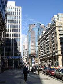 De Maisonneuve Boulevard, Les Cours Mont-Royal at right. | |
| Former name(s) | Western, Saint-Luc, Burnside Place |
|---|---|
| Owner | City of Montreal |
| Length | 11 km (7 mi) |
| Location | Between Havre Street and West Broadway Street |
| Coordinates | 45°30′39″N 73°33′54″W / 45.510877°N 73.56508°W |
| Construction | |
| Inauguration | November 5, 1966 |
De Maisonneuve Boulevard (officially in French: Boulevard de Maisonneuve) is a major westbound boulevard located in downtown Montreal, Quebec, Canada. It is named after the founder of Montreal, Paul Chomedey de Maisonneuve. It is a one-way street westbound.
De Maisonneuve Boulevard is about 11 kilometres (6.8 mi) long and begins on Du Havre Street in the east end (one block east of Frontenac Street in the borough of Ville-Marie), and ends at West Broadway in the city's west end (in the borough of Côte-des-Neiges-Notre-Dame-de-Grâce) near Concordia University's Loyola Campus. The street also runs through the wealthy enclave of Westmount, where it is one-way, and is cut in two by Westmount Park.
History

De Maisonneuve was created as a single street in 1966, following the construction of the Montreal Metro. From west to east, De Maisonneuve took the route of: Western, from Decarie to Atwater Street; St. Luc, from Atwater to Guy Street; Burnside, from Stanley Street to Union Street; Ontario Street, from Union to Jeanne-Mance, and De Montigny, from Saint Laurent Boulevard to du Havre. Today, Ontario Street still remains, as does a small section of de Montigny, from Saint Laurent to Saint Urbain Street. [3]
The downtown portion of De Maisonneuve Boulevard, between St. Hubert Street and St. Mathieu Street, lacks a distinct identity even though its official creation was relatively recent. Rather, it is wedged between two well-known streets: Sherbrooke Street to the north and St. Catherine Street to the south.
During the last 20 years, the multifunctional character of De Maisonneuve Boulevard increased. Institutions already located along the street such as the Université du Québec à Montréal, Place des Arts and Concordia University have built new buildings. Other institutions have also built new buildings on the street such as the Grande Bibliothèque, the Cinémathèque québécoise and the Salle Pierre-Mercure.
In the central business district, residential condominium buildings, such as Le Roc Fleuri and Le 1200 Ouest (Tours Lépine), have been constructed in the mid-2000s between the office towers which were built in the late 1980s and early 1990s.
However, De Maisonneuve Boulevard's multifunctional character still lacks uniformity limiting it to a transportation corridor. To solve this problem, the City of Montreal has undertaken a major project in 2005 to reconfigure the boulevard.
Claire Morissette bike path

In 2007, the city completed a 3.4 km year-round bicycle path along De Maisonneuve through downtown Montreal, from Berri Street to Atwater Street.[4] As of the 2009-2010 winter season, it is the only bike path cleared of snow. A report blamed the path's construction for damage to an underground pedestrian tunnel, part of Montreal's Underground City.[5]
On June 16, 2008, Montreal city council voted unanimously to name the path after the late Montreal cycling activist Claire Morissette.[6]
Points of interest
Westmount Square, Dawson College and the seven linked downtown malls are located on this street. Other notable buildings include the Grande Bibliothèque, Université du Québec à Montréal, Place des Arts, Les Cours Mont-Royal, both of Concordia University's campuses (Sir George Williams and Loyola) and Montreal Forum.
Transit
The Green line of the Montreal Metro runs under this street in between Papineau and Atwater. The Metro was constructed under this street to serve Saint Catherine Street, to the south, to avoid a prolonged disruption of commercial activity on that street. Vendôme station, on the Orange line, is also located on this boulevard.
References
- ↑ "Le boulevard De Maisonneuve et ses intersections — De l'avenue Greene à la rue Saint-Urbain" (in French). City of Montreal.
- ↑ "Drummond Court For Sale". The Montreal Gazette. October 22, 1958.
- ↑ Faguy, Steve (March 17, 2008). "Montreal Geography Trivia No. 17". Fagstein. Retrieved April 16, 2008.
- ↑ "Controversial bike path 'extraordinary' success, city councillor says". Montreal Gazette. Canwest. October 30, 2008. Retrieved October 30, 2008.
- ↑ Magder, Jason (February 27, 2008). "Bay study blames De Maisonneuve bike path for crack in underground". Montreal Gazette. Canwest. Retrieved April 16, 2008.
- ↑ O'Hanley, Stephanie (June 26, 2008). "De Maisonneuve bike path named for Claire Morissette". Hour. Retrieved August 30, 2008.
| Wikinews has related news: Loss of integrity in underground city tunnel causes evacuation of Downtown Montreal |
| Wikimedia Commons has media related to De Maisonneuve Boulevard, Montreal. |
Coordinates: 45°30′39″N 73°33′54″W / 45.510877°N 73.56508°W