Dahr El Ahmar
| Dahr El Ahmar ضهر إل أحمر | |
|---|---|
| Village | |
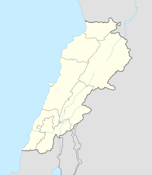 Dahr El Ahmar Location in Lebanon | |
| Coordinates: 33°31′45″N 35°50′55″E / 33.52917°N 35.84861°ECoordinates: 33°31′45″N 35°50′55″E / 33.52917°N 35.84861°E | |
| Country |
|
| Governorate | Beqaa Governorate |
| District | Rashaya District |
| Area | |
| • Total | 3.92 sq mi (10.14 km2) |
| Elevation | 3,540 ft (1,080 m) |
Dahr El Ahmar is a village in Lebanon, situated in the Rashaya District and south of the Beqaa Governorate. It is located near the Syrian border, approximately 6 km from Rashaya and south of Kfar Danis.[1] The population of the village is predominantly Druze.[2] There is a shrine in the village to an important woman in Druze history, Sitt Sarah, the niece of one of the authors of the Epistles of Wisdom, Baha'u d-Dīn as-Samuqī ("al-Muqtana Baha’ud-Dīn").[3] She is remembered for being a great peacemaker.[4]
Archaeological site
Some flints were found 500 metres north of the village in the hills including large axes, scrapers and sickle blades with fine denticulation. This was suggested by Jacques Cauvin and Marie-Claire Cauvin to have been a site contemporary with the earliest neolithic levels at Byblos.[5]
See also
References
- ↑ Ivan Mannheim (1 July 2001). Syria & Lebanon handbook: the travel guide. Footprint Travel Guides. pp. 603–. ISBN 978-1-900949-90-3. Retrieved 23 April 2011.
- ↑ British Druze Society - Druze communities in the Middle East
- ↑ Fuad I. Khuri (2004). Being a Druze. Druze Heritage Foundation. ISBN 978-1-904850-01-4. Retrieved 23 April 2011.
- ↑ Intisar J. Azzam (2007). Gender and religion: Druze women. Druze Heritage Foundation. ISBN 978-1-904850-12-0. Retrieved 23 April 2011.
- ↑ Moore, A.M.T. (1978). The Neolithic of the Levant. Oxford University, Unpublished Ph.D. Thesis. pp. 436–442.
External links
Capital: Rashaya | ||
| Towns and villages |
|  |