Cusick, Washington
| Cusick | |
|---|---|
| Town | |
| Cusick, Washington | |
| Nickname(s): čmq̓ʷoqnú | |
 Location of Cusick, Washington | |
| Coordinates: 48°20′12″N 117°17′46″W / 48.33667°N 117.29611°WCoordinates: 48°20′12″N 117°17′46″W / 48.33667°N 117.29611°W | |
| Country | United States |
| State | Washington |
| County | Pend Oreille |
| Area[1] | |
| • Total | 0.45 sq mi (1.17 km2) |
| • Land | 0.45 sq mi (1.17 km2) |
| • Water | 0 sq mi (0 km2) |
| Elevation | 2,054 ft (626 m) |
| Population (2010)[2] | |
| • Total | 207 |
| • Estimate (2015)[3] | 205 |
| • Density | 460.0/sq mi (177.6/km2) |
| Time zone | Pacific (PST) (UTC-8) |
| • Summer (DST) | PDT (UTC-7) |
| ZIP code | 99119 |
| Area code(s) | 509 |
| FIPS code | 53-16340 |
| GNIS feature ID | 1518433[4] |
Cusick (Salish: čmq̓ʷoqnú [5]) is a town in Pend Oreille County, Washington, United States. The population was 207 at the 2010 census.[6] Cusick is the headquarters of the federally recognized Kalispel Indian Community of the Kalispel Reservation.
History
Cusick occupies the former site of the largest village of the Pend d'Oreilles tribe, where as many as 1,000 people once lived.[7]
Cusick was founded in 1902 by Joseph W. Cusick.[7] Cusick was officially incorporated on March 15, 1927. One of the last Town Marshals was Kevin Derrick, who was the Marshal in the late 1970s.
Geography
Cusick is located at 48°20′12″N 117°17′46″W / 48.33667°N 117.29611°W (48.336552, -117.296204).[8]
According to the United States Census Bureau, the town has a total area of 0.45 square miles (1.17 km2), all of it land.[1]
Demographics
| Historical population | |||
|---|---|---|---|
| Census | Pop. | %± | |
| 1930 | 380 | — | |
| 1940 | 404 | 6.3% | |
| 1950 | 360 | −10.9% | |
| 1960 | 299 | −16.9% | |
| 1970 | 257 | −14.0% | |
| 1980 | 246 | −4.3% | |
| 1990 | 195 | −20.7% | |
| 2000 | 212 | 8.7% | |
| 2010 | 207 | −2.4% | |
| Est. 2015 | 205 | [9] | −1.0% |
| U.S. Decennial Census[10] 2015 Estimate[3] | |||
2010 census
As of the census[2] of 2010, there were 207 people, 86 households, and 56 families residing in the town. The population density was 460.0 inhabitants per square mile (177.6/km2). There were 101 housing units at an average density of 224.4 per square mile (86.6/km2). The racial makeup of the town was 73.4% White, 2.4% African American, 19.8% Native American, 1.4% from other races, and 2.9% from two or more races. Hispanic or Latino of any race were 3.4% of the population.
There were 86 households of which 32.6% had children under the age of 18 living with them, 34.9% were married couples living together, 22.1% had a female householder with no husband present, 8.1% had a male householder with no wife present, and 34.9% were non-families. 30.2% of all households were made up of individuals and 8.1% had someone living alone who was 65 years of age or older. The average household size was 2.41 and the average family size was 2.96.
The median age in the town was 42.8 years. 24.6% of residents were under the age of 18; 9.3% were between the ages of 18 and 24; 19.8% were from 25 to 44; 33.3% were from 45 to 64; and 13% were 65 years of age or older. The gender makeup of the town was 57.5% male and 42.5% female.
2000 census
As of the census of 2000, there were 212 people, 87 households, and 60 families residing in the town. The population density was 624.9 people per square mile (240.7/km²). There were 106 housing units at an average density of 312.4 per square mile (120.4/km²). The racial makeup of the town was 95.28% White, 3.77% Native American, and 0.94% from two or more races. Hispanic or Latino of any race were 0.47% of the population.
There were 87 households out of which 36.8% had children under the age of 18 living with them, 42.5% were married couples living together, 21.8% had a female householder with no husband present, and 29.9% were non-families. 27.6% of all households were made up of individuals and 12.6% had someone living alone who was 65 years of age or older. The average household size was 2.44 and the average family size was 2.90.
In the town the population was spread out with 29.7% under the age of 18, 5.7% from 18 to 24, 26.4% from 25 to 44, 25.9% from 45 to 64, and 12.3% who were 65 years of age or older. The median age was 37 years. For every 100 females there were 92.7 males. For every 100 females age 18 and over, there were 86.3 males.
The median income for a household in the town was $14,583, and the median income for a family was $14,000. Males had a median income of $30,625 versus $21,250 for females. The per capita income for the town was $11,371. About 36.2% of families and 41.2% of the population were below the poverty line, including 61.7% of those under the age of eighteen and 6.1% of those sixty five or over.
References
- 1 2 "US Gazetteer files 2010". United States Census Bureau. Archived from the original on 2012-01-24. Retrieved 2012-12-19.
- 1 2 "American FactFinder". United States Census Bureau. Retrieved 2012-12-19.
- 1 2 "Population Estimates". United States Census Bureau. Retrieved July 12, 2016.
- ↑ "US Board on Geographic Names". United States Geological Survey. 2007-10-25. Retrieved 2008-01-31.
- ↑ "Lesson 10 - Places to go. Kalispel I Curriculum" (PDF). Kalispel Tribe. 2009. Retrieved 2013-05-05.)
- ↑ "2010 Census Redistricting Data (Public Law 94-171) Summary File". American FactFinder. United States Census Bureau. Archived from the original on 21 July 2011. Retrieved 17 September 2012.
- 1 2 Majors, Harry M. (1975). Exploring Washington. Van Winkle Publishing Co. p. 59. ISBN 978-0-918664-00-6.
- ↑ "US Gazetteer files: 2010, 2000, and 1990". United States Census Bureau. 2011-02-12. Retrieved 2011-04-23.
- ↑ "Annual Estimates of the Resident Population for Incorporated Places: April 1, 2010 to July 1, 2015". Retrieved July 2, 2016.
- ↑ United States Census Bureau. "Census of Population and Housing". Archived from the original on May 11, 2015. Retrieved October 4, 2013.
Municipalities and communities of Pend Oreille County, Washington, United States | ||
|---|---|---|
| City | 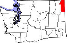 | |
| Towns | ||
| Unincorporated communities | ||