Crosshill
| Crosshill | |
| Scots: Croashull | |
 Dixon Halls, formerly Crosshill and Govanhill Burgh Hall |
|
 Crosshill |
|
| OS grid reference | NS585623 |
|---|---|
| Council area | Glasgow |
| Lieutenancy area | Glasgow |
| Country | Scotland |
| Sovereign state | United Kingdom |
| Post town | GLASGOW |
| Postcode district | G42 |
| Dialling code | 0141 |
| Police | Scottish |
| Fire | Scottish |
| Ambulance | Scottish |
| EU Parliament | Scotland |
| UK Parliament | Glasgow South |
| Scottish Parliament | Glasgow Southside |
Coordinates: 55°49′59″N 4°15′21″W / 55.83319°N 4.25583°W
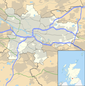
Crosshill is a district in the Scottish city of Glasgow. It is situated south of the River Clyde.
History
In earlier maps the area is called Corsehill, which means Gorse hill, so the name is probably a corruption of this earlier name, and does not refer to a cross. There is a great deal of gorse growing on the slopes of nearby Langside College in Battlefield. However, according to Hugh Macintosh's The Origin and History of Glasgow Streets, printed in 1902, "CROSSHILL derives its name from an ancient cross which stood on a height still named the Cross Hill. This monument was about ten feet high and three-and-a-half wide, and bore a sculptured representation of Christ entering Jerusalem riding on an ass. It was removed by some vandals about the end of the eighteenth century."[1] This would suggest that if a corruption of the name "Corse Hill" to "Cross Hill" occurred, it may indeed have resulted from the presence of a cross on the hill.
Government
Formerly part of the County of Renfrew, Crosshill enjoyed a brief existence as an independent police burgh from 1871 until it was absorbed by Glasgow in 1891. Crosshill and Govanhill to its north form a continuous built-up area and due to sharing a common postcode and amenities, as well as a similar design style in some buildings, they are often considered to be the same district (however historically this was not the case). Crosshill also borders Queens Park and Mount Florida to the south, Strathbungo to the west and Polmadie to the east. The area is home to Holyrood Secondary School and former football stadium Cathkin Park.
It is covered by Crosshill and Govanhill Community Council.[2]
Transport

The area is served by Crosshill railway station.
References
- ↑ Macintosh, Hugh (1902). The Origin and History of Glasgow Streets. Glasgow: James Hedderwick & Sons. Retrieved 30 January 2016.
- ↑ "Crosshill and Govanhill Community Council". Crosshill and Govanhill Community Council. Retrieved 30 January 2016.