Crooked River National Grassland
| Crooked River National Grassland | |
|---|---|
|
IUCN category VI (protected area with sustainable use of natural resources) | |
 | |
 | |
| Location | Jefferson County, Oregon, United States |
| Nearest city | Madras, Oregon |
| Coordinates | 44°32′N 121°07′W / 44.54°N 121.11°W[1]Coordinates: 44°32′N 121°07′W / 44.54°N 121.11°W[2] |
| Area | 173,629 acres (70,265 ha)[3] |
| Governing body | U.S. Forest Service |
| Website | Ochoco National Forest & Crooked River National Grassland |
Crooked River National Grassland is a National Grassland located in Jefferson County in the north-central part of the U.S. state of Oregon. It has a land area of 173,629 acres (70,265 ha). It contains two National Wild and Scenic Rivers, the Deschutes River and the Crooked River. The grassland is managed together with the Ochoco National Forest from Forest Service offices in Prineville. There are local ranger district offices located in Madras, its nearest city.[3]
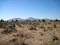
 "The Island", isolated by the canyons of the Deschutes and Crooked rivers.
References
- ↑ "Crooked River National Grassland". Geographic Names Information System. United States Geological Survey. Retrieved December 9, 2012.
- ↑ "Crooked River National Grassland". Geographic Names Information System. United States Geological Survey. Retrieved December 9, 2012.
- 1 2 "About the Forest". U.S. Forest Service. Retrieved January 1, 2015.
External links
 Media related to Crooked River National Grassland at Wikimedia Commons
This article is issued from Wikipedia - version of the 11/19/2016. The text is available under the Creative Commons Attribution/Share Alike but additional terms may apply for the media files.
