Corlier
| Corlier | ||
|---|---|---|
 | ||
| ||
 Corlier | ||
|
Location within Auvergne-Rhône-Alpes region  Corlier | ||
| Coordinates: 46°01′49″N 5°29′57″E / 46.0303°N 5.4992°ECoordinates: 46°01′49″N 5°29′57″E / 46.0303°N 5.4992°E | ||
| Country | France | |
| Region | Auvergne-Rhône-Alpes | |
| Department | Ain | |
| Arrondissement | Belley | |
| Canton | Hauteville-Lompnes | |
| Intercommunality | Plateau d'Hauteville | |
| Government | ||
| • Mayor (2008–2014) | Jean-François Dupont | |
| Area1 | 5.45 km2 (2.10 sq mi) | |
| Population (2019)2 | 121 | |
| • Density | 22/km2 (58/sq mi) | |
| Time zone | CET (UTC+1) | |
| • Summer (DST) | CEST (UTC+2) | |
| INSEE/Postal code | 01121 / 01110 | |
| Elevation |
560–917 m (1,837–3,009 ft) (avg. 800 m or 2,600 ft) | |
|
1 French Land Register data, which excludes lakes, ponds, glaciers > 1 km² (0.386 sq mi or 247 acres) and river estuaries. 2 Population without double counting: residents of multiple communes (e.g., students and military personnel) only counted once. | ||
.svg.png)
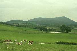
Corlier is a commune in the Ain department in eastern France.
Population
| Historical population | ||
|---|---|---|
| Year | Pop. | ±% |
| 1793 | 250 | — |
| 1800 | 214 | −14.4% |
| 1806 | 274 | +28.0% |
| 1821 | 263 | −4.0% |
| 1831 | 272 | +3.4% |
| 1836 | 212 | −22.1% |
| 1841 | 235 | +10.8% |
| 1846 | 246 | +4.7% |
| 1851 | 281 | +14.2% |
| 1856 | 258 | −8.2% |
| 1861 | 245 | −5.0% |
| 1866 | 242 | −1.2% |
| 1872 | 226 | −6.6% |
| 1876 | 212 | −6.2% |
| 1881 | 219 | +3.3% |
| 1886 | 225 | +2.7% |
| 1891 | 226 | +0.4% |
| 1896 | 194 | −14.2% |
| 1901 | 197 | +1.5% |
| 1906 | 165 | −16.2% |
| 1911 | 160 | −3.0% |
| 1921 | 139 | −13.1% |
| 1926 | 166 | +19.4% |
| 1931 | 148 | −10.8% |
| 1936 | 133 | −10.1% |
| 1946 | 104 | −21.8% |
| 1954 | 110 | +5.8% |
| 1962 | 89 | −19.1% |
| 1968 | 65 | −27.0% |
| 1975 | 69 | +6.2% |
| 1982 | 66 | −4.3% |
| 1990 | 76 | +15.2% |
| 1999 | 73 | −3.9% |
| 2008 | 119 | +63.0% |
See also
References
External links
| Wikimedia Commons has media related to Corlier. |
This article is issued from Wikipedia - version of the 10/27/2016. The text is available under the Creative Commons Attribution/Share Alike but additional terms may apply for the media files.