Apremont, Ain
| Apremont | |
|---|---|
 | |
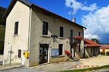
 Apremont | |
|
Location within Auvergne-Rhône-Alpes region  Apremont | |
| Coordinates: 46°12′28″N 5°39′26″E / 46.2078°N 5.6572°ECoordinates: 46°12′28″N 5°39′26″E / 46.2078°N 5.6572°E | |
| Country | France |
| Region | Auvergne-Rhône-Alpes |
| Department | Ain |
| Arrondissement | Nantua |
| Canton | Nantua |
| Intercommunality | Haut Bugey |
| Government | |
| • Mayor (2008–2020) | Jean-Pierre Girard |
| Area1 | 14.57 km2 (5.63 sq mi) |
| Population (2009)2 | 352 |
| • Density | 24/km2 (63/sq mi) |
| Time zone | CET (UTC+1) |
| • Summer (DST) | CEST (UTC+2) |
| INSEE/Postal code | 01011 / 01100 |
| Elevation |
658–1,042 m (2,159–3,419 ft) (avg. 850 m or 2,790 ft) |
|
1 French Land Register data, which excludes lakes, ponds, glaciers > 1 km² (0.386 sq mi or 247 acres) and river estuaries. 2 Population without double counting: residents of multiple communes (e.g., students and military personnel) only counted once. | |
Apremont is a French commune in the department of Ain in the Auvergne-Rhône-Alpes region of eastern France.
The inhabitants of the commune are known as Marranes[1]
Geography
Apremont is located halfway between Nantua and Oyonnax some 20 km north-west of Bellegarde-sur-Valserine and 40 km east of Bourg-en-Bresse. The commune has an area of 1456 hectares and is bounded by the communes of Bellignat, Oyonnax, Charix, Nantua, Montreal-la-Cluse, Martignat, and Groissiat. The commune is composed of several villages including:
- Petit Vallon
- Grand Vallon
- La Gotette
- Ablatrix
There are also a few isolated farms such as Les Éterres, le Cree, and Molet.
The commune can be accessed by road D74 from Oyonnax in the north passing though the heart of the commune and the village and continuing to Nantua in the south. There is also access via the D95 from Charix in the south-west to the town. There are also several small roads in the commune. The commune consists of forest and mountain landscape.
The Lange river rises in the town and flows north to Oyonnax before turning south and joining the Oignin at Le Mollard.[2]
Neighbouring communes and villages[2]
 |
Bellignat | Oyonnax | Belleydoux | |
| Martignat | |
Echallon | ||
| ||||
| | ||||
| Montreal-la-Cluse | Les Neyrolles | Charix |
Administration
List of Successive Mayors of Apremont[3]
| From | To | Name | Party | Position |
|---|---|---|---|---|
| 1995 | 2001 | Jean-Pierre Girard | ||
| 2001 | 2008 | Charles Sonthonnax | ||
| 2008 | 2020 | Jean-Pierre Girard |
(Not all data is known)
Demography
In 2009 the commune had 352 inhabitants. The evolution of the number of inhabitants is known through the population censuses conducted in the town since 1793. From the 21st century, a census of municipalities with fewer than 10,000 inhabitants is held every five years, unlike larger towns that have a sample survey every year.[Note 1]
| 1793 | 1800 | 1806 | 1821 | 1831 | 1836 | 1841 | 1846 | 1851 |
|---|---|---|---|---|---|---|---|---|
| 433 | 499 | 491 | 405 | 418 | 431 | 417 | 394 | 369 |
| 1856 | 1861 | 1866 | 1872 | 1876 | 1881 | 1886 | 1891 | 1896 |
|---|---|---|---|---|---|---|---|---|
| 361 | 383 | 358 | 348 | 334 | 308 | 294 | 298 | 314 |
| 1901 | 1906 | 1911 | 1921 | 1926 | 1931 | 1936 | 1946 | 1954 |
|---|---|---|---|---|---|---|---|---|
| 338 | 306 | 287 | 236 | 201 | 207 | 218 | 205 | 187 |
| 1962 | 1968 | 1975 | 1982 | 1990 | 1999 | 2009 | - | - |
|---|---|---|---|---|---|---|---|---|
| 176 | 148 | 200 | 279 | 341 | 328 | 352 | - | - |
Sources : Ldh/EHESS/Cassini until 1962, INSEE database from 1968 (population without double counting and municipal population from 2006)


Sites and monuments
- Ruins of a castle built in the 13th century
See also
External links
- Apremont on Lion1906
- Apremont on Google Maps
- Apremont on Géoportail, National Geographic Institute (IGN) website (French)
- Apremont on the 1750 Cassini Map
- Apremont on the INSEE website (French)
- INSEE (French)
Notes and references
Notes
- ↑ At the beginning of the 21st century, the methods of identification have been modified by law No. 2002-276 of 27 February 2002 , the so-called "law of local democracy" and in particular Title V "census operations" which allow, after a transitional period running from 2004 to 2008, the annual publication of the legal population of the different French administrative districts. For municipalities with a population greater than 10,000 inhabitants, a sample survey is conducted annually, the entire territory of these municipalities is taken into account at the end of the period of five years. The first "legal population" after 1999 under this new law came into force on 1 January 2009 and was based on the census of 2006.
References
- ↑ Inhabitants of Ain (French)
- 1 2 Google Maps
- ↑ List of Mayors of France (French)
| Wikimedia Commons has media related to Apremont (Ain). |