Climax, Georgia
| Climax, Georgia | |
|---|---|
| City | |
|
Climax City Hall | |
 Location in Decatur County and the state of Georgia | |
| Coordinates: 30°52′38″N 84°25′55″W / 30.87722°N 84.43194°WCoordinates: 30°52′38″N 84°25′55″W / 30.87722°N 84.43194°W | |
| Country | United States |
| State | Georgia |
| County | Decatur |
| Area | |
| • Total | 0.80 sq mi (2.07 km2) |
| • Land | 0.80 sq mi (2.07 km2) |
| • Water | 0 sq mi (0 km2) |
| Elevation | 285 ft (87 m) |
| Population (2010) | |
| • Total | 280 |
| • Density | 351/sq mi (135.4/km2) |
| Time zone | Eastern (EST) (UTC-5) |
| • Summer (DST) | EDT (UTC-4) |
| ZIP codes | 31734, 39834 |
| Area code(s) | 229 |
| FIPS code | 13-16908[1] |
| GNIS feature ID | 0355192[2] |

Climax is a city in Decatur County, Georgia, United States. The town was named "Climax" because it is located at the highest point of the railroad between Savannah, Georgia, and the Chattahoochee River.[3][4] The population was 280 at the 2010 census.[5]
Geography
Climax is located in eastern Decatur County at 30°52′38″N 84°25′55″W / 30.87722°N 84.43194°W (30.877194, -84.431975).[6] It sits on the crest of Curry Hill, a 300-foot-high (91 m) escarpment that forms the southwestern side of the Flint River valley.
U.S. Route 84 passes through Climax, leading west 10 miles (16 km) to Bainbridge, the Decatur County seat, and east 15 miles (24 km) to Cairo.
According to the United States Census Bureau, the city of Climax has a total area of 0.81 square miles (2.1 km2), all of it land.[5]
Demographics
| Historical population | |||
|---|---|---|---|
| Census | Pop. | %± | |
| 1910 | 328 | — | |
| 1920 | 345 | 5.2% | |
| 1930 | 451 | 30.7% | |
| 1940 | 372 | −17.5% | |
| 1950 | 73 | −80.4% | |
| 1960 | 3,293 | 4,411.0% | |
| 1970 | 275 | −91.6% | |
| 1980 | 407 | 48.0% | |
| 1990 | 226 | −44.5% | |
| 2000 | 297 | 31.4% | |
| 2010 | 280 | −5.7% | |
| Est. 2015 | 273 | [7] | −2.5% |
As of the census[1] of 2000, there were 297 people, 116 households, and 78 families residing in the city. The population density was 375.7 people per square mile (145.2/km²). There were 134 housing units at an average density of 169.5 per square mile (65.5/km²). The racial makeup of the city was 56.90% White, 41.08% African American, 0.34% Native American, 0.34% from other races, and 1.35% from two or more races. Hispanic or Latino of any race were 3.37% of the population.
There were 116 households out of which 31.0% had children under the age of 18 living with them, 50.0% were married couples living together, 13.8% had a female householder with no husband present, and 31.9% were non-families. 31.0% of all households were made up of individuals and 18.1% had someone living alone who was 65 years of age or older. The average household size was 2.56 and the average family size was 3.27.
In the city the population was spread out with 30.0% under the age of 18, 8.4% from 18 to 24, 22.6% from 25 to 44, 21.9% from 45 to 64, and 17.2% who were 65 years of age or older. The median age was 35 years. For every 100 females there were 85.6 males. For every 100 females age 18 and over, there were 80.9 males.
The median income for a household in the city was $26,250, and the median income for a family was $33,250. Males had a median income of $30,000 versus $17,083 for females. The per capita income for the city was $11,666. About 9.6% of families and 9.8% of the population were below the poverty line, including 13.2% of those under the age of eighteen and 6.8% of those sixty five or over.
Swine Time Festival
Climax's annual festival is held on the first Saturday after Thanksgiving. The event is attended by 35,000 people annually, a large number in light of Climax's sub-300 population. Contests and events include best-dressed pig, corn shucking, hog calling, eating chitterlings, pig racing, syrup making, baby crawling, and the great greased pig chase. The festival is kicked off with a parade down Main Street that leads up to the event grounds. There is also a beauty contest for different age groups where the winner is crowned Miss and Little Miss Swine Time.
References
- 1 2 "American FactFinder". United States Census Bureau. Archived from the original on 2013-09-11. Retrieved 2008-01-31.
- ↑ "US Board on Geographic Names". United States Geological Survey. 2007-10-25. Retrieved 2008-01-31.
- ↑ Climax, GA Historical Marker at the Historical Marker Database
- ↑ New Georgia Encyclopedia entry for Decatur County
- 1 2 "Geographic Identifiers: 2010 Demographic Profile Data (G001): Climax city, Georgia". U.S. Census Bureau, American Factfinder. Retrieved October 20, 2015.
- ↑ "US Gazetteer files: 2010, 2000, and 1990". United States Census Bureau. 2011-02-12. Retrieved 2011-04-23.
- ↑ "Annual Estimates of the Resident Population for Incorporated Places: April 1, 2010 to July 1, 2015". Retrieved July 2, 2016.
- ↑ "Census of Population and Housing". Census.gov. Archived from the original on May 11, 2015. Retrieved June 4, 2015.
External links
- Swine Time Festival
- Climax historical marker
Municipalities and communities of Decatur County, Georgia, United States | ||
|---|---|---|
| Cities | 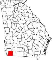 | |
| Town | ||
| Unincorporated communities | ||
| Ghost town | ||