Claysville, Alabama
| Claysville, Alabama | |
|---|---|
| Unincorporated community | |
 Claysville, Alabama  Claysville, Alabama | |
| Coordinates: 34°24′28″N 86°16′19″W / 34.40778°N 86.27194°WCoordinates: 34°24′28″N 86°16′19″W / 34.40778°N 86.27194°W | |
| Country | United States |
| State | Alabama |
| County | Marshall |
| Elevation | 623 ft (190 m) |
| Time zone | Central (CST) (UTC-6) |
| • Summer (DST) | CDT (UTC-5) |
| Area code(s) | 256 & 938 |
| GNIS feature ID | 156187[1] |
Claysville is an unincorporated community in Marshall County, Alabama, United States.
History
Claysville was named in honor of Henry Clay, and served as the county seat of Marshall County from 1836 to 1838.[2] During the American Civil War, Claysville became a strategic location, due to the ferry crossing of the Tennessee River. A Union Army garrison was located here during the latter part of the war.[3] The 13th Wisconsin Volunteer Infantry Regiment was stationed here under the command of Colonel William P. Lyon.[4] A post office operated under the name Claysville from 1831 to 1879.[5]
References
- ↑ "Claysville". Geographic Names Information System. United States Geological Survey.
- ↑ Foscue, Virginia (1989). Place Names in Alabama. Tuscaloosa: The University of Alabama Press. p. 35. ISBN 0-8173-0410-X.
- ↑ Samuel Gillespie; James E. Steele (1909). History of Clay County, Iowa: From Its Earliest Settlement to 1909. S.J. Clarke Publishing Company. pp. 638–.
- ↑ Magazine of Western History. 1887. p. 849. Retrieved 30 November 2014.
- ↑ "Marshall County". Jim Forte Postal History. Archived from the original on 29 November 2014. Retrieved 21 October 2014.
Municipalities and communities of Marshall County, Alabama, United States | ||
|---|---|---|
| Cities | 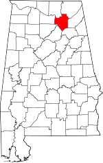 | |
| Towns | ||
| CDPs | ||
| Unincorporated communities | ||
| Ghost town | ||
| Footnotes | ‡This populated place also has portions in an adjacent county or counties | |
This article is issued from Wikipedia - version of the 11/26/2016. The text is available under the Creative Commons Attribution/Share Alike but additional terms may apply for the media files.
