Clark Township, Brown County, Ohio
| Clark Township, Brown County, Ohio | |
|---|---|
| Township | |
|
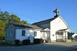
Mount Nebo United Methodist Church, State Route 774 | |
 Location of Clark Township in Brown County | |
| Coordinates: 38°55′27″N 83°59′26″W / 38.92417°N 83.99056°WCoordinates: 38°55′27″N 83°59′26″W / 38.92417°N 83.99056°W | |
| Country | United States |
| State | Ohio |
| County | Brown |
| Area | |
| • Total | 29.64 sq mi (76.77 km2) |
| • Land | 29.63 sq mi (76.75 km2) |
| • Water | 0.008 sq mi (0.02 km2) |
| Elevation[1] | 968 ft (295 m) |
| Population (2010) | |
| • Total | 3,121 |
| • Density | 105/sq mi (40.7/km2) |
| Time zone | Eastern (EST) (UTC-5) |
| • Summer (DST) | EDT (UTC-4) |
| FIPS code | 39-15224[2] |
| GNIS feature ID | 1085793[1] |
Clark Township is one of the sixteen townships of Brown County, Ohio, United States. The 2010 census found 3,121 people in the township, 2,575 of whom lived in the unincorporated portions of the township.[3]
Geography
Located in the western part of the county, it borders the following townships:
- Pike Township - north
- Scott Township - east
- Pleasant Township - southeast
- Lewis Township - south
- Tate Township, Clermont County - west
- Williamsburg Township, Clermont County - northwest corner
The village of Hamersville is located in central Clark Township.
Name and history
Statewide, other Clark Townships are located in Clinton, Coshocton, and Holmes counties.
Clark Township was established in 1808.[4]
Government
The township is governed by a three-member board of trustees, who are elected in November of odd-numbered years to a four-year term beginning on the following January 1. Two are elected in the year after the presidential election and one is elected in the year before it. There is also an elected township fiscal officer,[5] who serves a four-year term beginning on April 1 of the year after the election, which is held in November of the year before the presidential election. Vacancies in the fiscal officership or on the board of trustees are filled by the remaining trustees.
References
- 1 2 "US Board on Geographic Names". United States Geological Survey. 2007-10-25. Retrieved 2008-01-31.
- ↑ "American FactFinder". United States Census Bureau. Archived from the original on 2013-09-11. Retrieved 2008-01-31.
- ↑ "Geographic Identifiers: 2010 Demographic Profile Data (G001): Clark township, Brown County, Ohio". U.S. Census Bureau, American Factfinder. Retrieved February 19, 2014.
- ↑ The History of Brown County, Ohio. Higginson Book Company. 1883. p. 519.
- ↑ §503.24, §505.01, and §507.01 of the Ohio Revised Code. Accessed 4/30/2009.
External links
Municipalities and communities of Brown County, Ohio, United States | ||
|---|---|---|
| Villages |  | |
| Townships | ||
| CDPs | ||
| Unincorporated communities | ||
| Footnotes | ‡This populated place also has portions in an adjacent county or counties | |
