City of Rockdale
| City of Rockdale New South Wales | |||||||||||||
|---|---|---|---|---|---|---|---|---|---|---|---|---|---|
 Location in Metropolitan Sydney | |||||||||||||
| Coordinates | 33°55′S 151°15′E / 33.917°S 151.250°ECoordinates: 33°55′S 151°15′E / 33.917°S 151.250°E | ||||||||||||
| Population | 97,340 (2011)[1] | ||||||||||||
| • Density | 3,476.4/km2 (9,004/sq mi) | ||||||||||||
| Established | 1995 | ||||||||||||
| Area | 28 km2 (10.8 sq mi) | ||||||||||||
| Mayor | Bill Saravinovski (Labor) | ||||||||||||
| Council seat | Rockdale | ||||||||||||
| Region | Metropolitan Sydney | ||||||||||||
| State electorate(s) | |||||||||||||
| Federal Division(s) | Barton | ||||||||||||
| Website | City of Rockdale | ||||||||||||
| |||||||||||||
The City of Rockdale was a local government area in southern and St George regions of Sydney, in the state of New South Wales, Australia. The city centre was located 12 kilometres (7.5 mi) south-west of the Sydney central business district, on the western shores of Botany Bay. Rockdale was amalgamated with the neighbouring City of Botany Bay on 9 September 2016 to form the new municipality of Bayside Council.
The City of Rockdale has been previously known as the Municipality of West Botany and the Municipality of Rockdale. The City of Rockdale was declared in 1995.
The Mayor of the City of Rockdale at amalgamation was Cr. Bill Saravinovski, a member of the Labor Party.
Suburbs and localities in the local government area

Suburbs in the City of Rockdale were:
- Arncliffe
- Banksia
- Bardwell Park
- Bardwell Valley
- Bexley
- Bexley North
- Brighton-Le-Sands
- Carlton (parts are located in Georges River Council)
- Dolls Point
- Kingsgrove (parts are located in Canterbury-Bankstown & Georges River Council)
- Kogarah (parts are located in Georges River Council)
- Kyeemagh
- Monterey
- Ramsgate
- Ramsgate Beach
- Rockdale
- Sandringham
- Sans Souci (parts are located in Georges River Council)
- Sydney Airport
- Turrella
- Wolli Creek
The City of Rockdale also managed and maintained the following localities:
- Bardwell Creek
- Cooks Cove
- Lady Robinson Beach
- Muddy Creek
- Rocky Point
- Sandringham Bay
- St Kilda Point
Demographics
At the 2011 Census, there were 97,340 people in the Rockdale local government area, of these 49.4% were male and 50.6% were female. Aboriginal and Torres Strait Islander people made up 0.6% of the population. The median age of people in the City of Rockdale was 36 years. Children aged 0 – 14 years made up 17.4% of the population and people aged 65 years and over made up 15.1% of the population. Of people in the area aged 15 years and over, 50.9% were married and 10.8% were either divorced or separated.[1]
Population growth in the City of Rockdale between the 2001 Census and the 2006 Census was 5.09%; and in the subsequent five years to the 2011 Census, population growth was 5.66%. When compared with total population growth of Australia for the same periods, being 5.78% and 8.32% respectively, population growth in the Rockdale local government area was on par with the national average.[2] The median weekly income for residents within the City of Rockdale was on par with the national average.[1][3]
The proportion of residents who stated their ancestry was Macedonian was 6.5 times the New South Wales and national averages; the proportion of households where Macedonian is spoken at home is in excess of eight times the state and national averages; and the proportion of residents who stated an affiliation with Eastern Orthodox religion was in excess of six times the state and national averages.[1]
| Selected historical census data for Rockdale local government area | |||||
|---|---|---|---|---|---|
| Census year | 2001[2] | 2006[3] | 2011[1] | ||
| Population | Estimated residents on Census night | 87,657 | 92,126 | 97,340 | |
| LGA rank in terms of size within New South Wales | |||||
| % of New South Wales population | 1.41% | ||||
| % of Australian population | 0.47% | ||||
| Cultural and language diversity | |||||
| Ancestry, top responses | Australian | 12.4% | |||
| English | 12.2% | ||||
| Chinese | 10.0% | ||||
| Greek | 9.2% | ||||
| Lebanese | 6.1% | ||||
| Language, top responses (other than English) | Greek | 9.7% | |||
| Arabic | 8.3% | ||||
| Mandarin | 3.2% | ||||
| Macedonian | 6.3% | ||||
| Cantonese | 4.5% | ||||
| Religious affiliation | |||||
| Religious affiliation, top responses | Catholic | 25.6% | |||
| Eastern Orthodox | 19.2% | ||||
| No religion | 9.5% | ||||
| Islam | 8.2% | ||||
| Anglican | 12.9% | ||||
| Median weekly incomes | |||||
| Personal income | Median weekly personal income | A$457 | A$555 | ||
| % of Australian median income | 98.1% | 96.2% | |||
| Family income | Median weekly family income | A$1,035 | A$1,443 | ||
| % of Australian median income | 100.8% | 97.4% | |||
| Household income | Median weekly household income | A$1,163 | A$1,276 | ||
| % of Australian median income | 99.3% | 103.4% | |||
Council


Current composition and election method
Rockdale City Council was composed of fifteen Councillors elected proportionally as five separate wards, each electing three Councillors. All Councillors were elected for a fixed four-year term of office. The Mayor was elected by the Councillors at the first meeting of the Council. The most recent election was held on 8 September 2012, and the makeup of the Council was as follows:[4][5][6][7][8]
| Party | Councillors | |
|---|---|---|
| Liberal Party of Australia | 6 | |
| Australian Labor Party | 5 | |
| Independents | 4 | |
| Total | 15 | |
The final Council, elected in 2012, in order of election by ward, was:
| Ward | Councillor | Party | Notes | |
|---|---|---|---|---|
| First Ward[4] | Andrew Tsounis | Labor | ||
| Peter Poulos | Liberal | |||
| Mark Hanna | Independent | |||
| Second Ward[5] | Tarek Ibrahim | Labor | ||
| Nicholas Mickovski | Liberal | |||
| Michael Nagi | Independent | Deputy Mayor | ||
| Third Ward[6] | Petros Kalligas | Liberal | ||
| Lydia Sedrak | Liberal | |||
| Bill Saravinovski | Labor | Mayor | ||
| Fourth Ward[7] | Liz Barlow | Independent | ||
| Paul Sedrak | Liberal | |||
| Joe Awada | Labor | |||
| Fifth Ward[8] | Ron Bezic | Liberal | ||
| Shane O'Brien | Labor | |||
| James Macdonald | Independent | |||
History
The City of Rockdale was originally known as the West Botany Municipality. The Municipality of West Botany was declared on 13 January 1871 and covered 23 square kilometres (9 sq mi) in 1884. It included much of the land which was later used to build Sydney Airport. The West Botany name was officially changed to Rockdale in 1887, when land was being sub-divided for residential development.[9] Among the main developers during this period was Frederick Jamison Gibbes, a member of parliament whose name is perpetuated by Gibbes Street in Banksia.[10][11]
The area of the municipality was reduced when the mouth of Cooks River was moved further south of its original position in the mid-1940s, to allow for the extension of Sydney Airport. Only a small part of the airport remains in the local government area today. As the city's population increased, more suburbs were created within its boundaries. The Municipality of Rockdale was declared a city in 1995, and is now known as the City of Rockdale.[12][13]
2002 corruption inquiry
During 2002, two elected officials of Rockdale City Council were at the centre of an Independent Commission Against Corruption (ICAC) inquiry. The inquiry revealed that the Deputy Mayor, Adam McCormick (Labor) and Councillor Andrew Smyrnis (Liberal) engaged in corrupt conduct with two property developers Con Chartofillis and Terry Andriotakis via two intermediaries, Manuel Limberis and Tony Retsos. The ICAC recommended to the New South Wales Office of the Director of Public Prosecutions (DPP) that charges be laid against all six individuals under the Crimes Act 1900 (NSW) and the ICAC Act 1998 (NSW) s 87.[14][15] Both councillors resigned from Council and a by-election was held on 31 August 2002 to replace the two disgraced councillors.
Following consideration of the briefs and evidence involved, the DPP commenced action. It was successful in recording convictions, and the known determinations made by the Courts are as follows:
- Smyrnis was sentenced to two years periodic detention.[16][17]
- Retsos was fined $80,000 and sentenced to three years periodic detention.[18]
- McCormick, protested his innocence; with Smyrnis agreeing to testify against him.[16] McCormick was sentenced to a maximum of five years in custody for receiving $70,000 in bribes in return for delivering Labor Party support for a development application and for lying to the inquiry.[19][20]
Proposed amalgamation
A 2015 review of local government boundaries recommended that the City of Rockdale merge with the City of Botany Bay to form a new council with an area of 50 square kilometres (19 sq mi) and support a population of approximately 153,000.[21] The outcome of the review was an amalgamation with City of Botany Bay to form Bayside Council on 9 September 2016.[22]
Sister cities
The City of Rockdale has sister city links that encourage cultural and social contact, as well as giving the cities involved the chance to explore educational and economic opportunities. The sister cities are:[23]
-
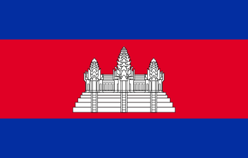 Takéo, Cambodia
 -
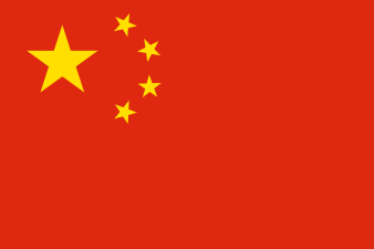 Tianjin, Tanggu, China
 -
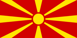 Bitola, Macedonia
 -
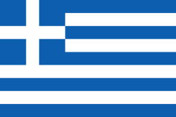 Glyfada, Greece
 -
 Rockdale, Texas, US
 -
 Bint Jbeil, Lebanon
 -
 Yamatsuri, Fukushima, Japan
 -
 Gilgandra, New South Wales, Australia
References
- 1 2 3 4 5 Australian Bureau of Statistics (31 October 2012). "Rockdale (C)". 2011 Census QuickStats. Retrieved 8 November 2012.
- 1 2 Australian Bureau of Statistics (9 March 2006). "Rockdale (C)". 2001 Census QuickStats. Retrieved 5 November 2012.
- 1 2 Australian Bureau of Statistics (25 October 2007). "Rockdale (CA)". 2006 Census QuickStats. Retrieved 5 November 2012.
- 1 2 "Rockdale City Council – First Ward". Local Government Elections 2012. Electoral Commission of New South Wales. 15 September 2012. Retrieved 20 September 2012.
- 1 2 "Rockdale City Council – Second Ward". Local Government Elections 2012. Electoral Commission of New South Wales. 15 September 2012. Retrieved 20 September 2012.
- 1 2 "Rockdale City Council – Third Ward". Local Government Elections 2012. Electoral Commission of New South Wales. 15 September 2012. Retrieved 20 September 2012.
- 1 2 "Rockdale City Council – Fourth Ward". Local Government Elections 2012. Electoral Commission of New South Wales. 15 September 2012. Retrieved 20 September 2012.
- 1 2 "Rockdale City Council – Fifth Ward". Local Government Elections 2012. Electoral Commission of New South Wales. 15 September 2012. Retrieved 20 September 2012.
- ↑ Lawrence, Joan (1996). Pictorial Memories of St. George: Rockdale, Kogarah, Hurstville. Australia: Kingsclear Books. ISBN 0-908272-45-6.
- ↑ Pollon, Frances, ed. (1990). The Book of Sydney Suburbs. Australia: Angus & Robertson. ISBN 0-207-14495-8.
- ↑ Post Office Directories, 1880-1932/33. Sands. 1933.
- ↑ Horne, Paul. A Century of Progress Rockdale 1871–1971. Lane Cove: Rockdale Municipal Council.
- ↑ Geeves, Phillip; Jervis, J (1986). Rockdale: its beginning and development (Revised ed.).
- ↑ Moss AO, Irene (July 2002). "Report into corrupt conduct associated with development proposals at Rockdale City Council" (PDF). Independent Commission Against Corruption. pp. 1–2. ISBN 1-920726-12-8. Retrieved 8 October 2012.
- ↑ Santow, Simon (9 July 2002). "Rockdale corruption scandal claims six scalps" (transcript). PM (ABC Radio). Australia. Retrieved 8 October 2012.
- 1 2 Jacobsen, Geesche (27 October 2005). "Armed man was not asking for a donation, court told". The Sydney Morning Herald. Retrieved 8 October 2012.
- ↑ Davies, Anne (4 February 2005). "Plot and counter-plot". The Sydney Morning Herald. Retrieved 8 October 2012.
- ↑ Jacobsen, Geesche; Wallace, Natasha (24 December 2004). "Career switch saves Face from prison". The Sydney Morning Herald. Retrieved 8 October 2012.
- ↑ Jacobsen, Geesche (7 April 2005). "Councillor tried to persuade accused to change his tune". The Sydney Morning Herald. Retrieved 8 October 2012.
- ↑ "Corrupt Rockdale councillor jailed". ABC News. Australia. 16 December 2005. Retrieved 8 October 2012.
- ↑ "Merger proposal: City of Botany Bay Council, Rockdale City Council" (PDF). Government of New South Wales. January 2016. p. 7. Retrieved 2 March 2016.
- ↑ Stronger Councils
- ↑ "Sister Cities". About Rockdale. Rockdale City Council. 2012. Retrieved 8 November 2012.
