City of Camberwell
| City of Camberwell Victoria | |||||||||||||
|---|---|---|---|---|---|---|---|---|---|---|---|---|---|
 Location in Melbourne | |||||||||||||
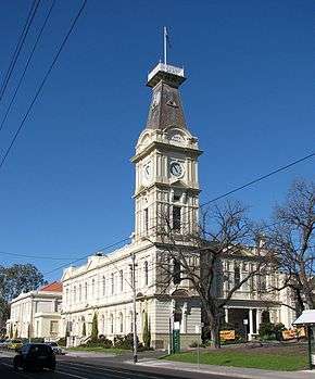 Camberwell Town Hall | |||||||||||||
| Population | 91,000 (1992)[1] | ||||||||||||
| • Density | 2,527/km2 (6,550/sq mi) | ||||||||||||
| Established | 1914 | ||||||||||||
| Area | 36.01 km2 (13.9 sq mi) | ||||||||||||
| Council seat | Camberwell | ||||||||||||
| Region | Melbourne | ||||||||||||
| County | Bourke | ||||||||||||
 | |||||||||||||
The City of Camberwell was a local government area about 10 kilometres (6 mi) east of Melbourne, the state capital of Victoria, Australia. The city covered an area of 36.01 square kilometres (13.90 sq mi), and existed from 1914 until 1994.
History
Camberwell was first incorporated as the Boroondara Road District on 11 July 1864, which became the Shire of Boroondara on 17 November 1871. At this point, Camberwell consisted of two small settlements; one near the Camberwell Inn and the other to the east, at Hartwell. Much of the shire's area was under cultivation, with a few sites for fine residences at the northern end.[2]
The shire was renamed to the Shire of Camberwell and Boroondara on 16 May 1905. It became a borough on 28 April 1905, a town on 15 May 1906 and a city, by proclamation, on 20 April 1914.[3]
The council's pathway to amalgamation was a little different from most. Following a redevelopment deal for land behind the Burke Road shops, the council reneged on the deal and had over $24 million damages awarded against it. Combined with an investigation which revealed serious governance breaches and other issues,[4] all councillors were sacked and replaced with a commissioner on 22 June 1993. At the same time, a major reform of local government in Victoria was taking place, and the decision was made to merge Camberwell with the Cities of Hawthorn and Kew into the newly created City of Boroondara, which took effect on 22 June 1994.[2][5]
Council meetings were held at the Camberwell Town Hall, on Camberwell Road, Camberwell. It presently serves as the council seat for the City of Boroondara.
Wards
The City of Camberwell was subdivided into four wards on 22 May 1934:
- North East Ward
- North West Ward
- Centre Ward
- South Ward
Each of the four wards elects three councillors.[3]
Suburbs
- Ashburton
- Balwyn
- Balwyn North
- Camberwell
- Canterbury
- Glen Iris (shared with the Cities of Malvern and Hawthorn)
- Surrey Hills (shared with the City of Box Hill)
Population
| Year | Population |
|---|---|
| 1911 | 12,551 |
| 1933 | 50,052 |
| 1947 | 76,125 |
| 1954 | 90,397 |
| 1958 | 99,300* |
| 1961 | 99,353 |
| 1966 | 99,867 |
| 1971 | 98,302 |
| 1976 | 89,865 |
| 1981 | 85,883 |
| 1986 | 83,792 |
| 1991 | 83,799 |
* Estimate in the 1958 Victorian Year Book.
Further reading
- Blainey, Geoffrey (1980). A History of Camberwell (Revised ed.). Melbourne: Lothian. ISBN 0-85091-124-9.
- Camberwell Conservation Study (1991)[6][7][8][9][10][11][12][13][14][15][16]
References
- ↑ Australian Bureau of Statistics, Victoria Office (1994). Victorian Year Book. p. 49. ISSN 0067-1223.
- 1 2 Monash University (1999). "Australian Places – Camberwell". Archived from the original on 3 October 2003. Retrieved 4 January 2008.
- 1 2 Victorian Municipal Directory. Brunswick: Arnall & Jackson. 1992. pp. 327–328. Accessed at State Library of Victoria, La Trobe Reading Room.
- ↑ "Investigation into Camberwell Council" (PDF). Parliament of Victoria. Retrieved 16 July 2016.
- ↑ Australian Bureau of Statistics (1 August 1995). Victorian local government amalgamations 1994–1995: Changes to the Australian Standard Geographical Classification (PDF). Commonwealth of Australia. p. 4. ISBN 0-642-23117-6. Retrieved 16 December 2007.
- ↑ Camberwell Conservation Study 1991 Vol 1 Recommendations & Guidelines – Part 1 (PDF), City of Camberwell, 1991, archived from the original (PDF) on 13 March 2011
- ↑ Camberwell Conservation Study 1991 Vol 1 Recommendations & Guidelines – Part 2 (PDF), City of Camberwell, 1991, archived from the original (PDF) on 13 March 2011
- ↑ Camberwell Conservation Study 1991 Vol 1 Recommendations & Guidelines – Part 3 (PDF), City of Camberwell, 1991, archived from the original (PDF) on 13 March 2011
- ↑ Camberwell Conservation Study 1991 Vol 2 (PDF), City of Camberwell, 1991, archived from the original (PDF) on 13 March 2011
- ↑ Camberwell Conservation Study 1991 Vol 3 – Part 1 (PDF), City of Camberwell, 1991, archived from the original (PDF) on 13 March 2011
- ↑ Camberwell Conservation Study 1991 Vol 3 – Part 2 (PDF), City of Camberwell, 1991, archived from the original (PDF) on 13 March 2011
- ↑ Camberwell Conservation Study 1991 Vol 3 – Part 3 (PDF), City of Camberwell, 1991, archived from the original (PDF) on 13 March 2011
- ↑ Camberwell Conservation Study 1991 Vol 4 – Part 1 (PDF), City of Camberwell, 1991, archived from the original (PDF) on 13 March 2011
- ↑ Camberwell Conservation Study 1991 Vol 4 – Part 2 (PDF), City of Camberwell, 1991, archived from the original (PDF) on 13 March 2011
- ↑ Camberwell Conservation Study 1991 Vol 4 – Part 3 (PDF), City of Camberwell, 1991, archived from the original (PDF) on 13 March 2011
- ↑ Camberwell Conservation Study 1991 Vol 5 (PDF), City of Camberwell, 1991, archived from the original (PDF) on 13 March 2011
Coordinates: 37°50′06″S 145°04′16″E / 37.835°S 145.071°E
