Changhua County
| Changhua County 彰化縣 | |||
|---|---|---|---|
| County | |||
|
Top:View of Wu River from National Highway 74, between Changsha and Wuri, 2nd left:Changhua County Hall, 2nd right:Baguashan Great Buddha in Changhua City, 3rd left:Lukang Tinhau Temple, 3rd right:View of inside in roof at Longshan Temple, Lukang, Bottom left:View of entrance in Baguashan Buddha Park, Bottom right:Koo's House in Lukang Folk Museum | |||
| |||
 | |||
| Coordinates: 23°56′N 120°32′E / 23.933°N 120.533°ECoordinates: 23°56′N 120°32′E / 23.933°N 120.533°E | |||
| Country | Taiwan | ||
| Province | Taiwan Province | ||
| Region | Western Taiwan | ||
| Seat | Changhua City | ||
| Largest city | Changhua City | ||
| Boroughs | 2 cities, 24 (6 urban, 18 rural) townships | ||
| Government | |||
| • County Magistrate | Wei Ming-ku (DPP) | ||
| Area | |||
| • Total | 1,074.396 km2 (414.827 sq mi) | ||
| Area rank | 15 of 22 | ||
| Population (2016)[1] | |||
| • Total | 1,288,923 | ||
| • Rank | 6 of 22 | ||
| • Density | 1,200/km2 (3,100/sq mi) | ||
| Time zone | National Standard Time (UTC+8) | ||
| Website | |||
| Symbols | |||
| Bird | Grey-faced buzzard (Butastur indicus) | ||
| Flower | Chrysanthemum | ||
| Tree | Peepul (Ficus religiosa) | ||


| Changhua County | |||||||||||||||||
| Traditional Chinese | 彰化縣 | ||||||||||||||||
|---|---|---|---|---|---|---|---|---|---|---|---|---|---|---|---|---|---|
| Simplified Chinese | 彰化县 | ||||||||||||||||
| |||||||||||||||||
Changhua County (Chinese: 彰化縣; pinyin: Zhānghuà Xiàn) is the smallest county on the main island of Taiwan by area, and the fourth smallest in the country. With a total population of 1.3 million, Changhua County is the most populous county in Taiwan.
History
There are prehistoric burial sites in Changhua that date back 5000 years. The number of burials tally to 32. The original name of the area was Poasoa (Chinese: 半線; Pe̍h-ōe-jī: Pòaⁿ-sòaⁿ; literally: "half line"), colloquially so-named by Taiwanese aboriginals. Poasoa used to be inhabited primarily by the Babuza people, who have since been mostly assimilated by the Han Chinese.
Qing Dynasty
Qing rule in Taiwan began in 1683, and in 1684, Taiwan Prefecture was established to administer Taiwan under Fujian Province. The prefecture consisted of three counties: Taiwan County, Fongshan District (Formosa) and Zhuluo. Poasoa and modern-day Changhua County were under the jurisdiction of Zhuluo, but the Changhua area was spread over three counties.
In 1723, after the Zhu Yigui rebellion, an inspector official in Taiwan requested to the Qing Emperor to designate Changhua to another county magistrate and legal warden because of the increasing population in the northern part of Zhuluo County.[2] As a result, Changhua County was created, encompassing the area of modern Changhua County, Taichung, half of Yunlin County and three townships of Nantou County. Changhua County Hall was built in the middle of the district and is regarded as the beginning of the Changhua County establishment.[3]
The name of Changhua, meaning "manifestation of a royal civilization", is formally worded "manifestation of the majestic Emperor's civilization spread over the seas".[3]
Empire of Japan
During early Japanese rule, the island was subdivided into three ken (縣): Taihoku, Taiwan, and Tainan. Changhua was ruled under Taiwan Ken. In 1920, after several administrative changes, Taichū Prefecture was established, covering modern-day Changhua County, Nantou County and Taichung City. By 1930, the population in Changhua already exceeded one million.
Republic of China
After the handover of Taiwan from Japan to the Republic of China on 25 December 1945, the area of the current Changhua County was established under the jurisdiction of Taichung County. On 16 August 1950 after its separation from Taichung County, Changhua County was established with Changhua City as its county seat on 1 December 1951.
Geography
Changhua county is located on the west coast of Taiwan, bordering Taichung City on the north separated by Dadu River, so Changhua County and Taichung City are often referred to as the Taichung–Changhua metropolitan area. Changhua County is bordered by Yunlin County to the south by the Zhuoshui River. To the east, Changhua County is separated from Nantou County and southern Taichung City by Bagua Plateau. To the west, Changhua County faces the Taiwan Strait.[4]
The County's total area is 1,074 km2, being Taiwan's smallest county. It owns a 60 km of coastline. The landscape of Changhua can be roughly divided into two parts, one being the western flat land, and the other being the Changhua Plain. This two combines together measures up to 88% of Changhua county's total area. The highest elevation in Changhua is "Hen Shan" (443m).
Administration
%E9%AD%8F%E6%98%8E%E8%B0%B7_Congressman_of_Taiwan_from_ChangHua_County_Wei%2C_Ming_Ku.jpg)


| Historical population | ||
|---|---|---|
| Year | Pop. | ±% |
| 1985 | 1,223,209 | — |
| 1990 | 1,245,288 | +1.8% |
| 1995 | 1,288,447 | +3.5% |
| 2000 | 1,310,531 | +1.7% |
| 2005 | 1,315,034 | +0.3% |
| 2010 | 1,307,286 | −0.6% |
| 2015 | 1,289,072 | −1.4% |
| Source:"Populations by city and country in Taiwan". Ministry of the Interior Population Census. | ||
Changhua County is divided into 2 cities, 6 urban townships and 18 rural townships. Changhua City is the seat of the county which houses the Changhua County Government and Changhua County Council. Changhua County has the highest number of urban townships of all the counties in Taiwan. It also has the second highest number of rural townships after Pingtung County. The current Magistrate of Changhua County is Wei Ming-ku of the Democratic Progressive Party.
Cities
- Changhua City (彰化市 Zhānghuà Shì)
- Yuanlin City (員林市 Yuánlín Shì)
Townships
Urban townships
- Beidou Township (北斗鎮 Běidǒu Zhèn)
- Erlin Township (二林鎮 Èrlín Zhèn)
- Hemei Township (和美鎮 Héměi Zhèn)
- Lukang Township (鹿港鎮 Lùgǎng Zhèn)
- Tianzhong Township (田中鎮 Tiánzhōng Zhèn)
- Xihu Township (溪湖鎮 Xīhú Zhèn)
Rural townships
- Dacheng Township (大城鄉)
- Dacun Township (大村鄉)
- Ershui Township (二水鄉)
- Fenyuan Township (芬園鄉)
- Fangyuan Township (芳苑鄉)
- Fuxing Township (福興鄉)
- Huatan Township (花壇鄉)
- Pitou Township (埤頭鄉)
- Puxin Township (埔心鄉)
- Puyan Township (埔鹽鄉)
- Shengang Township (伸港鄉)
- Shetou Township (社頭鄉)
- Tianwei Township (田尾鄉)
- Xianxi Township (線西鄉)
- Xiushui Township (秀水鄉)
- Xizhou Township (溪州鄉)
- Yongjing Township (永靖鄉)
- Zhutang Township (竹塘鄉)
Electoral politics
Changhua County is seen as a political battleground between the Kuomintang (KMT) and the Democratic Progressive Party (DPP). While it has historically favored the KMT, recent elections have swung in the direction of the DPP.
County Magistrate
The Changhua County Magistrate is the democratically-elected chief executive officer of the county. The current incumbent is Wei Ming-ku of the Democratic Progressive Party.
| Election | Winner | Party | Runner-up | Party | Majority | ||
|---|---|---|---|---|---|---|---|
| 2001 | Wong Chin-chu | DPP | Yeh Chin-fong | KMT | 44,080 | ||
| 2005 | Cho Po-yuan | KMT | Wong Chin-chu | DPP | 99,841 | ||
| 2009 | Cho Po-yuan | KMT | Wong Chin-chu | DPP | 71,444 | ||
| 2014 | Wei Ming-ku | DPP | Lin Tsang-min | KMT | 101,667 | ||
Legislative Yuan
Since the reorganization of the Legislative Yuan into a 113-member chamber in 2008, Changhua has been divided into four constituencies, each of which return one legislator. In 2011 the incumbent in Changhua 1, Chen Shou-ching, died in office. Because there was less than a year left on her term in office, the seat was left vacant until the 2012 election.[5] In 2014 a by-election was held in Changhua 4 after Wei Ming-ku was elected as Changhua County Magistrate.
| Constituency | Administrative areas | 2008 election | 2012 election | 2014 by-election | 2016 election | ||||||||
|---|---|---|---|---|---|---|---|---|---|---|---|---|---|
| Legislator | Party | Legislator | Party | Legislator | Party | Legislator | Party | ||||||
| Changhua 1 | Shengang, Xianxi, Hemei, Lukang, Fuxing, Xiushui | Chen Shou-ching | KMT | Wang Hui-mei | KMT | No change | Wang Hui-mei | KMT | |||||
| Changhua 2 | Changhua City, Huatan, Fenyuan | Lin Tsang-min | KMT | Lin Tsang-min | KMT | No change | Huang Hsiu-fang | DPP | |||||
| Changhua 3 | Fenyuan, Erlin, Puyan, Xihu, Puxin, Dacheng, Zhutang, Pitou, Beidou, Xizhou | Cheng Ju-fen | KMT | Cheng Ju-fen | KMT | No change | Hung Tsung-yi | DPP | |||||
| Changhua 4 | Dacun, Yuanlin, Yongjing, Shetou, Tianwei, Tianzhong, Ershui | Hsiao Ching-tien | KMT | Wei Ming-ku | DPP | Chen Su-yue | DPP | Chen Su-yue | DPP | ||||
Culture
Changhua County in films
Economy
Lukang used to be the economic hub of central Taiwan in its early years where it was a commercially prosperous area. It was an important trading port during the Qing Dynasty.[6]
Farming
Around 1,200 hectares of total land used for growing fruits in the county is used for grape cultivation with Xihu Township acts as the largest grape production hub in the county.[7]
Education
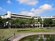
- National Changhua University of Education
- Dayeh University
- MingDao University
- Chienkuo Technology University
- Chung Chou University of Science and Technology
Energy

Changhua County is home to Taiwan's two gas-fired power plants, which are the Hsingyuan Power Plant with a capacity of 490 MW and Hsingneng Power Plant with a capacity of 490 MW as well. Both power plants are located in Lukang Township.
Tourism

Changhua was one of the cultural centers of Taiwan, with a lot of ancient monuments and structures left from the Qing Dynasty, including the Confucian Temple, Tian Ho Gung, built in Lukang in 1647. There are currently 6 National Certified Historical Monuments, 42 County Certified Historical Monuments, 67 Historical Infrastructures, and 1 Cultural Center in Changhua County.
Museums
Museums in the county include the BRAND'S Health Museum, Changhua County Art Museum and Changhua Arts Museum.
Art and culture centers
The county is home to the following art and culture centers, which are Lukang Culture Center, Lukang Folk Arts Museum and National Changhua Living Art Center.
Temples
Temples in Changhua County are Baozang Temple, Confucian Temple of Changhua, Lukang Longshan Temple and Lukang Wen Wu Temple.
Nature
Nature tourism in the county are Changhua Fitzroy Gardens.
Historical buildings
Historical buildings in the county are the Daodong Tutorial Academy, Fuxing Barn, Lukang Ai Gate, Lukang Kinmen Hall, Spring of Youth, Lukang Rimao Hang and Yusan Hall.
Transportation


Rail
There are 8 stations in Changhua County of the Taiwan Railway Administration (TRA), with the largest being Changhua Station located in Changhua City. The rest are: Huatan Station, Dacun Station, Yuanlin Station, Yongjing Station, Shetou Station, Tianzhong Station and Ershui Station.
Taiwan High Speed Rail has also one station in the county, which is Changhua Station.
Road
National Highway 1 and National Highway 3 both pass through Changhua County. In addition, there are plenty of provincial highways as well. The Xiluo Bridge, with a span over 1,900 meters and opened in 1953, links Changhua County with neighboring Yunlin County.
Sister cities
-
 Nagano Prefecture, Japan (2008)
Relative location
 |
|
| ||
| Taiwan Strait (South China Sea) Fujian, |
|
| ||
| ||||
| | ||||
| |
See also
References
- ↑ "公布欄-彰化縣政府全球資訊網 - 彰化縣105年4月份戶籍人口結構公告". www.chcg.gov.tw (in Chinese). 1 February 2007. Retrieved 6 June 2016.
- ↑ Davidson, James W. (1903). The Island of Formosa, Past and Present : history, people, resources, and commercial prospects : tea, camphor, sugar, gold, coal, sulphur, economical plants, and other productions. London and New York: Macmillan & co. p. 73. OL 6931635M.
After the terrible insurrection of 1722, it was found that the district of Choolo was too large to be conveniently administered by a single magistrate, and the northern portion was detached to become a new prefecture, named Changwha, while the north part of the island was formed into a ting or division, Tamsui, and was placed under the authority of a marine magistrate.
- 1 2 "History". Changhua County Government. 23 Nov 2010.
- ↑ "Geographic Location-CHANGHUA COUNTYGOVERNMENT". chcg.gov.tw.
- ↑ Yan Ruo-chin, 國民黨立委陳秀卿 久病過世 (KMT Legislator Chen Shou-ching Dies of Cancer), Liberty Times
- ↑ "Attractions > Tourism Towns > Lukang Township, Changhua County: Craftsmanship, Cuisine, and Historic Sites >". taiwan.net.tw.
- ↑ http://www.chinapost.com.tw/taiwan/local/changhua/2015/06/02/437437/Grapes-grown.htm
External links
| Wikimedia Commons has media related to Changhua County. |
| Special municipalities (6) |  | |
|---|---|---|
| Provincial cities (3) | ||
| Counties (13) | ||
| ||
Cities and townships of Changhua County | ||
|---|---|---|
| Cities | | |
| Urban townships | ||
| Rural townships | ||