Centralia, Missouri
| Centralia, Missouri | |
|---|---|
| City | |
|
Chatol, the A.B. Chance Guest House | |
| Nickname(s): Anchor City or Prairie Queen | |
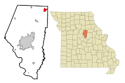 Location of Centralia, Missouri | |
| Coordinates: 39°12′35″N 92°8′11″W / 39.20972°N 92.13639°WCoordinates: 39°12′35″N 92°8′11″W / 39.20972°N 92.13639°W | |
| Country | United States |
| State | Missouri |
| Counties | Audrain, Boone |
| Area[1] | |
| • Total | 2.84 sq mi (7.36 km2) |
| • Land | 2.84 sq mi (7.36 km2) |
| • Water | 0 sq mi (0 km2) |
| Elevation | 883 ft (269 m) |
| Population (2010)[2] | |
| • Total | 4,027 |
| • Estimate (2012[3]) | 4,136 |
| • Density | 1,421/sq mi (548.5/km2) |
| Time zone | Central (CST) (UTC-6) |
| • Summer (DST) | CDT (UTC-5) |
| ZIP code | 65240 |
| Area code(s) | 573 |
| FIPS code | 29-12898[4] |
| GNIS feature ID | 0715695[5] |
| Website |
www |

Centralia is a city in Audrain and Boone counties in the U.S. state of Missouri. The population was 4,027 at the 2010 census,[6] with an estimated population of 4,136 in 2012.[7]
The Boone County portion of Centralia (by far the majority of the city) is part of the Columbia Metropolitan Statistical Area, while the Audrain County portion is part of the Mexico Micropolitan Statistical Area.
Geography
Centralia is located at 39°12′35″N 92°8′11″W / 39.20972°N 92.13639°W (39.209657, -92.136300).[8] According to the United States Census Bureau, the city has a total area of 2.84 square miles (7.36 km2), all of it land.[1]
Demographics
| Historical population | |||
|---|---|---|---|
| Census | Pop. | %± | |
| 1880 | 703 | — | |
| 1890 | 1,275 | 81.4% | |
| 1900 | 1,722 | 35.1% | |
| 1910 | 2,116 | 22.9% | |
| 1920 | 2,071 | −2.1% | |
| 1930 | 2,009 | −3.0% | |
| 1940 | 1,996 | −0.6% | |
| 1950 | 2,460 | 23.2% | |
| 1960 | 3,200 | 30.1% | |
| 1970 | 3,623 | 13.2% | |
| 1980 | 3,537 | −2.4% | |
| 1990 | 3,414 | −3.5% | |
| 2000 | 3,774 | 10.5% | |
| 2010 | 4,027 | 6.7% | |
| Est. 2015 | 4,194 | [9] | 4.1% |
| source:[10][11] | |||
2010 census
As of the census[2] of 2010, there were 4,027 people, 1,601 households, and 1,063 families residing in the city. The population density was 1,418.0 inhabitants per square mile (547.5/km2). There were 1,755 housing units at an average density of 618.0 per square mile (238.6/km2). The racial makeup of the city was 96.5% White, 1.0% African American, 0.4% Native American, 0.2% Asian, 0.5% from other races, and 1.3% from two or more races. Hispanic or Latino of any race were 1.6% of the population.
There were 1,601 households of which 36.0% had children under the age of 18 living with them, 48.4% were married couples living together, 12.7% had a female householder with no husband present, 5.2% had a male householder with no wife present, and 33.6% were non-families. 28.3% of all households were made up of individuals and 14.1% had someone living alone who was 65 years of age or older. The average household size was 2.47 and the average family size was 3.01.
The median age in the city was 38 years. 26.6% of residents were under the age of 18; 7.3% were between the ages of 18 and 24; 25.5% were from 25 to 44; 23% were from 45 to 64; and 17.7% were 66 years of age or older. The gender makeup of the city was 46.5% male and 53.5% female.
2000 census
As of the census[4] of 2000, there were 3,774 people, 1,505 households, and 1,032 families residing in the city. The population density was 1,492.0 people per square mile (575.9/km²). There were 1,648 housing units at an average density of 651.5 per square mile (251.5/km²). The racial makeup of the city was 97.11% White, 1.14% African American, 0.42% Native American, 0.08% Asian, 0.21% from other races, and 1.03% from two or more races. Hispanic or Latino of any race were 0.82% of the population.
There were 1,505 households out of which 37.7% had children under the age of 18 living with them, 53.3% were married couples living together, 12.6% had a female householder with no husband present, and 31.4% were non-families. 27.7% of all households were made up of individuals and 14.5% had someone living alone who was 65 years of age or older. The average household size was 2.45 and the average family size was 2.97.
In the city the population was spread out with 28.2% under the age of 18, 7.3% from 18 to 24, 27.9% from 25 to 44, 19.1% from 45 to 64, and 17.5% who were 65 years of age or older. The median age was 36 years. For every 100 females there were 83.8 males. For every 100 females age 18 and over, there were 77.8 males.
The median income for a household in the city was $34,475, and the median income for a family was $40,671. Males had a median income of $30,399 versus $21,115 for females. The per capita income for the city was $17,583. About 2.8% of families and 4.5% of the population were below the poverty line, including 3.0% of those under age 18 and 8.0% of those age 65 or over.
Education
The Centralia R-IV School District operates four schools: Chance Elementary (grades K-2), Centralia Intermediate (grades 3-5), Chester Boren Middle School (grades 6-8), and Centralia High School (grades 9-12).[12] Centralia Intermediate School is the newest building of the four, having opened for classes in August 2009. It was constructed in order to deal with the district's increasing enrollment. This new technology-rich building contains 15 classrooms, each with 12 computers.[13]
History
Centralia was laid out in 1857. It was named from its central location on the North Missouri Railroad from St. Louis to Ottumwa, Iowa, and from the fact that it was located near the center of a vast prairie between Mexico and Huntsville, and between Columbia and Paris.[14]
On September 27, 1864, 22 unarmed Union soldiers returning home on leave were pulled from a train in Centralia and executed by Confederate bushwhackers under William T. "Bloody Bill" Anderson. A Union force pursuing the guerrillas was ambushed, and about 150 were killed; some were executed, and some were tortured first. Many of the bodies were mutilated, then stuffed with the remains of rotting cattle bones. The incident came to be known as the Centralia Massacre.
Registered Historic Places
The following Centralia locations have been listed on the National Register of Historic Places:
Notable People
- Clyde Majerus – avid gardener who developed Clyde's Vegetable Garden Planner
References
- 1 2 "US Gazetteer files 2010". United States Census Bureau. Archived from the original on 2012-01-24. Retrieved 2012-07-08.
- 1 2 "American FactFinder". United States Census Bureau. Retrieved 2012-07-08.
- ↑ "Population Estimates". United States Census Bureau. Archived from the original on 2013-06-17. Retrieved 2013-05-30.
- 1 2 "American FactFinder". United States Census Bureau. Archived from the original on 2013-09-11. Retrieved 2008-01-31.
- ↑ "US Board on Geographic Names". United States Geological Survey. 2007-10-25. Retrieved 2008-01-31.
- ↑ "Geographic Identifiers: 2010 Demographic Profile Data (G001): Centralia city, Missouri". U.S. Census Bureau, American Factfinder. Retrieved January 23, 2014.
- ↑ "Annual Estimates of the Resident Population: April 1, 2010 to July 1, 2012: 2012 Population Estimates (PEPANNRES): Missouri". U.S. Census Bureau, American Factfinder. Retrieved January 23, 2014.
- ↑ "US Gazetteer files: 2010, 2000, and 1990". United States Census Bureau. 2011-02-12. Retrieved 2011-04-23.
- ↑ "Annual Estimates of the Resident Population for Incorporated Places: April 1, 2010 to July 1, 2015". Retrieved July 2, 2016.
- ↑ "Missouri Population 1900 - 1990" (CSV). Missouri Census Data Center. Retrieved 28 February 2010.
- ↑ "Census of Population and Housing, 1890, Final Reports Volume 1". United States Census Bureau. 1895. Archived from the original on 11 May 2015. Retrieved 1 May 2015.
- ↑ "Archived copy". Archived from the original on 2010-03-10. Retrieved 2010-02-06.
- ↑ "A New Day in a New Building: School Has Started." Centralia Fireside Guard 26 Aug. 2009: 1-2. Print.
- ↑ Eaton, David Wolfe (1916). How Missouri Counties, Towns and Streams Were Named. The State Historical Society of Missouri. p. 212.
External links
- City of Centralia official website
- Centralia Area Chamber of Commerce
- PBS American Experience site
- Historic maps of Centralia in the Sanborn Maps of Missouri Collection at the University of Missouri
- CREDI (Centralia Regional Economic Development, Inc.)
Municipalities and communities of Audrain County, Missouri, United States | ||
|---|---|---|
| Cities |  | |
| Villages | ||
| Townships | ||
| Unincorporated communities | ||
| Ghost town | ||
| Footnotes | ‡This populated place also has portions in an adjacent county or counties | |
Municipalities and communities of Boone County, Missouri, United States | ||
|---|---|---|
| Cities | 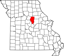 | |
| Villages | ||
| Townships | ||
| Unincorporated communities | ||
| Ghost towns | ||
| Footnotes | ‡This populated place also has portions in an adjacent county or counties | |
