Carlisle, Arkansas
| Carlisle, Arkansas | |
|---|---|
| City | |
| Motto: "Land here" | |
 Location in Lonoke County and the state of Arkansas | |
 Carlisle, Arkansas Location in the United States | |
| Coordinates: 34°47′10″N 91°44′41″W / 34.78611°N 91.74472°WCoordinates: 34°47′10″N 91°44′41″W / 34.78611°N 91.74472°W | |
| Country | United States |
| State | Arkansas |
| County | Lonoke |
| Area | |
| • Total | 4.9 sq mi (12.7 km2) |
| • Land | 4.9 sq mi (12.6 km2) |
| • Water | 0 sq mi (0.1 km2) |
| Elevation | 230 ft (70 m) |
| Population (2010) | |
| • Total | 2,214 |
| • Density | 470.2/sq mi (181.4/km2) |
| Time zone | Central (CST) (UTC-6) |
| • Summer (DST) | CDT (UTC-5) |
| ZIP code | 72024 |
| Area code(s) | 870 |
| FIPS code | 05-11500 |
| GNIS feature ID | 0069544 |
| Website | www.carlislear.org |
Carlisle is a city in Lonoke County, Arkansas, United States. It is the easternmost municipality within the Little Rock–North Little Rock–Conway Metropolitan Statistical Area. Carlisle was incorporated in 1878.
Geography
Carlisle is located at 34°47′10″N 91°44′41″W / 34.78611°N 91.74472°W (34.786109, -91.744835).[1]
According to the United States Census Bureau, the city has a total area of 4.9 square miles (13 km2), of which, 4.9 square miles (13 km2) of it is land and 0.04 square miles (0.10 km2) of it (0.41%) is water.
Demographics
| Historical population | |||
|---|---|---|---|
| Census | Pop. | %± | |
| 1880 | 159 | — | |
| 1890 | 185 | 16.4% | |
| 1900 | 212 | 14.6% | |
| 1910 | 516 | 143.4% | |
| 1920 | 602 | 16.7% | |
| 1930 | 907 | 50.7% | |
| 1940 | 1,080 | 19.1% | |
| 1950 | 1,396 | 29.3% | |
| 1960 | 1,514 | 8.5% | |
| 1970 | 2,048 | 35.3% | |
| 1980 | 2,567 | 25.3% | |
| 1990 | 2,253 | −12.2% | |
| 2000 | 2,304 | 2.3% | |
| 2010 | 2,214 | −3.9% | |
| Est. 2015 | 2,183 | [2] | −1.4% |
2015 Estimate[4] | |||
As of the census[5] of 2000, there were 2,304 people, 955 households, and 645 families residing in the city. The population density was 471.7 people per square mile (182.3/km²). There were 1,029 housing units at an average density of 210.7 per square mile (81.4/km²). The racial makeup of the city was 86.28% White, 12.46% Black or African American, 0.52% Native American, 0.22% Asian, and 0.52% from two or more races. 0.56% of the population were Hispanic or Latino of any race.
There were 954 households out of which 27.5% had children under the age of 18 living with them, 52.9% were married couples living together, 11.3% had a female householder with no husband present, and 32.4% were non-families. 29.9% of all households were made up of individuals and 15.9% had someone living alone who was 65 years of age or older. The average household size was 2.32 and the average family size was 2.87.
In the city the population was spread out with 22.9% under the age of 18, 7.5% from 18 to 24, 24.5% from 25 to 44, 24.8% from 45 to 64, and 20.3% who were 65 years of age or older. The median age was 41 years. For every 100 females there were 88.9 males. For every 100 females age 18 and over, there were 80.8 males.
The median income for a household in the city was $30,086, and the median income for a family was $39,853. Males had a median income of $30,292 versus $20,563 for females. The per capita income for the city was $15,725. About 10.5% of families and 15.5% of the population were below the poverty line, including 16.3% of those under age 18 and 26.7% of those age 65 or over.
Education
Public education for early childhood, elementary and secondary school students is provided from:
- Carlisle School District (primary), which leads to graduation from Carlisle High School.
- Des Arc School District, which leads to graduation from Des Arc High School.
Notable people
- Johnny Adams - Jockey and racehorse trainer: born in Carlisle, raised in Iola, Kansas
- Maurice Britt - Medal of Honor recipient from World War II. First Republican lieutenant governor of Arkansas since Reconstruction; born in Carlisle and reared in Lonoke.
- Mitch Petrus - NFL offensive lineman for the New York Giants
References
- ↑ "US Gazetteer files: 2010, 2000, and 1990". United States Census Bureau. 2011-02-12. Retrieved 2011-04-23.
- ↑ "Annual Estimates of the Resident Population for Incorporated Places: April 1, 2010 to July 1, 2015". Retrieved July 2, 2016.
- ↑ "Census of Population and Housing". Census.gov. Archived from the original on May 11, 2015. Retrieved June 4, 2015.
- ↑ "Annual Estimates of the Resident Population for Incorporated Places: April 1, 2010 to July 1, 2015". Retrieved June 2, 2016.
- ↑ "American FactFinder". United States Census Bureau. Archived from the original on 2013-09-11. Retrieved 2008-01-31.
External links
- Encyclopedia of Arkansas History & Culture entry: Carlisle (Lonoke County)
Municipalities and communities of Lonoke County, Arkansas, United States | ||
|---|---|---|
| Cities | 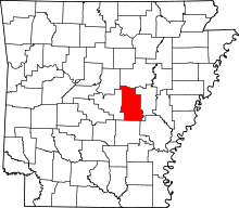 | |
| Towns | ||
| CDP | ||
| Townships |
| |
| Unincorporated communities | ||
| Footnotes | ‡This populated place also has portions in an adjacent county or counties | |
