Cantaron
| Cantaron | ||
|---|---|---|
|
The church and the cemetery on the right, the village is on the left | ||
| ||
 Cantaron | ||
|
Location within Provence-A.-C.d'A. region 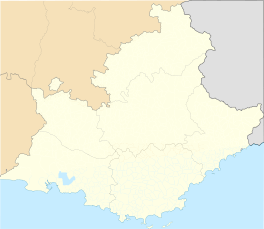 Cantaron | ||
| Coordinates: 43°45′46″N 7°19′09″E / 43.7628°N 7.3192°ECoordinates: 43°45′46″N 7°19′09″E / 43.7628°N 7.3192°E | ||
| Country | France | |
| Region | Provence-Alpes-Côte d'Azur | |
| Department | Alpes-Maritimes | |
| Arrondissement | Nice | |
| Canton | Contes | |
| Intercommunality | Pays des Paillons | |
| Government | ||
| • Mayor (2008–2014) | Michel Guidi | |
| Area1 | 7.38 km2 (2.85 sq mi) | |
| Population (2008)2 | 1,192 | |
| • Density | 160/km2 (420/sq mi) | |
| Time zone | CET (UTC+1) | |
| • Summer (DST) | CEST (UTC+2) | |
| INSEE/Postal code | 06031 / 06340 | |
| Elevation |
90–780 m (300–2,560 ft) (avg. 100 m or 330 ft) | |
|
1 French Land Register data, which excludes lakes, ponds, glaciers > 1 km² (0.386 sq mi or 247 acres) and river estuaries. 2 Population without double counting: residents of multiple communes (e.g., students and military personnel) only counted once. | ||


Cantaron is a commune in the Alpes-Maritimes department in southeastern France.
Population
| Historical population | ||
|---|---|---|
| Year | Pop. | ±% |
| 1962 | 329 | — |
| 1968 | 539 | +63.8% |
| 1975 | 774 | +43.6% |
| 1982 | 956 | +23.5% |
| 1990 | 1,233 | +29.0% |
| 1999 | 1,258 | +2.0% |
| 2008 | 1,192 | −5.2% |
See also
References
| Wikimedia Commons has media related to Cantaron. |
This article is issued from Wikipedia - version of the 1/29/2015. The text is available under the Creative Commons Attribution/Share Alike but additional terms may apply for the media files.