Roquebillière
| Roquebillière | ||
|---|---|---|
|
A general view of the village, with the belfry in the middle | ||
| ||
 Roquebillière | ||
|
Location within Provence-A.-C.d'A. region 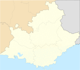 Roquebillière | ||
| Coordinates: 44°00′43″N 7°18′27″E / 44.0119°N 07.3075°ECoordinates: 44°00′43″N 7°18′27″E / 44.0119°N 07.3075°E | ||
| Country | France | |
| Region | Provence-Alpes-Côte d'Azur | |
| Department | Alpes-Maritimes | |
| Arrondissement | Nice | |
| Canton | Roquebillière | |
| Government | ||
| • Mayor (2008–2014) | Gérard Manfredi | |
| Area1 | 25.92 km2 (10.01 sq mi) | |
| Population (2008)2 | 1,636 | |
| • Density | 63/km2 (160/sq mi) | |
| Time zone | CET (UTC+1) | |
| • Summer (DST) | CEST (UTC+2) | |
| INSEE/Postal code | 06103 / 06450 | |
| Elevation | 500–2,045 m (1,640–6,709 ft) | |
|
1 French Land Register data, which excludes lakes, ponds, glaciers > 1 km² (0.386 sq mi or 247 acres) and river estuaries. 2 Population without double counting: residents of multiple communes (e.g., students and military personnel) only counted once. | ||
.jpg)

Roquebillière is a commune in the Alpes-Maritimes department in southeastern France.
History
It was part of the historic County of Nice until 1860 as Roccabigliere." The town was at one time a Templar settlement.
Population
| Historical population | ||
|---|---|---|
| Year | Pop. | ±% |
| 1962 | 1,377 | — |
| 1968 | 1,426 | +3.6% |
| 1975 | 1,336 | −6.3% |
| 1982 | 1,504 | +12.6% |
| 1990 | 1,539 | +2.3% |
| 1999 | 1,467 | −4.7% |
| 2008 | 1,636 | +11.5% |
See also
References
External links
- (English) (French) & (Occitan) Dance and traditional music from Roquebillière
| Wikimedia Commons has media related to Roquebillière. |
This article is issued from Wikipedia - version of the 3/15/2016. The text is available under the Creative Commons Attribution/Share Alike but additional terms may apply for the media files.