Campbell's Covered Bridge
| Campbell's Covered Bridge | |
|---|---|
 A photo of Campbell's Covered Bridge near Gowensville, South Carolina. | |
| Coordinates | |
|
Campbell's Covered Bridge | |
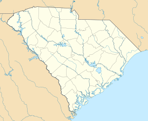  | |
| Location | 123 Campbell Covered Bridge Rd., Gowensville, South Carolina |
| Coordinates | 35°5′9″N 82°15′51″W / 35.08583°N 82.26417°WCoordinates: 35°5′9″N 82°15′51″W / 35.08583°N 82.26417°W |
| Area | less than one acre |
| Built | 1909 |
| Architectural style | Howe truss |
| NRHP Reference # | 09000483[1] |
| Added to NRHP | July 1, 2009 |
| Carries | 123 Campbell Covered Bridge Rd. |
| Crosses | Beaverdam Creek |
| Locale | Gowensville, Greenville County, South Carolina |
| Characteristics | |
| Design | Covered bridge |
| Total length | 38 ft (12 m) |
| Width | 12 ft (3.7 m) |
| History | |
| Construction end | 1909 |
Campbell's Covered Bridge is a wooden covered bridge in northeastern Greenville County, South Carolina, near the small town of Gowensville,[2][3] and crosses Beaverdam Creek off Pleasant Hill Road.[4]
Campbell's Covered Bridge is the last remaining covered bridge in South Carolina.[5] It is owned by Greenville County, which closed it to motorized traffic in the early 1980s.[6] The bridge was added to the National Register of Historic Places on July 1, 2009.[1]
History
The bridge was built in 1909 by Charles Irwin Willis (1878–1966)[7] and was named for grist mill owner Alexander Lafayette Campbell (1836–1920), who built and maintained a nearby corn mill for many years,[7] portions of which remain.[6]
The Campbell bridge has been restored twice, first in 1964 by the Crescent Garden Club,[4] and then in 1990.[8]
The land surrounding the bridge was owned by Sylvia Pittman until 2005,[6] when she sold 10 acres (40,000 m2) to the Greenville County.[6] She said, "I had in mind to have a park preserve this to let everyone enjoy this like we have."[6] The US$180,000 for beginning the park was covered by state and county grants.[6]
Structure
The Campbell's bridge is 38 feet (12 m) long and 12 feet (3.7 m) wide.[4] It was constructed in the relatively rare four-span, Howe truss design and features vertical iron rods and diagonal pine timbers.[9]
References
- 1 2 National Park Service (2010-07-09). "National Register Information System". National Register of Historic Places. National Park Service.
- ↑ Brown, Weylin; Dean Campbell (March 14, 2009). "Campbell's Covered Bridge" (pdf). National Register of Historic Places - Nomination and Inventory. Retrieved 8 July 2012.
- ↑ "Campbell's Covered Bridge, Greenville County (123 Campbell Covered Bridge Rd., Gowensville vicinity)". National Register Properties in South Carolina. South Carolina Department of Archives and History. Retrieved 8 July 2012.
- 1 2 3 "Designated Sites - Campbell Covered Bridge". Greenville County Historic Preservation Commission. Retrieved 2008-10-07.
- ↑ "Gowensville, South Carolina – Campbell Covered Bridge". South Carolina Information Highway (SCIway.net). Retrieved 2008-10-02. External link in
|publisher=(help) - 1 2 3 4 5 6 "Covered Bridge To Become Centerpiece Of New Park". WYFF. 2005-04-14. Retrieved 2008-10-03.
- 1 2 "Campbell's Covered Bridge (23-25)". Waymarking.com. 2006-06-23. Retrieved 2008-10-02.
- ↑ John F. Clark; Patricia A. Pierce (2003). Scenic Driving South Carolina. Globe Pequot. p. 40. Retrieved 2008-10-07.
- ↑ Scott Cochran (2007). Motorcycle Journeys Through the American South. Springer Science & Business. p. 234. Retrieved 2008-10-04.
| Topics |   | |
|---|---|---|
| Lists by county |
| |
| Lists by city | ||
| Other lists | ||