Bulhary (Břeclav District)
| Bulhary | |||
| Village | |||
|
|||
| Country | Czech Republic | ||
|---|---|---|---|
| Region | South Moravian | ||
| District | Břeclav | ||
| Elevation | 170 m (558 ft) | ||
| Coordinates | CZ 48°49′53.28″N 16°44′55.46″E / 48.8314667°N 16.7487389°ECoordinates: CZ 48°49′53.28″N 16°44′55.46″E / 48.8314667°N 16.7487389°E | ||
| Area | 15.16 km2 (6 sq mi) | ||
| - land | 14.86 km2 (6 sq mi) | ||
| - water | 0.30 km2 (0 sq mi) | ||
| Population | 804 (December 31, 2008[1]) | ||
| Density | 53/km2 (137/sq mi) | ||
| First mentioned | 1244 | ||
| Mayor | Pavel Lebloch | ||
| Timezone | CET (UTC+1) | ||
| - summer (DST) | CEST (UTC+2) | ||
| Postal code | 691 89 | ||
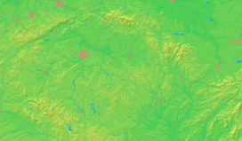
  Location in the Czech Republic
| |||
| Statistics: statnisprava.cz, CZSO Public Database | |||
| Website: http://www.bulhary.cz/ | |||
Bulhary (before 1949 Pulgary,German Pulgram) is village located 8 km from Mikulov, South Moravia Region, Czech Republic. Bulhary was found in 12th century by Germany colonists. The first written report is from 1244, when Bulhary was belonged to Lednice manor. Around village is located important archaeological site mammoth hunters. About 800 people lives here. Postal code is 691 89.
Bulhary is wine village in Mikulov wine subregion (vineyard Nad Sklepy, Doubrava, Na pískách, Panské, Podlesí, Zahrady).
External links
- (Czech) Official website
References
- ↑ "Vybrané statistické údaje za obec" (in Czech). Czech Statistical Office. Retrieved July 8, 2009.
| Wikimedia Commons has media related to Bulhary (Břeclav District). |
This article is issued from Wikipedia - version of the 10/23/2016. The text is available under the Creative Commons Attribution/Share Alike but additional terms may apply for the media files.
