Bucklin, Missouri
| Bucklin, Missouri | |
|---|---|
| City | |
|
Informational plaque (photo by Roy Wyatt) | |
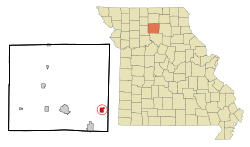 Location of Bucklin, Missouri | |
| Coordinates: 39°47′1″N 92°53′17″W / 39.78361°N 92.88806°WCoordinates: 39°47′1″N 92°53′17″W / 39.78361°N 92.88806°W | |
| Country | United States |
| State | Missouri |
| County | Linn |
| Area[1] | |
| • Total | 1.18 sq mi (3.06 km2) |
| • Land | 1.18 sq mi (3.06 km2) |
| • Water | 0 sq mi (0 km2) |
| Elevation | 899 ft (274 m) |
| Population (2010)[2] | |
| • Total | 467 |
| • Estimate (2012[3]) | 455 |
| • Density | 395.8/sq mi (152.8/km2) |
| Time zone | Central (CST) (UTC-6) |
| • Summer (DST) | CDT (UTC-5) |
| ZIP code | 64631 |
| Area code(s) | 660 |
| FIPS code | 29-09388[4] |
| GNIS feature ID | 0735539[5] |

Bucklin is a city in Linn County, Missouri, United States. The population was 467 at the 2010 census.
History
Bucklin was laid out in 1854, and named after James H. Bucklin, a railroad official.[6] A post office called Bucklin has been in operation since 1860.[7]
Geography
Bucklin is located at 39°47′1″N 92°53′17″W / 39.78361°N 92.88806°W (39.783582, -92.888071).[8] According to the United States Census Bureau, the city has a total area of 1.18 square miles (3.06 km2), all of it land.[1]
Demographics
| Historical population | |||
|---|---|---|---|
| Census | Pop. | %± | |
| 1880 | 430 | — | |
| 1890 | 711 | 65.3% | |
| 1900 | 642 | −9.7% | |
| 1910 | 790 | 23.1% | |
| 1920 | 863 | 9.2% | |
| 1930 | 932 | 8.0% | |
| 1940 | 842 | −9.7% | |
| 1950 | 783 | −7.0% | |
| 1960 | 639 | −18.4% | |
| 1970 | 654 | 2.3% | |
| 1980 | 713 | 9.0% | |
| 1990 | 616 | −13.6% | |
| 2000 | 524 | −14.9% | |
| 2010 | 467 | −10.9% | |
| Est. 2015 | 446 | [9] | −4.5% |
2010 census
As of the census[2] of 2010, there were 467 people, 228 households, and 132 families residing in the city. The population density was 395.8 inhabitants per square mile (152.8/km2). There were 271 housing units at an average density of 229.7 per square mile (88.7/km2). The racial makeup of the city was 99.4% White, 0.2% Native American, and 0.4% from two or more races. Hispanic or Latino of any race were 1.9% of the population.
There were 228 households of which 17.5% had children under the age of 18 living with them, 46.9% were married couples living together, 7.5% had a female householder with no husband present, 3.5% had a male householder with no wife present, and 42.1% were non-families. 37.3% of all households were made up of individuals and 17.1% had someone living alone who was 65 years of age or older. The average household size was 2.05 and the average family size was 2.63.
The median age in the city was 48.8 years. 18.2% of residents were under the age of 18; 5.7% were between the ages of 18 and 24; 20.4% were from 25 to 44; 31.6% were from 45 to 64; and 24% were 65 years of age or older. The gender makeup of the city was 49.9% male and 50.1% female.
2000 census
As of the census[4] of 2000, there were 524 people, 241 households, and 145 families residing in the city. The population density was 442.6 people per square mile (171.5/km²). There were 273 housing units at an average density of 230.6/sq mi (89.3/km²). The racial makeup of the city was 98.09% White, 0.57% from other races, and 1.34% from two or more races. Hispanic or Latino of any race were 1.34% of the population.
There were 241 households out of which 22.0% had children under the age of 18 living with them, 46.5% were married couples living together, 10.4% had a female householder with no husband present, and 39.8% were non-families. 36.5% of all households were made up of individuals and 23.2% had someone living alone who was 65 years of age or older. The average household size was 2.17 and the average family size was 2.81.
In the city the population was spread out with 21.4% under the age of 18, 6.5% from 18 to 24, 24.0% from 25 to 44, 22.7% from 45 to 64, and 25.4% who were 65 years of age or older. The median age was 43 years. For every 100 females there were 91.2 males. For every 100 females age 18 and over, there were 82.3 males.
The median income for a household in the city was $21,490, and the median income for a family was $26,000. Males had a median income of $23,500 versus $19,375 for females. The per capita income for the city was $13,709. About 17.3% of families and 20.0% of the population were below the poverty line, including 39.7% of those under age 18 and 12.9% of those age 65 or over.
References
- 1 2 "US Gazetteer files 2010". United States Census Bureau. Archived from the original on 2012-07-14. Retrieved 2012-07-08.
- 1 2 "American FactFinder". United States Census Bureau. Retrieved 2012-07-08.
- ↑ "Population Estimates". United States Census Bureau. Archived from the original on 2013-06-17. Retrieved 2013-05-30.
- 1 2 "American FactFinder". United States Census Bureau. Archived from the original on 2013-09-11. Retrieved 2008-01-31.
- ↑ "US Board on Geographic Names". United States Geological Survey. 2007-10-25. Retrieved 2008-01-31.
- ↑ "Linn County Place Names, 1928–1945". The State Historical Society of Missouri. Archived from the original on June 24, 2016. Retrieved October 29, 2016.
- ↑ "Post Offices". Jim Forte Postal History. Retrieved 29 October 2016.
- ↑ "US Gazetteer files: 2010, 2000, and 1990". United States Census Bureau. 2011-02-12. Retrieved 2011-04-23.
- ↑ "Annual Estimates of the Resident Population for Incorporated Places: April 1, 2010 to July 1, 2015". Retrieved July 2, 2016.
- ↑ "Census of Population and Housing". Census.gov. Archived from the original on May 11, 2015. Retrieved June 4, 2015.
External links
- Bucklin schools
- Historic maps of Bucklin in the Sanborn Maps of Missouri Collection at the University of Missouri
Municipalities and communities of Linn County, Missouri, United States | ||
|---|---|---|
| Cities |  | |
| Townships | ||
| Unincorporated communities | ||
| Footnotes | ‡This populated place also has portions in an adjacent county or counties | |