Broke, New South Wales
| Broke New South Wales | |
|---|---|
 View of Broke from nearby hills | |
|
Broke | |
| Coordinates | 32°44′54″S 151°06′04″E / 32.74833°S 151.10111°ECoordinates: 32°44′54″S 151°06′04″E / 32.74833°S 151.10111°E |
| Population | 636 (2011 census)[1] |
| Postcode(s) | 2330 |
| Time zone | AEST (UTC+10) |
| • Summer (DST) | AEDT (UTC+11) |
| Location | |
| LGA(s) | Singleton Council[2] |
| Region | Hunter[2] |
| County | Northumberland[3] |
| Parish | Harrowby[3] |
| State electorate(s) | Cessnock[4] |
| Federal Division(s) | Hunter[5] |
Broke is a village of approximately 636[1] people in the Hunter Region of New South Wales, Australia in Singleton Shire. It is located 157 kilometres (98 mi) to the north of Sydney on the original early colonial road from Sydney to Singleton (24 kilometres (15 mi) north).[6][7]
Description
The Broke area is well known for its boutique wine production and is usually referred to as the 'Broke-Fordwich' wine region (a sub-region to the more famous Pokolbin area nearby). There is also substantial open-cut and underground coal mining in the area between Broke and Singleton. The village also holds an annual fair in September.
Broke contains a primary school, a Catholic church, an Anglican church and a service station with store and post office. The brick house on the south side of the store is the former police station and lock-up.[8] The south side of Broke provides views across properties to the Broken Back Range, the most conspicuous feature of which is the sandstone formation known as Yellow Rock.[9]
History
Explorers first reached the Broke area in 1818 and land grants followed in 1824. John Blaxland received a grant because he had found a route to the Hunter Valley, while grants also went to George Blaxland and Robert Rodd. The village was given its name by Major Thomas Mitchell, the Surveyor General, who used the name of his English friend Sir Charles Broke-Vere.
John Blaxland had built a mill at the nearby Fordwich by 1860. Six years later, Broke had an Anglican church, a farm implements workshop and a school. The Great North Road was completed and became the main stock route to Sydney; since it passed through Broke, it contributed to further growth of the village, with something like a thousand head of cattle using the route each week. This amount of activity meant that by the late 1800s Broke had several hotels, a post office, a school, a mill, two churches, a hall, a brick kiln, a butchery, bakery and blacksmith.
However, it was not to last. The railways eventually replaced the Great North Road as the main route between Sydney and the Hunter, which meant a drastic drop in traffic through Broke. A railway service between Wollombi and Singleton was proposed but never constructed. Broke reverted to being the quiet village it had originally been. However, a number of significant buildings have survived from the early days. They include the original post office (1882), the village hall (1898), public school (1876), Anglican church and Catholic church, the old police station and the remains of the Blaxland Homestead on Broke Road.[8]
Baiame cave
Approximately 12 kilometres (7 mi) north-west of Broke is an 80-hectare (198-acre) site containing rock shelters with several Aboriginal paintings, which are thought to depict Baiame, the Sky Father who created the world through his dreaming. The site, which is on private property, is popularly known as Baiame Cave and is on the Register of the National Estate.[10]
Gallery
 Ruins of Blaxland Homestead, Broke Road
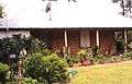 Former police station, Broke Road
 Catholic Church, Broke Road
 Yellow Rock
References
- 1 2 Australian Bureau of Statistics (31 October 2012). "Broke (State Suburb)". 2011 Census QuickStats. Retrieved 12 April 2015.
- 1 2 "Suburb Search - Local Council Boundaries - Hunter (HT) - Singleton Council". New South Wales Division of Local Government. Retrieved 14 January 2010.
- 1 2 "Broke". Geographical Names Register (GNR) of NSW. Geographical Names Board of New South Wales. Retrieved 14 January 2010.
- ↑ "Cessnock". New South Wales Electoral Commission. 28 March 2015. Retrieved 12 April 2015.
- ↑ "Hunter". Australian Electoral Commission. 10 January 2007. Retrieved 14 January 2010.
- ↑ "Broke". Land and Property Management Authority - Spatial Information eXchange. New South Wales Land and Property Information. Retrieved 14 January 2010.
- ↑ "MapMaker". Travelmate.com.au. Retrieved 14 January 2010.
- 1 2 "History of Broke". Singleton Council. Retrieved 14 January 2010.
- ↑ Broken Back Topographic Map 9132-3-N, Land Information Centre of New South Wales
- ↑ The Heritage of Australia, Macmillan Company, 1981, p.2/211
External links
| Wikimedia Commons has media related to Hunter Valley. |
| Wikimedia Commons has media related to Broke, New South Wales. |