British Columbia Highway 11
| ||||
|---|---|---|---|---|
|
Abbotsford-Mission Highway Sumas Way | ||||
|
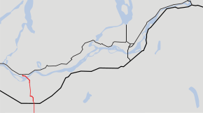
Highway 11 highlighted in red. | ||||
| Route information | ||||
| Length: | 17 km (11 mi) | |||
| Existed: | 1958 – present | |||
| Major junctions | ||||
| South end: |
| |||
|
| ||||
| North end: |
| |||
| Location | ||||
| Major cities: | Abbotsford, Mission | |||
| Highway system | ||||
|
British Columbia provincial highways
| ||||

Highway 11, known locally as the Abbotsford-Mission Highway, is a 17 km (11 mi) long at-grade expressway (With the southernmost part of the highway two lanes) that literally cuts the Fraser Valley in half. The highway was first given the '11' designation in 1958, and it originally followed South Fraser Way through Abbotsford, being re-routed onto the four-lane Sumas Way in the mid-1980s. Highway 11 originally entered Mission over the same bridge that carries a spur of the Canadian Pacific Railway across the Fraser River, but it was re-routed onto its own bridge, the Mission Bridge, in 1973.
Route details
In the south, Highway 11 begins at the Huntingdon Canada–US border crossing, where it connects with Washington State Route 9. The highway goes north for 3 km (2 mi) to its junction with Highway 1. North of Highway 1, the route travels 4 km (2½ mi) north, passing through two interchanges, before arriving at an intersection with Gladys Road. Highway 11 is facing west at this point, so it turns right onto its own dedicated route. Highway 11 from this point proceeds north for 10 km (6 mi). It passes through the community of Matsqui and an interchange into Matsqui's centre, then crosses the Fraser River over the Mission Bridge into Mission, where it terminates at its junction with Highway 7.
Major intersections
The entirely of the route is in the Fraser Valley Regional District.
| Location | km | mi | Destinations | Notes | |||
|---|---|---|---|---|---|---|---|
| Continues as | |||||||
| City of Abbotsford | 2nd Avenue east | ||||||
| 4th Avenue | |||||||
| Vye Road | |||||||
| Partially grade-separated | |||||||
| Delair Road | |||||||
| Marshall Road | |||||||
| South Fraser Way | |||||||
| Old Yale Road | Grade-separated; no southbound exit | ||||||
| Old Clayburn Road | Grade-separated | ||||||
| Gladys Avenue south | Highway 11 turns right from Sumas Way onto Abbotsford-Mission Highway | ||||||
| Turner Street | Southbound exit/entrance | ||||||
| Hazelwood Avenue, Industrial Avenue | |||||||
| McCallum Road west | |||||||
| Valley Road west | |||||||
| Bateman Road east | |||||||
| Clayburn Road | |||||||
| Townshipline Road | Partial access (right in/right out) | ||||||
| Harris Road | |||||||
| Fore Road | Northbound exit/entrance | ||||||
| Riverside Street | Partial access (northbound entrance, southbound exit) | ||||||
| Mission Bridge over Fraser River | |||||||
| District of Mission | Horne Street expressway connector to | ||||||
| Northbound collector lane; exits to London Avenue, shopping centre | |||||||
| Southbound collector lane; exits to London Avenue, Dyke Road to Mission Raceway Park and Horne Street | |||||||
| Northern terminus | |||||||
| Continues as Cedar Valley Connector and Cedar Street into Mission | |||||||
| 1.000 mi = 1.609 km; 1.000 km = 0.621 mi | |||||||
