Bridge at Falling Creek
|
Bridge at Falling Creek | |
|
Bridge at Falling Creek, September 2012 | |
  | |
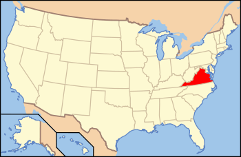
| Location | US 1/301 at Falling Cr., near Richmond, Virginia |
|---|---|
| Coordinates | 37°26′22″N 77°26′22″W / 37.43944°N 77.43944°WCoordinates: 37°26′22″N 77°26′22″W / 37.43944°N 77.43944°W |
| Area | 2.5 acres (1.0 ha) |
| Built | c. 1823 |
| Built by | Carter, William |
| NRHP Reference # | 95001171[1] |
| VLR # | 020-0135 |
| Significant dates | |
| Added to NRHP | October 12, 1995 |
| Designated VLR | August 28, 1995[2] |

| Bridge at Falling Creek | |
|---|---|
| Carries |
|
| Crosses | Falling Creek, Virginia |
| Locale | Chesterfield, Virginia |
| Official name | Bridge at Falling Creek |
| History | |
| Opened | 1823 |
| Closed | 1977 |
The Bridge at Falling Creek is a historic stone arch bridge located near Richmond, in Chesterfield County, Virginia. It was built about 1823, and is built of rough-cut, uncoursed granite. The bridge is carried by two semicircular barrel arches with voussoirs of rough-finished granite. The total width, including parapets is 24 feet and the length is 148 feet. The bridge carried the southbound lanes of U.S. Route 301 until 1977, when it was put out of service. It is accessible from a wayside that includes the Falling Creek UDC Jefferson Davis Highway Marker.[3] The bridge was partially damaged in 2004 but still remains significant.
It was listed on the National Register of Historic Places in 1995.[1]
References
- 1 2 National Park Service (2010-07-09). "National Register Information System". National Register of Historic Places. National Park Service.
- ↑ "Virginia Landmarks Register". Virginia Department of Historic Resources. Retrieved 5 June 2013.
- ↑ James Christian Hill (April 1995). "National Register of Historic Places Inventory/Nomination: Bridge at Falling Creek" (PDF). Virginia Historic Landmarks Commission. and Accompanying two photos

This article is issued from Wikipedia - version of the 11/30/2016. The text is available under the Creative Commons Attribution/Share Alike but additional terms may apply for the media files.