Birur
| Birur ಬೀರೂರು | |
|---|---|
| town | |
 Birur Location in Karnataka, India | |
| Coordinates: 13°35′45″N 75°58′16″E / 13.5959°N 75.9711°ECoordinates: 13°35′45″N 75°58′16″E / 13.5959°N 75.9711°E | |
| Country |
|
| State | Karnataka |
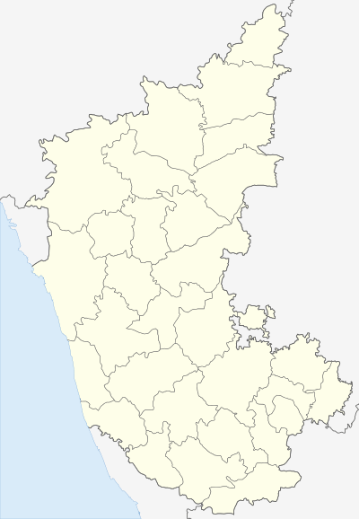
| District | Chikkamagaluru |
| Elevation | 833 m (2,733 ft) |
| Population (2001) | |
| • Total | 22,601 |
| Languages | |
| • Official | Kannada |
| Time zone | IST (UTC+5:30) |
| PIN | 577 116 |
| Telephone code | 08267 |
| Vehicle registration | KA-18 |
| Website |
web |
Birur is a town located in Kadur Taluk in Chikkamagaluru district in the state of Karnataka, India.
Brief Introduction of Birur TMC : -
- The Town Municipal Council was started in 01/09/1912
- It has the distance of 47 km from District Headquarter Chikmagalur
- It has a population of 22723 as per 2011 Census
- The TMC has 23 wards and equal number of councilors
- Birur TMC stretches up to an area of 5.70 Sq. km.
Birur, situated at a distance of 214 km from Bangalore and 7 km from Kadur (Taluk Hq) . An inscription dated 1063 A.D. mentions the place as ‘Beeravuru’. There are temples dedicated to Antaraghattamma, Mailaralinga and Biredevaru. The Biredevaru jatra takes place once in 12 years for 15 days
About Birur (rural)
Birur (rural) is a small Village/hamlet in Kadur Taluk in Chikmagalur District of Karnataka State, India. It belongs to Mysore Division . It is located 41 km towards East from District headquarters Chikkamagaluru. 214 km from State capital Bangalore
Birur(rural) is surrounded by Tarikere Taluk towards west, Chikmagalur Taluk towards west, Chickmagalur Taluk towards South, Arsikere Taluk towards East,Kadur, Tarikere, Chikmagalur, Arasikere, Hassan are the nearby Cities to Birur (rural).
Demographics of Birur (rural)
Kannada is the Local Language here. Total population of Birur (rural) is 23. Males are 10 and Females are 13 living in 7 Houses. Total area of Birur (rural) is 322 hectares. HOW TO REACH Birur (rural)
By Road Birur is the Nearest Town to Birur (rural). Road connectivity is there from Birur to Birur (rural).
By Rail Kadur Jn Rail Way Station, Birur Jn Rail Way Station are the very nearby railway stations to Birur (rural). Also you can consider railway Stations from Near By town Birur. Birur Jn Rail Way Station, Kadur Jn Rail Way Station are the railway Stations near to Birur. You can reach from Birur to Birur (rural) by road after . How ever Kadur Jn Rail Way Station is major railway station 7 km near to Birur (rural)
Pincodes near Birur (rural) 577548 ( Kadur Town ), 577116 ( Birur ), 577135 ( Sakrepatna )
Colleges near Birur (rural)
Government Pre-university College Address : B.H Road, Kadur-577548 Government First Grade College Address : B.H Road, Kadur-577548 Government Pre-university College Address : Main Road,kuvempu Nagar,chowlahiriyur-577180 Skpu Callage Address : Singatagere Banavara Road Sri Maruthi Pre University College Address : Nidaghatta Post Kadur [t] Chikkamagalur [d]pin 577548 Schools near Birur (rural)
External links
Birur is a town in Chikkamagaluru district Kadur Taluk in the state of Karnataka, India. It has an average elevation of 833 metres (2732 feet).It is also called as the Gateway of Malnad region. As of 2001 India census, Birur had a population of 22,601.
Birur is a place famous for its Arecanut/Supari plantations and Coconut. Birur is Railway Junction from where trains run mainly to three directions, 1. Bangalore IT Hub, 2. Hubli,Mumbai lane and 3. To Talaguppa lane which takes to wonderful world of Nature and world famous water fall JogFalls. From this place we can travel to famous hill stations called Kemmanugundi, Mullayanagiri which is the highest peak in the Sahyadri Range.
In and around of Birur: Kemmangundi: 35 km from Birur town is Kemmangundi, a scenic hill station on the Baba Budan range of hills. Kemmangundi is also known as K.R. Hills after Wodeyar King, Krishnaraja Wodeyar who had made it his favourite summer camp. Kemmangundi, at a height of 1,434 meters, is surrounded by thick forests and a salubrious climate the year. It is ringed by the Baba Budangiri range and blessed with silver cascades of mountain streams and lush vegetation. Its beautifully laid out ornamental gardens and enchanting mountain and valley views are a treat to the eye. Linger over the spectacular sunset from the Raj Bhavan. For the adventurous, Kemmangundi offers many peaks to scale and intricate jungle paths to explore.This place has a beautiful Rose Garden along with many other attractions. There is a place called Z-point at about 10minutes walk from this main place which gives a nice aerial view of the grass lands of the Western Ghats. KSTDC maintained accommodation facilities are available at Kemmangundi.
Kallathigiri Falls : Just 10 km away from Kemmangundi is Kallahathigiri falls, also known as Kalahasti falls. water cascades down from the top of the Chandra Drona Hill from a height of 122 meters amidst fascinating scenery. There is an old Veerabhadra temple dedicated to Lord Shiva, constructed in a gap between rocks. This Temple can be approached after crossing the waterfall.
Amrithapura : 37 km north of Birur, Amrithapura is known for the Amruteshwara temple built in 1196 A.D by Amriteshwara Dandanayaka, a general of the Hoysala ruler Ballala II. Delicacy of touch, originality of design and fine features have made this temple one of the notable structures of the Hoysala period.
Hebbe Falls: This beautiful waterfall is 10 km away from the famous hill station Kemmangundi. This waterfall is inside coffee estate can either be reached by walk or a four wheeler. Here water streams down from a height of 168 meters in two stages to form Dodda Hebbe (Big Falls) and Chikka Hebbe (Small Falls.).