Bhidauni
| Bhidauni Bangar | |
|---|---|
| Village | |
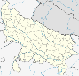 Bhidauni Bangar Location of Bhidauni on the map of Uttar Pradesh | |
| Coordinates: 27°45′25″N 77°41′40″E / 27.75694°N 77.69444°ECoordinates: 27°45′25″N 77°41′40″E / 27.75694°N 77.69444°E | |
| Country |
|
| State | Uttar Pradesh |
| District | Mathura |
| Lok Sabha | Mant (Assembly constituency) |
| Vidhan Sabha | Mathura |
| Government | |
| • Type | Local government in India |
| • Body | Gram Panchayat |
| • Pradhan | Kartar Singh |
| Elevation | 189 m (620 ft) |
| Population (2011) | |
| • Total | 3,256 |
| Languages | |
| • Official | Hindi, |
| • Local | Braj Bhasha |
| Time zone | IST (UTC+5:30) |
| PIN | 281205 |
| Telephone code | 05663 |
| Vehicle registration | UP85 XXXX |
| Nearest city | Raya,Vrindavan,Bajna,Kosi KalanMathura, |
| Website |
www |
Bhidauni is a North West Village and Gram panchayat of two Village Kewat Nagla and Bhidauni Officially Know as Bhidauni Bangar located between the Yamuna river and Yamuna Expressway in the Mat Tehsil of Mathura district, Uttar Pradesh, India. Village is about 45 kilometers from Mathura City on the Raya Road joining to Bajna Road.[1][2][3][4]
Demography
Bhidauni Village has a total population of 3,256 as per Population Census 2011.[5][6]Sex ratio of Village is 880 and child sex ratio is 890. Uttar Pradesh state average for both ratios is 912 and 902 respectively.
| Particulars | Total | Male | Female | Comments |
|---|---|---|---|---|
| Total No. of Houses | 485 | - | - | (census 2011)[7] |
| Population | 3,256 | 1,732 | 1,524 | |
| Child (0-6) | 582 | 308 | 274 | |
| Schedule Caste | 977 | 506 | 471 | |
| Literacy | 64.36% | 76.76% | 50.24% | |
| Total Workers | 1,111 | 817 | 294 | |
| Main Worker | 701 | 0 | 0 | |
| Marginal Worker | 410 | 0 | 0 |
Geography
According to Census 2011 information the location code or village code of Bhidauni Bangar village is 123925.[8][9] Bhidauni has an average elevation of 189 metres (600 feet). It is only 2 km away Near Yamuna Expressway also known as Taj Expressway which connecting with Agra to Greater Noida and Delhi. The Yamuna River, runs about 3 km west of the Bhidauni Village.[7]
| State code: | 09 |
| District code: | 145 |
| Tahsil code: | 00762 |
| Village code: | 123925 |
Neighbourhoods
Bhidauni is a vast village and is home to a population of more than 3.2 thousand people. They mainly belong to Hindu religious and some of Muslim community. It is the only village comprising multiple neighbourhoods. This is a list of major neighbourhoods in the village and only pertains. Baghel Samaj,[10] Saini Mohalla,[11] Kui Mohalla, Harijan Basti, Thakur Basti, Rawat Colony etc.
Siyaraha Bangar (2 km), Surir Vijaru Bangar (3 km), Bhadanwara (5 km ) are the nearby Villages to Bhidauni Bangar. Bhidauni Bangar is surrounded by Mat Tehsil towards south, Chhata Tehsil towards west, Chaumuha Tehsil towards south, Vrindavan Tehsil towards south.
Economy
The village's main occupation is agriculture. Farmers mainly produce wheat, mustard (or rapeseed), potato and other vegetables. Production of paddy has been introduced recently with the introduction of deep bore-wells. Sub-soil water is the main source of irrigation. Farmer use tractors for farm works. Many families there live in poverty. Some are farm workers, some of the people go to neighboring cities for extra income or their livelihood.
Ever since the country's independence from the British rule in 1947, the economy of the nation has banked upon its agrarian society. A majority of the persons living in village have involved themselves in agriculture and associated industries, and have thus made the country the quickest developing world economy.
History
There sources or old age person said it is a holy village.
Government and Gram Panchayat
As per constitution of India and Panchyati Raaj Act, Bhidauni Bangar village is administrated by Pradhan (Head of Village) who is elected representative of village, The village follows the Panchayati raj system.[12]
at Present Kartar Singh is a Gram Pradhan of Bhidauni Village. he is elected by the Villager of Bhidauni and Kewat Nagla.
List of Gram Pradhan of Bhidauni Village
| Sr. | Name | Term of work | Total | Opp. | Margin | Achievement |
|---|---|---|---|---|---|---|
| 1 | Late Ram Ballabh Bhattacharyya | 1952 to 1954 | 2 year | |||
| 2 | Late Kumar ji | 1954-1958 | 3 Year | |||
| 3 | Late Babu Lal | (1959–60) - (1985) | 25 Year | |||
| 4 | Late Kisan Lal Thakur | 1985-1994 | 9-10 Year | Fields Distribution | ||
| 5 | Lala Ram | 1994-1990 | 5 year | |||
| 6 | Ramboo valmiki | 1995-2000 | 5 year | |||
| 7 | Khillu Wife | 2000-2005 | 5 year | |||
| 8 | Khushi Ram Thakur | 2005-2010 | 5 year | |||
| 9 | Meera (मीरा)[13] | 2010-2015 | 5 Year | Dr. Mahesh Rawat | Roads Development | |
| 10 | Kartar Singh (करतार सिंह)[14] | Assumed commission 13 Dec 2015 to Onwards | preceded by | Meera Devi | Won Gram Panchayat Election 2015 | Youngest Gram Pradhan (Sarpanch) |
Caste composition and factor
There are Brahmin, Thakur, Baghel, Jatav, Kumhar, Nai, are main Hindu castes in this village.[15][16] Bhidauni Village currently haven't any Scheduled Tribes (STs) population. Bhidauni has substantial population of Schedule Caste. Schedule Caste (SC) constitutes 30.01% of total population in Village.[17]
Work and services
Bhidauni Village is known for the agriculture. Most of the families in the village are engaged in agriculture. Some of Person Main Work (Employment or Earning more than 6 Months) near cities. Some of Bhidauni persons are involved in defence services.
Education
Schools

Colleges
- Rashtriya Inter College Surir, Uttar Pradesh 281205[21]
Culture
The villagers worship or devotees of Lord Krishna and also believe in all Hindu Devi Devs. There are five temples to Hindu Gods. Most popular is known as Dewala, the temple is dedicated to lord Krishna was also known as Bankey Bihari Ji Temple. There is a new temple building under contraction near the village. The villagers live in the midst of natural surroundings. The residents or natives of Bhidauni and surroundings are called Brijwasi. The village is famous for its nature.

Religion

Hinduism is the main religion in the village some Muslim families also live in the village. Bhidauni sees heightened activities during the major festivities dedicated to Krishna Janmashtami, Raksha Bandhan, Diwali, Holi are the most celebrated festivals in the village. A fair is organized every year in the village after the complete of Ramleela play.

Transportation
Villagers have been using their personal vehicles to reach travel from one place to other villages and the city. For travelling to nearby villages, bikes and actors are more popular. Bullock cart or camel cart are still used in villages as means of transport.
Rail
Mathura Railway Junction around 45 km is the nearest railway junction.
The nearest railway stations in and around Bhidauni Bangar:
- Chhata Railway Station 39.6 km.
- Kosi Kalan Railway Station, 42.8 km.
- Raya Railway Station 31.9 km. (via Raya — Mant Rd)
Road
Bhidauni Village is connected to major road Yamuna Expressway though Raya Cut & Vrindavan Cut and Surir bypass is also afflicted to get off but not an authorized Stop. Raya — Bajna Road also connects to Mathura and in fact shortest way to reach Bhidauni vai Surir by road.

Air
Airports present near Bhidauni are:
- Aligarh Airport 46.6 km.
- Agra Air Force Station 73.0 km.
- Safdarjung Airport 102.3 km.
Nearby villages
Cities
Villages & Town
See also
References
- ↑ "खाकी ने सीज कराया जालसाज का बैंक खाता". Jagran. Retrieved 10 August 2012.
- ↑ Bhidauni, Village. "BHIDONI Pincode (UP)". bhidoni.pincodez.co.in. Retrieved 31 July 2015.
- ↑ Bhidauni, Bangar. "Details of Post Office BHIDONI, MATHURA". pincode.net.in. Retrieved 31 July 2015.
- ↑ "Bhidoni Pin Code". mapsofindia.com. Retrieved 31 July 2015.
- ↑ "Polling Stations List for Lok Sabha Elections 2014". empowering india. Retrieved 14 September 2015.
- ↑ "ननरभरचक नभमभरलल 2014 भिदौनी" (PDF). Retrieved 14 September 2015.
- 1 2 "Bhidauni Bangar Population - Mathura, Uttar Pradesh". census2011.co.in. Retrieved 12 October 2011.
- ↑ "Bhidauni Bangar Village". vlist.in. Retrieved 30 July 2015.
- ↑ "Global View Village". lgdirectory.gov.in. Retrieved 20 July 2015.
- ↑ "Baghel Samaj". Retrieved 13 November 2016.
- ↑ "Saini Mohalla, Bhidauni, Uttar Pradesh 281205". Retrieved 13 November 2016.
- ↑ "District: Mathura, Block: NAUJHIL, Gram Panchayat: BHIDAUNI BANGAR". fcs.up.nic.in. fcs up. Retrieved 16 July 2015.
- ↑ State Election Commission, Gram Panchayat. "panchayat samanya nirvachan 2010" (PDF). sec.up.nic.in. State Election Commission Uttar Pradesh. Retrieved 14 December 2015.
- ↑ Election, Gram Panchayat. "State Election Commission Uttar Pradesh 2015, Lucknow". sec.up.nic.in. State Election Commission Uttar Pradesh. Retrieved 14 December 2015.
- ↑ "Character, not caste, to the fore in Mathura". The Hindu. Retrieved 23 February 2012.
- ↑ "Baghel Vani". Baghel Vani. Retrieved 12 February 2010.
- ↑ "Bhidauni Bangar Population - Mathura, Uttar Pradesh". www.census2011.co.in. Retrieved 1 September 2015.
- ↑ "List of Polling Booth in Mant". elections.in. Retrieved 10 March 2014.
- ↑ "Junior High School Bhidauni". google.co.in/maps. Google Maps. Retrieved 31 July 2015.
- ↑ "Kundan Lal Hariram Inter College". plus.google.com. Retrieved 16 July 2015.
- ↑ "RASHTRIYA INTER COLLEGE SURIR MATHURA". upmspboard.com. Retrieved 16 July 2015.
External links
| Wikimedia Commons has media related to Mathura. |
- Official Facebook Page
- Read details about Mathura
- About Bhidauni by Onefivenine.com
-
 Mathura travel guide from Wikivoyage
 |
Chaumuha Tehsil | | ||
| Chhata Tehsil | |
Hathras district | ||
| ||||
| | ||||
| Chaumuha | Mat Tehsil |