Bexleyheath and Crayford (UK Parliament constituency)
| Bexleyheath and Crayford | |
|---|---|
|
Borough constituency for the House of Commons | |
|
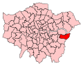
Boundary of Bexleyheath and Crayford in Greater London. | |
| County | Greater London |
| Population | 87,848 (2011 census)[1] |
| Electorate | 64,144 (December 2010)[2] |
| Current constituency | |
| Created | 1997 |
| Member of parliament | David Evennett (Conservative) |
| Number of members | One |
| Created from | Bexleyheath and Erith & Crayford |
| Overlaps | |
| European Parliament constituency | London |

Bexleyheath and Crayford is a borough constituency represented in the House of Commons of the Parliament of the United Kingdom. It elects one Member of Parliament (MP) by the first past the post system of election.
It was created in 1997 from parts of the former seats of Bexleyheath and Erith & Crayford.
Boundaries
1997-2010: The London Borough of Bexley wards of Barnehurst, Barnehurst North, Bostall, Brampton, Christchurch, Crayford, North End, St Michael’s, and Upton.
2010-present: The London Borough of Bexley wards of Barnehurst, Brampton, Christchurch, Colyers, Crayford, Danson Park, North End, and St Michael’s.
Boundary review
Following their review of parliamentary representation in South London, and as a consequence of changes to ward boundaries, the Boundary Commission for England recommended that part of Danson Park ward be transferred to Bexleyheath and Crayford from the constituency of Old Bexley and Sidcup; that part of Colyers ward be transferred from Erith and Thamesmead; and that parts of Lesnes Abbey ward, Belvedere ward, Northumberland Heath ward and Erith ward be transferred to Bexleyheath and Crayford from Erith and Thamesmead.
Members of Parliament
| Election | Member[3] | Party | |
|---|---|---|---|
| 1997 | Nigel Beard | Labour | |
| 2005 | David Evennett | Conservative | |
Election results
Elections in the 2010s
| Party | Candidate | Votes | % | ± | |
|---|---|---|---|---|---|
| Conservative | David Evennett | 20,643 | 47.3 | -3.2 | |
| Labour | Stefano Borella | 11,451 | 26.2 | -0.3 | |
| UKIP | Chris Attard | 9,182 | 21.0 | +17.4 | |
| Liberal Democrat | Richard Davis | 1,308 | 3.0 | -9.7 | |
| Green | Stella Gardiner[6] | 950 | 2.2 | +1.3 | |
| English Democrat | Maggi Young | 151 | 0.3 | -0.8 | |
| Majority | 9,192 | 21.3 | -2.7 | ||
| Turnout | 43,685 | 67.4 | +1.0 | ||
| Conservative hold | Swing | -1.4 | |||
| Party | Candidate | Votes | % | ± | |
|---|---|---|---|---|---|
| Conservative | David Evennett | 21,794 | 50.5 | +3.9 | |
| Labour | Howard Dawber | 11,450 | 26.5 | −7.7 | |
| Liberal Democrat | Karelia Scott | 5,502 | 12.7 | −0.4 | |
| BNP | Stephen James | 2,042 | 4.7 | +1.8 | |
| UKIP | John Dunford | 1,557 | 3.6 | +0.4 | |
| English Democrat | John Griffiths | 466 | 1.1 | +1.1 | |
| Green | Adrian Ross | 371 | 0.9 | +0.9 | |
| Majority | 10,344 | 24.0 | |||
| Turnout | 43,182 | 66.4 | +1.8 | ||
| Conservative hold | Swing | +5.8 | |||
Elections in the 2000s
| Party | Candidate | Votes | % | ± | |
|---|---|---|---|---|---|
| Conservative | David Evennett | 19,722 | 46.3 | +6.4 | |
| Labour | Nigel Beard | 15,171 | 35.6 | −8.0 | |
| Liberal Democrat | David Raval | 5,144 | 12.1 | +1.0 | |
| UKIP | John Dunford | 1,302 | 3.1 | +1.2 | |
| BNP | Jay Lee | 1,245 | 2.9 | −0.6 | |
| Majority | 4,551 | 10.7 | |||
| Turnout | 42,584 | 65.5 | +2.0 | ||
| Conservative gain from Labour | Swing | +7.2 | |||
| Party | Candidate | Votes | % | ± | |
|---|---|---|---|---|---|
| Labour | Nigel Beard | 17,593 | 43.6 | −1.9 | |
| Conservative | David Evennett | 16,121 | 39.9 | +1.5 | |
| Liberal Democrat | Nick O'Hare | 4,476 | 11.1 | −0.1 | |
| BNP | Colin Smith | 1408 | 3.5 | +2.6 | |
| UKIP | John Dunford | 780 | 1.9 | +1.1 | |
| Majority | 1,472 | 3.6 | |||
| Turnout | 40,378 | 63.5 | −12.6 | ||
| Labour hold | Swing | −1.7 | |||
Elections in the 1990s
| Party | Candidate | Votes | % | ± | |
|---|---|---|---|---|---|
| Labour | Nigel Beard | 21,942 | 45.5 | N/A | |
| Conservative | David Evennett | 18,527 | 38.4 | N/A | |
| Liberal Democrat | Mrs. Francoise J. Montford | 5,391 | 11.2 | N/A | |
| Referendum | Barrie R. Thomas | 1,551 | 3.2 | N/A | |
| BNP | Mrs. Pauline Smith | 429 | 0.9 | N/A | |
| UKIP | W. Jenner | 383 | 0.8 | N/A | |
| Majority | 3,415 | 7.1 | N/A | ||
| Turnout | 48,223 | 76.1 | N/A | ||
| Labour win (new seat) | |||||
See also
- List of Parliamentary constituencies in Greater London
- David Evennett's website
- Bexleyheath and Crayford Conservative Association website
References
- ↑ "Bexleyheath and Crayford: Usual Resident Population, 2011". Neighbourhood Statistics. Office for National Statistics. Retrieved 29 January 2015.
- ↑ "Electorate Figures - Boundary Commission for England". 2011 Electorate Figures. Boundary Commission for England. 4 March 2011. Archived from the original on 6 November 2010. Retrieved 13 March 2011.
- ↑ Leigh Rayment's Historical List of MPs – Constituencies beginning with "B" (part 3)
- ↑ "Election Data 2015". Electoral Calculus. Archived from the original on 17 October 2015. Retrieved 17 October 2015.
- ↑ election result http://democracy.bexley.gov.uk/mgElectionAreaResults.aspx?XXR=0&ID=95&RPID=9646312 9Jul15
- ↑ http://bexley.greenparty.org.uk/news-for-bexley/green-party-candidates-for-general-election.html
- ↑ "Election Data 2010". Electoral Calculus. Archived from the original on 17 October 2015. Retrieved 17 October 2015.
- ↑ "Election Data 2005". Electoral Calculus. Archived from the original on 15 October 2011. Retrieved 18 October 2015.
- ↑ "Election Data 2001". Electoral Calculus. Archived from the original on 15 October 2011. Retrieved 18 October 2015.
- ↑ "Election Data 1997". Electoral Calculus. Archived from the original on 15 October 2011. Retrieved 18 October 2015.
Coordinates: 51°28′N 0°10′E / 51.46°N 0.16°E