Bens Run, West Virginia
| Bens Run, West Virginia | |
|---|---|
| Unincorporated community | |
 Bens Run, West Virginia  Bens Run, West Virginia | |
| Coordinates: 39°27′57″N 81°06′30″W / 39.46583°N 81.10833°WCoordinates: 39°27′57″N 81°06′30″W / 39.46583°N 81.10833°W | |
| Country | United States |
| State | West Virginia |
| County | Tyler |
| Elevation | 620 ft (190 m) |
| Time zone | Eastern (EST) (UTC-5) |
| • Summer (DST) | EDT (UTC-4) |
| ZIP code | 26135 |
| Area code(s) | 304 & 681 |
| GNIS feature ID | 1535644[1] |
Bens Run is an unincorporated community in Tyler County, West Virginia, United States. Bens Run is located on the Ohio River at the junction of West Virginia Route 2 and County Route 5, 4.3 miles (6.9 km) southwest of Friendly.[2] Bens Run had a post office, which closed on November 2, 2002.[3]
Prehistoric earthworks were once located between Bens Run and the nearby community of Long Reach. Lewis Summers first described these earthworks in 1808 as "an ancient encampment" covering an area of 10 acres (4.0 ha) and surrounded by trenches; later accounts estimated their size at near 400 acres (160 ha). The Archaeology Section of the West Virginia Geological and Economic Survey formally noted the earthworks in 1965, by which point there were no remaining signs of their existence.[4]
Climate
The climate in this area is characterized by hot, humid summers and generally mild to cool winters. According to the Köppen Climate Classification system, Bens Run has a humid subtropical climate, abbreviated "Cfa" on climate maps.[5]
References
- ↑ "Bens Run". Geographic Names Information System. United States Geological Survey.
- ↑ Tyler County, West Virginia General Highway Map (PDF) (Map). West Virginia Department of Transportation. 2011. p. 1. Retrieved December 26, 2011.
- ↑ "Postmaster Finder - Post Offices by ZIP Code". United States Postal Service. Retrieved December 26, 2011.
- ↑ Spencer, Darla. "Bens Run Earthworks". The West Virginia Encyclopedia. Retrieved February 22, 2012.
- ↑ Climate Summary for Bens Run, West Virginia
Municipalities and communities of Tyler County, West Virginia, United States | ||
|---|---|---|
| Cities | 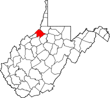 | |
| Towns | ||
| Unincorporated communities | ||
| Footnotes | ‡This populated place also has portions in an adjacent county or counties | |