Bennett, Wisconsin
| Bennett, Wisconsin | |
|---|---|
| Town | |
 Location of Bennett, Wisconsin | |
| Coordinates: 46°27′11″N 91°48′5″W / 46.45306°N 91.80139°W | |
| Country | United States |
| State | Wisconsin |
| County | Douglas |
| Area | |
| • Total | 48.3 sq mi (125.1 km2) |
| • Land | 47.5 sq mi (123.1 km2) |
| • Water | 0.8 sq mi (2.0 km2) |
| Elevation[1] | 1,234 ft (376 m) |
| Population (2000) | |
| • Total | 622 |
| • Density | 13.1/sq mi (5.1/km2) |
| Time zone | Central (CST) (UTC-6) |
| • Summer (DST) | CDT (UTC-5) |
| Area code(s) | 715 and 534 |
| FIPS code | 55-06775[2] |
| GNIS feature ID | 1582794[1] |
| Website | www.townofbennettwi.org |
Bennett is a town in Douglas County, Wisconsin, United States. The population was 622 at the 2000 census. The unincorporated communities of Beebe and Bennett are located in the town.
Transportation
U.S. Highway 53, County Road L, and County Road E are three of the main routes in the community.
Geography
According to the United States Census Bureau, the town has a total area of 48.3 square miles (125.1 km²), of which, 47.5 square miles (123.1 km²) of it is land and 0.8 square miles (2.0 km²) of it (1.59%) is water.
Bennett is located 27 miles southeast of the city of Superior; and 7 miles north–northwest of Solon Springs.
Demographics
As of the census[2] of 2000, there were 622 people, 224 households, and 174 families residing in the town. The population density was 13.1 people per square mile (5.1/km²). There were 297 housing units at an average density of 6.2 per square mile (2.4/km²). The racial makeup of the town was 98.07% White, 1.13% Native American, 0.32% Asian, and 0.48% from two or more races. Hispanic or Latino of any race were 0.96% of the population.
There were 224 households out of which 38.8% had children under the age of 18 living with them, 69.2% were married couples living together, 4.5% had a female householder with no husband present, and 22.3% were non-families. 18.8% of all households were made up of individuals and 8.5% had someone living alone who was 65 years of age or older. The average household size was 2.78 and the average family size was 3.18.
In the town the population was spread out with 30.4% under the age of 18, 5.8% from 18 to 24, 27.5% from 25 to 44, 24.8% from 45 to 64, and 11.6% who were 65 years of age or older. The median age was 37 years. For every 100 females there were 105.3 males. For every 100 females age 18 and over, there were 107.2 males.
The median income for a household in the town was $40,313, and the median income for a family was $49,063. Males had a median income of $31,667 versus $22,344 for females. The per capita income for the town was $18,335. About 4.6% of families and 7.7% of the population were below the poverty line, including 10.6% of those under age 18 and none of those age 65 or over.
Election history
2004- Total Votes 377 George W. Bush:167 John Kerry:205 Ralph Nader:2 David Cobb:1
Coordinates: 46°26′55″N 91°51′13″W / 46.44861°N 91.85361°W
References
- 1 2 "US Board on Geographic Names". United States Geological Survey. 2007-10-25. Retrieved 2008-01-31.
- 1 2 "American FactFinder". United States Census Bureau. Archived from the original on 2013-09-11. Retrieved 2008-01-31.
External links
Municipalities and communities of Douglas County, Wisconsin, United States | ||
|---|---|---|
| City | 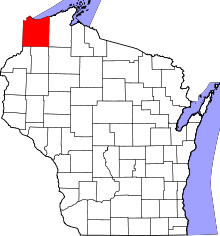 | |
| Villages | ||
| Towns | ||
| CDPs | ||
| Unincorporated communities |
| |
| Indian reservation | ||
| Footnotes | ‡This populated place also has portions in an adjacent county or counties | |
