Bella Vista, Arkansas
| Bella Vista, Arkansas | |
|---|---|
| City | |
|
Clockwise, from top: Mildred B. Cooper Memorial Chapel, Lake Ann, Bella Vista golf, and a waterfall along Tanyard Creek | |
 Location in Benton County and the state of Arkansas | |
 Bella Vista, Arkansas Location in the United States | |
| Coordinates: 36°28′8″N 94°16′7″W / 36.46889°N 94.26861°WCoordinates: 36°28′8″N 94°16′7″W / 36.46889°N 94.26861°W | |
| Country | United States |
| State | Arkansas |
| County | Benton |
| Government | |
| • Mayor | Peter Christie |
| Area | |
| • Total | 45.9 sq mi (118.9 km2) |
| • Land | 44.2 sq mi (114.6 km2) |
| • Water | 1.6 sq mi (4.2 km2) |
| Elevation | 1,150 ft (350 m) |
| Population (2010) | |
| • Total | 30,078 |
| • Density | 598/sq mi (230.8/km2) |
| Time zone | Central (CST) (UTC-6) |
| • Summer (DST) | CDT (UTC-5) |
| ZIP codes | 72714, 72715 |
| Area code(s) | 479 |
| FIPS code | 05-04840 |
| GNIS feature ID | 0076292 |
| Website |
www |

Bella Vista is a city in Benton County, Arkansas. First established in 1965 as a summer resort town, the community evolved into a retirement community, and continues to change following incorporation in 2006.[1] The city's struggle with incorporation began in 1977 and periodically returned as the community grew rapidly. Following the change, municipal government replaced the Property Owners Association as primary government; entering a new era for Bella Vista. The community is located on the Springfield Plateau of the Ozark Mountains. Valleys, creeks, and steep rises characterize the city's topography. Bella Vista is located north of Bentonville and Rogers and is the northernmost city in the Northwest Arkansas metropolitan statistical area. The city has been experiencing a population and building boom in recent years, as indicated by a 60% growth in population between the 2000 and 2010 censuses.
The rapid growth of the Northwest Arkansas area, including Bella Vista, has expedited the need for a fully controlled access highway in the area. Bella Vista is the northern terminus of Interstate 49 (I-49) in Arkansas. The Bella Vista Bypass, currently a two-lane freeway that is ultimately planned to route I-49 to the south and west of Bella Vista, is under construction.
Geography
Bella Vista is located in northern Benton County at 36°28'8" North, 94°16'7" West (36.4691, -94.2687). Its northern border is the Missouri state line. According to the United States Census Bureau, the city has a total area of 45.9 square miles (118.9 km2), of which 44.2 square miles (114.6 km2) is land and 1.6 square miles (4.2 km2) is water,[2] consisting mainly of the several lakes within the city.
Demographics
| Historical population | |||
|---|---|---|---|
| Census | Pop. | %± | |
| 1980 | 2,589 | — | |
| 1990 | 9,083 | 250.8% | |
| 2000 | 16,582 | 82.6% | |
| 2010 | 26,461 | 59.6% | |
| Est. 2015 | 27,999 | [3] | 5.8% |
| [1] | |||
As of the census[4] of 2000, there were 16,582 people, 7,818 households, and 6,004 families residing in the community, which at the time was recorded as a census-designated place (CDP). The population density was 252.8 inhabitants per square mile (97.6/km²). There are 8,854 housing units at an average density of 135.0 per square mile (52.1/km²). The racial makeup of the CDP was 97.87% White, 0.18% Black or African American, 0.69% Native American, 0.27% Asian, 0.01% Pacific Islander, 0.20% from other races, and 0.78% from two or more races. Hispanic or Latino of any race were 1.01% of the population.
There were 7,818 households out of which 13.5% had children under the age of 18 living with them, 72.4% are married couples living together, 3.2% had a female householder with no husband present, and 23.2% were non-families. 20.5% of all households were made up of individuals and 13.3% had someone living alone who was 65 years of age or older. The average household size was 2.10 and the average family size was 2.38.
In the CDP the population was spread out with 12.3% under the age of 18, 3.0% from 18 to 24, 16.4% from 25 to 44, 26.3% from 45 to 64, and 41.9% who were 65 years of age or older. The median age was 61 years. For every 100 females there were 92.5 males. For every 100 females age 18 and over, there were 90.9 males.
The median income for a household in the CDP was $44,090, and the median income for a family was $48,233. Males had a median income of $34,547 versus $24,690 for females. The per capita income for the CDP was $25,406. About 1.5% of families and 2.5% of the population were below the poverty line, including 3.7% of those under the age of 18 and 1.0% of those 65 and older.
Government

Bella Vista's Declarations and Protective Covenants[5] is the "rule book" that governs the village. The Property Owners Association must follow this "rule book" composed of various articles. There are Class A and Class B members of Bella Vista Village. Class B refers to Cooper Industries, Inc., the land developer, who gets 10 votes per lot owned and Class A refers to lot private lot purchasers who receive one vote per lot owned. Cooper Industries now owns too few lots to sway the vote. Both Class A and class B members must approve a vote before it is binding.
The POA is governed by a nine-member Board of Directors who serve three-year terms. They set the direction and long-term objectives for the POA guided by the village's declarations and protective covenants. The day-to-day activity of the POA is directed by its general manager, with division heads and site managers responsible for the various departments and facilities throughout the village.
Recently, the Village members have voted to incorporate as an official city. The POA still remains intact to service the recreational amenities, but the City of Bella Vista has now assumed many of the functional and infrastructure responsibilities.
Parks and recreation
Lakes

Bella Vista has seven lakes. These lakes are not "public" in that only members of the community or their guests are permitted to use them. Lake Ann, Lake Windsor, and Lake Loch Lomond are the largest all-sports lakes in the town. Lake Avalon, Lake Norwood, and Lake Rayburn are primarily fishing lakes with "no wake" restrictions. Current POA boat permits are required as are Arkansas fishing licenses, when fishing Bella Vista lakes.
- Lake Ann is an all-water sport lake with 112.5 acres (0.455 km2) of surface area. Because it is 53.5 feet (16.3 m) deep with no power limit, water skiing is allowed on Lake Ann.
- Lake Windsor is the second largest of the lakes, covering 220 acres (0.89 km2) with a maximum depth of 79.5 feet (24.2 m). Lake Windsor is also an unlimited power lake, and water skiing is allowed.
- Loch Lomond is the largest of all the lakes in the city. It is 80 feet (24 m) deep and covers 477 acres (1.93 km2). There is no power limit, skiing is allowed, and boat rental is offered.
- Lake Avalon is a limited-power lake that features an enclosed, heated fishing dock located off Tamworth Circle. This lake covers 67 acres (270,000 m2) and is 50 feet (15 m) deep.
- Lake Brittany is 77 feet (23 m) deep, has a 35-acre (140,000 m2) surface area and is a limited-power lake. Although there is currently no launching ramp, the terrain is suitable for launching.
- Lake Norwood, located just north of Bella Vista's Town Center, has 34.5 acres (140,000 m2) of surface area and is 75 feet (23 m) deep. The Lake Norwood launching ramp is located north of Harp's Food Store in Town Center. This is a limited-power lake.
- Lake Rayburn is 60 feet (18 m) deep and has a 47-acre (190,000 m2) surface area. This lake has limited power regulations. It also features a designated swimming area and a launching ramp that is accessible from Lakeside Drive.
Trails

Bella Vista Lake has a 1.8-mile-long (2.9 km) walking/biking trail that goes around the lake. (The trail, however, is actually maintained by the city of Bentonville.) Tanyard Creek is the site of another walking trail off Lake Windsor in the center of the village. It has a footbridge and some waterfalls except during dry times.
Economy
Travel to Bella Vista and the surrounding areas increases greatly in the summertime.
Education
There are two school districts serving the village. On the east side is the Bentonville School District,[6] and on the west side is Gravette School District.[7] Also serving the village is a private preschool, Bella Vista Montessori Academy.[8] New to the village is Cooper Elementary, part of the Bentonville District. It serves school to half of Bella Vista's K-4 population.
Northwest Arkansas Community College is also part of the community, with its main branch in Bentonville near I-540 and its "College at the Crossing" and "Highlands Crossing Center" located in Bella Vista.[9]
Infrastructure
Communications
Phone service is provided by AT&T, and cable television is provided by Cox Communications.
Electricity
Carroll Electric Cooperative provides electricity for Bella Vista residents.
Public safety

The Bella Vista Fire Department is a career fire department with three fully staffed fire stations. There are three shifts with 12 career firefighters on each shift. The fire department also provides Advanced Life Support paramedic service to the city with six ambulances. The department has plans to open a fourth new fire station near the Highlands gate in 2016.
Transportation

Infrastructure issues currently exist in Bella Vista, where traffic levels are quickly increasing. Google provides a map [10] showing the Interstate 540 spur route in Arkansas and the Interstate-standard US 71 in Missouri, which will eventually connect to become part of a long-planned future Interstate 49. Some locals refer to this as a western bypass or one taking the current portion of US 71 passing through Bella Vista. Many drivers in both Arkansas and Missouri, especially ones with semi trucks, are desperate to see the highway became fully connected and flowing because of the current traffic congestion. On April 13, 2006, the Arkansas Highway Commission approved the use of tolls to finance construction.[11] The construction of the Bella Vista Bypass began on June 8, 2011.[12]
Solid waste
The POA provides water and sanitation (trash pick-up) service to Bella Vista residents. There also are two semi-annual pick ups of large items.
Water and Wastewater
Village Waste Water provides sewer service to portions of Bella Vista.
Notable people
- Donna Hutchinson, member of the Arkansas House of Representatives from 2007 to 2013
- Robin Lundstrum, member of the Arkansas House for Benton and Washington counties since 2015; former Bella Vista resident[13]
- Jim Sheets, member of the Arkansas House from 1967 to 1968 in the Winthrop Rockefeller administration; retired resident of Bella Vista
See also
References
- 1 2 Spurgeon, John (March 19, 2012). "Bella Vista (Benton County)". Encyclopedia of Arkansas History and Culture. Butler Center for Arkansas Studies at the Central Arkansas Library System. Retrieved October 24, 2013.
- ↑ "Geographic Identifiers: 2010 Demographic Profile Data (G001): Bella Vista town, Arkansas". U.S. Census Bureau, American Factfinder. Retrieved September 24, 2013.
- ↑ "Annual Estimates of the Resident Population for Incorporated Places: April 1, 2010 to July 1, 2015". Retrieved July 2, 2016.
- ↑ "American FactFinder". United States Census Bureau. Archived from the original on 2013-09-11. Retrieved 2008-01-31.
- ↑ Bella Vista Village Property Owner's Association Governing Documents Archived June 22, 2011, at the Wayback Machine.
- ↑ Bentonville Public Schools
- ↑ Welcome to Gravette Public Schools
- ↑ Bella Vista Montessori Academy - Home Archived February 28, 2008, at the Wayback Machine.
- ↑
- ↑ Google Maps
- ↑ Toll Road News Archived September 27, 2011, at the Wayback Machine. Accessed 10/2/2010
- ↑ "Archived copy". Archived from the original on 2013-12-21. Retrieved 2013-12-22.
- ↑ "Robin Hall Lundstrum". intelius.com. Retrieved April 12, 2015.
External links
- City of Bella Vista official website
- Bella Vista Village Property Owner's Association
- Bella Vista Public Library
- Bentonville/Bella Vista Chamber of Commerce
Municipalities and communities of Benton County, Arkansas, United States | ||
|---|---|---|
| Cities | 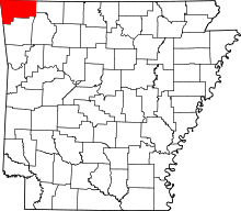 | |
| Towns | ||
| Townships | ||
| CDPs | ||
| Other communities |
| |
| Ghost town | ||
| Footnotes | ‡This populated place also has portions in an adjacent county or counties | |