Barryton, Michigan
| Barryton, Michigan | |
|---|---|
| Village | |
 Location of Barryton in Mecosta, Michigan | |
| Coordinates: 43°45′2″N 85°8′37″W / 43.75056°N 85.14361°WCoordinates: 43°45′2″N 85°8′37″W / 43.75056°N 85.14361°W | |
| Country | United States |
| State | Michigan |
| County | Mecosta |
| Area[1] | |
| • Total | 1.04 sq mi (2.69 km2) |
| • Land | 0.96 sq mi (2.49 km2) |
| • Water | 0.08 sq mi (0.21 km2) |
| Elevation | 981 ft (299 m) |
| Population (2010)[2] | |
| • Total | 355 |
| • Estimate (2012[3]) | 361 |
| • Density | 369.8/sq mi (142.8/km2) |
| Time zone | Eastern (EST) (UTC-5) |
| • Summer (DST) | EDT (UTC-4) |
| ZIP code | 49305 |
| Area code(s) | 989 |
| FIPS code | 26-05580[4] |
| GNIS feature ID | 2398039[5] |
Barryton is a village in Mecosta County in the U.S. state of Michigan. The population was 355 at the 2010 census. The village is located in Fork Township on M-66. It was established in 1894.[6]
Geography
According to the United States Census Bureau, the village has a total area of 1.04 square miles (2.69 km2), of which 0.96 square miles (2.49 km2) is land and 0.08 square miles (0.21 km2) is water.[1]
Demographics
| Historical population | |||
|---|---|---|---|
| Census | Pop. | %± | |
| 1910 | 411 | — | |
| 1920 | 364 | −11.4% | |
| 1930 | 331 | −9.1% | |
| 1940 | 342 | 3.3% | |
| 1950 | 445 | 30.1% | |
| 1960 | 418 | −6.1% | |
| 1970 | 368 | −12.0% | |
| 1980 | 422 | 14.7% | |
| 1990 | 393 | −6.9% | |
| 2000 | 381 | −3.1% | |
| 2010 | 355 | −6.8% | |
| Est. 2015 | 357 | [7] | 0.6% |
2010 census
As of the census[2] of 2010, there were 355 people, 154 households, and 89 families residing in the village. The population density was 369.8 inhabitants per square mile (142.8/km2). There were 195 housing units at an average density of 203.1 per square mile (78.4/km2). The racial makeup of the village was 98.0% White, 0.3% African American, 0.3% Native American, 0.3% Asian, and 1.1% from two or more races. Hispanic or Latino of any race were 0.6% of the population.
There were 154 households of which 26.0% had children under the age of 18 living with them, 39.0% were married couples living together, 13.6% had a female householder with no husband present, 5.2% had a male householder with no wife present, and 42.2% were non-families. 39.6% of all households were made up of individuals and 20.1% had someone living alone who was 65 years of age or older. The average household size was 2.31 and the average family size was 2.92.
The median age in the village was 41.2 years. 22% of residents were under the age of 18; 13.7% were between the ages of 18 and 24; 19.7% were from 25 to 44; 21.1% were from 45 to 64; and 23.4% were 65 years of age or older. The gender makeup of the village was 48.7% male and 51.3% female.
2000 census
As of the census[4] of 2000, there were 381 people, 159 households, and 104 families residing in the village. The population density was 402.6 per square mile (154.8/km²). There were 188 housing units at an average density of 198.7 per square mile (76.4/km²). The racial makeup of the village was 95.28% White, 1.84% African American, 0.79% Native American, and 2.10% from two or more races. Hispanic or Latino of any race were 1.57% of the population.
There were 159 households out of which 31.4% had children under the age of 18 living with them, 45.3% were married couples living together, 13.8% had a female householder with no husband present, and 34.0% were non-families. 28.9% of all households were made up of individuals and 17.0% had someone living alone who was 65 years of age or older. The average household size was 2.39 and the average family size was 2.90.
In the village the population was spread out with 28.6% under the age of 18, 7.3% from 18 to 24, 23.6% from 25 to 44, 21.0% from 45 to 64, and 19.4% who were 65 years of age or older. The median age was 38 years. For every 100 females there were 95.4 males. For every 100 females age 18 and over, there were 83.8 males.
The median income for a household in the village was $23,333, and the median income for a family was $28,750. Males had a median income of $28,125 versus $21,250 for females. The per capita income for the village was $12,166. About 15.1% of families and 18.0% of the population were below the poverty line, including 22.8% of those under age 18 and 12.7% of those age 65 or over.
Culture
Barryton is home to the Barryton Lilac Festival. The annual festival is held in May and includes a car show, carnival rides, 5k race, flea market, and parade.[9]
Education
Barryton has one elementary school, Barryton Elementary. The school was built in 1935 and has about 260 students from preschool to fourth grade. [10] The school is part of Chippewa Hills School District.
References
Notes
- 1 2 "US Gazetteer files 2010". United States Census Bureau. Archived from the original on 2012-01-24. Retrieved 2012-11-25.
- 1 2 "American FactFinder". United States Census Bureau. Retrieved 2012-11-25.
- ↑ "Population Estimates". United States Census Bureau. Archived from the original on 2013-06-17. Retrieved 2013-06-03.
- 1 2 "American FactFinder". United States Census Bureau. Archived from the original on 2013-09-11. Retrieved 2008-01-31.
- ↑ U.S. Geological Survey Geographic Names Information System: Barryton, Michigan
- ↑ Romig 1986, p. 44.
- ↑ "Annual Estimates of the Resident Population for Incorporated Places: April 1, 2010 to July 1, 2015". Retrieved July 2, 2016.
- ↑ "Census of Population and Housing". Census.gov. Archived from the original on May 11, 2015. Retrieved June 4, 2015.
- ↑ "Barryton Lilac Festival". Michigan.org. 2015. Retrieved 25 May 2015.
- ↑ "Barryton Elementary" (webpage). http://chsd.us/barryton/index.htm Chippewa Hills School District. 2015. Retrieved 25 May 2015. External link in
|publisher=(help)
Sources
- Romig, Walter (October 1, 1986) [1973]. Michigan Place Names: The History of the Founding and the Naming of More Than Five Thousand Past and Present Michigan Communities. Great Lakes Books Series (Paperback). Detroit, Michigan: Wayne State University Press. ISBN 978-0-8143-1838-6.
Municipalities and communities of Mecosta County, Michigan, United States | ||
|---|---|---|
| City | 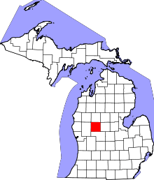 | |
| Villages | ||
| Charter townships | ||
| General law townships | ||
| CDP | ||
| Other unincorporated communities | ||