Bang Bon District
| Bang Bon บางบอน | |
|---|---|
| Khet | |
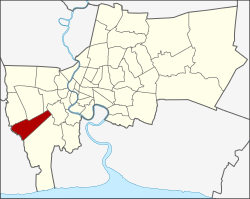 Khet location in Bangkok | |
| Country |
|
| Province | Bangkok |
| Seat | Bang Bon |
| Khwaeng | 1 |
| Khet established | 6 March 1998 |
| Area | |
| • Total | 34.745 km2 (13.415 sq mi) |
| Population (2013) | |
| • Total | 106,085 |
| • Density | 2,723.75/km2 (7,054.5/sq mi) |
| Time zone | ICT (UTC+7) |
| Postal code | 10150 |
| Geocode | 1050 |
Bang Bon (Thai: บางบอน; IPA: [bāːŋ bɔ̄ːn]) is one of the 50 districts (khet) of Bangkok, Thailand. Its neighbors, clockwise from north, are Bang Khae, Phasi Charoen, Chom Thong, and Bang Khun Thian districts of Bangkok, Amphoe Mueang and Amphoe Krathum Baen of Samut Sakhon Province, and Nong Khaem District of Bangkok.
History
Formerly Bang Bon was a tambon of amphoe Bang Khun Thian in Thonburi Province, prior to the merger of Thonburi and Phra Nakhon into a single province, after which it was a sub-district of the Bang Khun Thian District.
On 14 October 1997, Bang Bon was split from Bang Khun Thian and established as a new district, and the district office opened on 6 March 1998. Its district office was the last office of Bangkok's 50 districts to open, first established temporarily at the Thepyada Arak Fresh Market building, but later moved to a permanent location on Ekachai Road.
Administration
The district has one sub-district (khwaeng).
| 1. | Bang Bon | บางบอน |
Places
- Wat Bang Bon
Economy
Agriculture is an important part of the area economy. Among Bang Bon's famous products are Nam Dok Mai mangos, coconuts, orchids, and lotus.
.svg.png)
