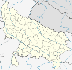
Banda, Uttar Pradesh
| Banda | |
|---|---|
| city | |
 Banda | |
| Coordinates: 25°29′N 80°20′E / 25.483°N 80.333°ECoordinates: 25°29′N 80°20′E / 25.483°N 80.333°E | |
| Country |
|
| Government | |
| • Body | Banda Municipal Corporation |
| • Chairman | Vinod Jain (BJP) |
| Area | |
| • Total | 443.1 km2 (171.1 sq mi) |
| Elevation | 123 m (404 ft) |
| Population (2011)[1] | |
| • Total | 1,54,428 |
| • Density | 350/km2 (900/sq mi) |
| Languages | |
| • Official | Hindi, Bundelkhandi |
| Time zone | IST (UTC+5:30) |
| PIN | 210001 |
| Telephone code | 91-5192 |
| Vehicle registration | UP-90 |
| Sex ratio | 881[2] ♂/♀ |
| Literacy | 82.05% |
| Website |
www |
Banda (Hindi: बांदा; Urdu: باندہ) is a city and a municipal board in Banda district in the state of Uttar Pradesh, India. Banda lies south of the Yamuna river in the Bundelkhand region. It is the administrative headquarters of Banda District. The town is well connected to major cities with railways and state highways. The town is near the right bank of the river Ken, 95 m. S. W. of Allahabad.
Banda is famous for its Shajar stone, used for making jewellery. Banda was a town and district of British India, in the Allahabad division of the United Provinces. The population in 1901 was 22,565. It was formerly, but is no longer, a military cantonment.
Languages
Among Banda's languages are Bundeli, which has a lexical similarity of 72-91% with Hindi[5] (compared to 60% for German and English)[6] and is spoken by about 7,800,000 people in Bundelkhand.[5]
Government
Civic administration

The city elects members to the Lok Sabha as well as the Uttar Pradesh Vidhan Sabha (State Assembly). The city is under the jurisdiction of a District Magistrate, who is an IAS officer. The Collectors are in charge of property records and revenue collection for the Central Government, and oversee the national elections held in the city. The Collector is also responsible for maintaining law and order in the city. The city is administered by the Banda Municipal Corporation with executive power vested in the Municipal Commissioner of Banda, who is an administrative officer. The corporation comprises elected members (corporators elected from the wards directly by the people) with City Mayor as its head. An Assistant Municipal Commissioner oversees each ward for administrative purposes. The Banda Police is headed by a Deputy Inspector General, who is an IPS officer. The Banda Police comes under the state Home Ministry. The city is divided into several police zones and traffic police zones. The Traffic Police is a semi-autonomous body under the Banda Police. The Banda Fire Brigade department is headed by the Chief Fire Officer, who is assisted by Deputy Chief Fire Officers and Divisional Officers.
Economy
It contains an area of 3,061 square miles (7,930 km2). In some parts it rises into irregular uplands and elevated plains, interspersed with detached rocks of granite; in others it sinks into marshy lowlands, which frequently remain under water during the rainy season. The sloping country on the bank of the Yamuna (previously called Jamuna)is full of ravines. To the south-east the Vindhya chain of hills takes its origin in a low range not exceeding 500 feet (150 m) in height, and forming a natural boundary of the district in that direction. The principal river of the district is the Yamuna, which flows from north-west to south-east, along the north-east boundary of the district, for 125 miles (201 km) The black soil of the district yields crops of which the principal are millet, other food-grains, pulse, rice, cotton and oil-seeds. Banda cotton enjoys a high repute in the market. A branch railway from Manikpur to Jhansi traverses the length of the district, which is also crossed by the East Indian main line to Jabalpur (earlier Jubbulpore).[3] The BDA (Banda development Authority) has planned to make one mall in town.
Demographics
As per provisional data of latest census 2011, Banda urban agglomeration has a population of 85,370 out of which males are 75,103 and females are 8,33,534. The literacy rate is 82.05%. The sex ratio is 881 which is much lower than the national average of 940.[4][5]
As per 2011 census, Hinduism is practiced by 77.73%, Islam 21.26% and the remaining religions 1.01% out of the total population.[6]
History
Banda, which forms one of the districts included under the general name of Bundelkhand, has formed an arena of contention for the successive races who have struggled for the sovereignty of India.
Divisions
The district is divided into four tehsils, Banda, Naraini, Baberu and Atarra. Banda has a good city. In Banda district Baberu has a good tehseel.
Culture
Folk-songs and folk-dances
The seasonal folk songs commonly sung in the villages are Hori or Phag during spring. Malhar and Kajri in the rainy season. Women have their own songs for special occasions such as sohar (sung on the occasion of the birth of a child ) or Mangla geet (gari) during marriage ceremony. Bhajan-Kirtan in a chorus accompanied with musical is very much liked by inhabitants of the district. alha which is sung in the praise of Alha and Udal, the most popular heroes of this region, is also the most popular song of the district during rainy season.
A number of open air performances, combining the rural style of folk music and dancing with some national theme are a regular feature of rural life in the district. Nautanki and dramas based on mythology are often staged and attract large gatherings, particularly in the villages.
There are a number of fairs/melas organized at the different places and Utsavs :
- Bhuragarh fair
- Nawab Tank fair
- Chilla fair
- Bilgav fair
- Kalinjar fair
- Khatri Pahar fair
- Tihramafi fair
- Simauni Fair
- Maheshwari devi Temple
- Gadariya Fair
- Bamdeveshwar Temple
- Bhuiyarani Fair
- Pachkauri Naga Temple
- Maa durga mela in Budhauli Regen (9th day of every Navrat)
- Diwari dance
Kalinjar Mahotsava: Every Year Banda-District celebrates week long Kalinjar Mahotasava to promote Kalinjar Fort's Heritage & Tourism. Kalinjar Mahotsava includes many Cultural and Social activities.
Transport
Road transport
The available multiple modes of public transport in the city are taxis, cycle rickshaws, auto rickshaws. National Highway 76 (India) passes through Banda which connects it to Jhansi and Allahabad. State Highway 92, connects banda to Fatehpur. state highway 76 connects to allahabad. National Highway 86 connects to kanpur. Apart from the long distance services, there are many services to nearby places within the state. There are number of daily buses to kanpur, Allahabad, Delhi, Sagar, Lucknow, Jhansi, Khajuraho, in uttar pradesh and to many others state. You can also reached Kanpur by road Bara Galauli, Pailani Road. Govt. has been establish temporary bridge in Yamuna River near Galauli village to connect fatepur and Kanpur (This bridge name PIPA Pull) in rainy season between mid June this bridge stopped due to rain and again started in September.
Railways
Banda is served by Banda railway station, a Category A station, under the Jhansi railway division of the North Central Railway Zone.[7] It is well connected by trains with all major cities namely Kolkata, Delhi, Mumbai, Lucknow, Bhopal, Bilaspur, Gwalior, Jabalpur, Raipur, Varanasi, Agra. The city is well connected to Kanpur, Allahabad, Jhansi, and other neighbouring cities.

banda station stop
Media
Local channels
There are numerous local channels in Banda. Most of them show movies throughout the day and then news and educational programs in evening. All the channels are run by local cable operators.
Newspapers
Several daily newspapers in Hindi and Urdu are published in the city. Among the Hindi papers are Jansandesh Times" "Dainik Jagran, Amar Ujala, Dainik Hindustan, Rashtriya Sahara, Jansatta, and Karmyug Swatantra Bharat.
Radio
Yes there is 1 radio station in Banda and also broadcasts from radio stations in other cities are received.
Internet
The city has broadband internet connectivity and video conferencing facilities. Major companies like BSNL, Bharti Airtel, Reliance Communications, Tata Communications & STPI, have a wide infrastructure to provide broadband Internet bandwidth. 3G Internet connectivity is also available through various service providers.
People associated with Banda
- Goswami Tulsidas, the author of Ramcharitmanas, born in Rajapur Banda.
Places of interest
- Kalinjar Fort
The most famous place to visit from the city is ancient Kalinjer Fort which is located south approx from Banda and mentioned in Mahabharata.
There is also a temple on the top of the hill called Khatri Pahar at Shydha, which is located 24 km approx from the city. The temple is dedicated to goddess Angleshwari.[8]

- Bhuragarh Fort
- Across the river Ken there are ruins of Bhuragarh fort said to be built with brown stones by Raja Guman Singh in the 17th century. This place was important during the freedom struggle. A mela is organised in this place called ‘Natbali Ka Mela’.

- Bhuragrah Fort is situated at the bank of Ken river. Seeing the sunset from fort is a beautiful experience. The historical importance of Bhuragarh Fort is related to Bundela reign and Hridaya Shah and Jagat Rai, sons of Maharaja Chattrasal. Kirat Singh, son of Jagat Rai, mended Bhuragarh Fort in 1746 A.D. None Arjun Singh was the caretaker of the fort.
In 1787 A.D., Nawab Ali Bahudur I started looking after the domain Banda. He fought a war against None Arjun Singh in 1792 A.D. Then it came under Nawab's rule for some time but Rajaram Dauwa and Laxman Dauwa won it again from Nawabs. After the death of None Arjun Singh, Nawab Ali Bahudar took the control of Bhuragarh Fort. Nawab died in 1802 A.D. and Gaurihar Maharaj took the administration after him. The Great Freedom Struggle against British empire started on 14 June 1857. It was led by Nawab Ali Bahadur II in Banda. This struggle was much fierce than expected and revolutionaries from Allahbad, Kanpur and Bihar joined Nawab in fight against Britishers. On 15 June 1857, revolutionaries killed Joint Magistrate Cockrail. On 16 April 1858, Whitluck arrived Banda and he fought against revolutionary army of Banda. About 3000 revolutionaries were killed in the fort during this war. Nuts( one who performs acrobatic feats) from Sarbai sacrificed in this war. Their graves are found inside the fort. Graves are of many revolutionaries are found around fort.
- Bamdeveshwar Temple & Mount

- The temple is said to derive its name from Bamdeo Rishi, a sage mentioned in Hindu mythology as a contemporary of Lord Rama. Bamdeo is said to have had his hermitage at the foot of a hill. There is one big and oldest Shivling is situated in the temple in the kho of Bambeshar Pahar.

- Maheshwari Devi Temple
- This temple is situated at the middle place of the Banda city. There are many murtis of Devis and Devatas in the temple.
- Nawab Tank
- Nawab tank, which was built to fulfill water necessaties in Banda is situated about 3 km south of Banda. This tank was built by the Nawab of Banda, and therefore it is known as Nawab Tank.
[Gudha ke Hanuman ji ka Mandir], this temple is situated in Gudha kalan and is apart from about 40 km from banda.
[Sankat Mochan Mandir], this temple is situated in banda kachehari road.
- Jama-Masjid
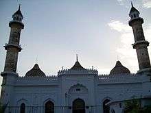
- one of the oldest mosque in the city.

- St. George's Church (YELLOW CHURCH)
- Yellow Church, established in1835 A.D. is the most famous and oldest church of Banda. Rather some records have been found that proved that Christianity was in Banda before 1809 A.D. but Yellow Church is best the symbol of British architecture and religion.
- Yellow Church was built by Churches of India (CNI) for regular prayers of Catholic Englishmen and their families living in Banda during early British Period.
- From last 170 years, Window Pans which was then imported from Belgium have not been replaced.
- During 1857 revolt, no damage was made to the Church. It stands just as it is as it was.
- The roof garders of this Church is made up English Cast Iron.
- The Rust free 170 years old Windowsw Speaks the tale of fine English metallurgical talent.
- The Church is built in Typical Italian Style with Conical Tops and Tall Windows.
- Inside the Campus there are three graves of Norwegian Natives of this Church.
Education
- Government Medical College, Banda is a state medical college in Banda.
- [KCNIT Kali Charan Nigam Institute of technology] is 3 km apart from banda city.
- [Pt.j n PG college], is in main city banda.
- [Banda university of Agriculture and technology] is near about circuit house.
- [Gvot Engineering college], formerly Dr. Bhim Rao Ambedkar Engineering college of Information Technology.is 29 km apart from banda city.
- [Banda Paramedical college], Charity Hospital Kotwali Road, Banda.
Notes
- ↑ "Banda City Census 2011 data". Census 2011 - Census of India.
- ↑ "Banda City Census 2011 data". Census 2011 - Census of India.
- ↑ Chisholm 1911.
- ↑ "Banda City Census 2011 data". Census 2011 - Census of India.
- ↑ "Population Census 2011". Census 2011- Census of India.
- ↑ "Banda City Census 2011 data". Census 2011 - Census of India.
- ↑ "Statement showing Category-wise No.of stations in IR based on Pass. earning of 2011" (PDF). Archived from the original (PDF) on 28 January 2016. Retrieved 15 January 2016.
- ↑ http://www.banda.nic.in/khat.htm
External links
Attribution
-
 Chisholm, Hugh, ed. (1911). "Banda". Encyclopædia Britannica. 3 (11th ed.). Cambridge University Press.
