Baillie-Hamilton Island
 Baillie-Hamilton Island, Nunavut | |
| Geography | |
|---|---|
| Location | Northern Canada |
| Coordinates | 75°53′N 94°35′W / 75.883°N 94.583°WCoordinates: 75°53′N 94°35′W / 75.883°N 94.583°W |
| Archipelago |
Queen Elizabeth Islands Canadian Arctic Archipelago |
| Area | 290 km2 (110 sq mi) |
| Length | 27 km (16.8 mi) |
| Width | 22 km (13.7 mi) |
| Administration | |
|
Canada | |
| Territory | Nunavut |
| Demographics | |
| Population | Uninhabited |
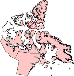
Baillie-Hamilton Island is one of the Canadian arctic islands in Nunavut, Canada. The island is rectangular in shape, 26 to 12 km (16.2 to 7.5 mi), and has an area of 290 km2 (110 sq mi).
Baillie-Hamilton Island is surrounded by larger islands. Devon Island is to the north and the east, across Wellington Channel. Cornwallis Island is to the south, across Maury Channel. Bathurst Island is to the west, across Queens Channel.[1]
References
- ↑ "Baillie-Hamilton Island". oceandots.com. Archived from the original on December 23, 2010. Retrieved 2008-05-06.
External links
- Baillie-Hamilton Island in the Atlas of Canada - Toporama; Natural Resources Canada
This article is issued from Wikipedia - version of the 3/28/2016. The text is available under the Creative Commons Attribution/Share Alike but additional terms may apply for the media files.