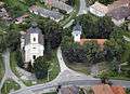
Bánhorváti
| Bánhorváti | |
|---|---|
 Bánhorváti Location of Bánhorváti | |
| Coordinates: 48°13′31″N 20°30′16″E / 48.22525°N 20.50441°ECoordinates: 48°13′31″N 20°30′16″E / 48.22525°N 20.50441°E | |
| Country |
|
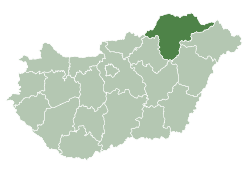
| County | Borsod-Abaúj-Zemplén |
| Area | |
| • Total | 28.47 km2 (10.99 sq mi) |
| Population (2004) | |
| • Total | 1,584 |
| • Density | 55.63/km2 (144.1/sq mi) |
| Time zone | CET (UTC+1) |
| • Summer (DST) | CEST (UTC+2) |
| Postal code | 3642 |
| Area code(s) | 48 |
Bánhorváti is a village in Borsod-Abaúj-Zemplén county, Hungary.

External links
- Official webpage of Bánhorváti
- Street map (Hungarian)
This article is issued from Wikipedia - version of the 2/6/2014. The text is available under the Creative Commons Attribution/Share Alike but additional terms may apply for the media files.
