Avignon – Provence Airport
| Avignon - Provence Airport Aéroport d'Avignon-Provence | |||||||||||||||||||
|---|---|---|---|---|---|---|---|---|---|---|---|---|---|---|---|---|---|---|---|
 | |||||||||||||||||||
| IATA: AVN – ICAO: LFMV | |||||||||||||||||||
| Summary | |||||||||||||||||||
| Airport type | Public | ||||||||||||||||||
| Operator | CCI Vaucluse | ||||||||||||||||||
| Serves | Avignon / Caumont | ||||||||||||||||||
| Location | Montfavet, France | ||||||||||||||||||
| Elevation AMSL | 124 ft / 38 m | ||||||||||||||||||
| Coordinates | 43°54′24″N 004°54′07″E / 43.90667°N 4.90194°ECoordinates: 43°54′24″N 004°54′07″E / 43.90667°N 4.90194°E | ||||||||||||||||||
| Website | www.avignon.aeroport.fr | ||||||||||||||||||
| Maps | |||||||||||||||||||
 Location of Provence-Alpes-Côte d’Azur region in France | |||||||||||||||||||
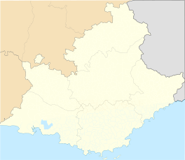 LFMV Location in Provence-Alpes-Côte d'Azur region | |||||||||||||||||||
| Runways | |||||||||||||||||||
| |||||||||||||||||||
|
Source: French AIP[1] | |||||||||||||||||||
Avignon – Provence Airport (French: Aéroport d'Avignon-Provence, IATA: AVN[2], ICAO: LFMV) is an airport located in the village of Montfavet, 8 kilometres (5 mi) southeast of Avignon[1] and 4 kilometres (2 mi) west of Caumont-sur-Durance,[3] in the Vaucluse department of the Provence-Alpes-Côte d'Azur region in France.
Facilities
The airport resides at an elevation of 38 metres (125 ft) above mean sea level. It has one paved runway designated 17/35 which measures 1,880 by 45 metres (6,168 ft × 148 ft). It also has a two parallel grass runways: 17R/35L measuring 700 by 50 metres (2,297 ft × 164 ft) and 17L/35R measuring 250 by 20 metres (820 ft × 66 ft). The shorter grass runway is for use by ultralight aircraft.[1]
Airlines and destinations
| Airlines | Destinations |
|---|---|
| Flybe | Seasonal: Birmingham, Southampton |
Access
Rapid bus connections to several even distant parts of Provence and into Avignon. Some require bus company to be phoned 48 hours before arrival to ensure collection. Car hire kiosk.
References
- 1 2 3 LFMV – Avignon Caumont. AIP from French Service d'information aéronautique, effective 10 November 2016.
- ↑ "IATA Location Code Search (AVN – City: Avignon, Airport: Caumont)". International Air Transport Association. Retrieved 22 December 2012.
- ↑ "Distance and heading from Caumont-sur-Durance (43°53'44"N 04°56'49"E) to LFMV (43°54'24"N 04°54'07"E)". Great Circle Mapper. 22 December 2012.
External links
![]() Media related to Avignon airport at Wikimedia Commons
Media related to Avignon airport at Wikimedia Commons
- Aéroport d'Avignon-Provence (official site) (French)
- Caravelle Guyane (official site) (French)
- Aéroport d'Avignon (Union des Aéroports Français) (French)
- Aeronautical chart for LFMV at SkyVector
- Current weather for LFMV at NOAA/NWS
- Accident history for AVN at Aviation Safety Network
