Austrey
| Austrey | |
 Saint Nicholas parish church, Austrey |
|
 Austrey |
|
| Population | 1,527 (2011 census)[1] |
|---|---|
| OS grid reference | SK294065 |
| – London | 104 miles |
| Civil parish | Austrey |
| District | North Warwickshire |
| Shire county | Warwickshire |
| Region | West Midlands |
| Country | England |
| Sovereign state | United Kingdom |
| Post town | Atherstone |
| Postcode district | CV9 |
| Dialling code | 01827 |
| Police | Warwickshire |
| Fire | Warwickshire |
| Ambulance | West Midlands |
| EU Parliament | West Midlands |
| UK Parliament | North Warwickshire |
| Website | Welcome to Austrey |
|
|
Coordinates: 52°39′21″N 1°33′55″W / 52.655751°N 1.565414°W
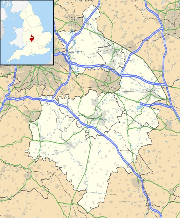
Austrey is a village and civil parish in the North Warwickshire District of Warwickshire, England.[2] and the village lies at the northern extremity of the County.
Location / transport
With a population of over 1,500 inhabitants, Austrey lies in a peaceful, pretty and central location at the far northeastern extremity of North Warwickshire and is also uniquely close to three County Boundaries of Leicestershire (less than a mile to the East), Staffordshire (less than two miles to the North) and Derbyshire (less than four miles to the North East). North Warwickshire Villages of Newton Regis (1 mile), Polesworth (3 miles), Dordon (4 miles), Warton (1.5 miles), No Man's Heath (1.5 miles) and Leicestershire villages of Appleby Parva (1.5 miles), Appleby Magna (2 miles), Twycross (2.5 miles), Norton-juxta-Twycross (1.5 miles), Orton on the Hill (1.5 miles) are the local neighbouring villages.
Austrey is two miles by road from Junction 11 of the M42 / A42 and this Motorway / A Road corridor provides excellent access to many fast transport links:-
Road:- M1 (Jcn 23A – 15 miles (via A42)), M6 Toll (M6 Toll Start /Junction 9 M42 – 15 miles (via M42)), short motorway and A road links to the centre of at least five of the countries major cities:- Birmingham (M42/M6/M38M) – 26 miles, Leicester (A42/A511/A50) – 23 miles, Nottingham (A42/M1/A52) – 30 miles, Derby (A42/A511/A514) – 24 miles and Coventry (A444) – 23 miles. The village is also close to five towns:- Atherstone, home of the administrative offices of the borough of North Warwickshire (6 miles), Tamworth (6.5 miles), Ashby-de-la-Zouch (8 miles), Swadlincote (9 miles) and Nuneaton (11 miles).
Rail:- Birmingham International Station (23 miles), Nottingham East Midlands Parkway (21 miles), Tamworth Railway Station (7 miles), Atherstone Railway Station (7 miles), Polesworth Railway Station (4 miles)
Air:- Birmingham International Airport (23 miles), East Midlands Airport (17 miles), Manchester Airport (83 miles) and London Luton Airport (82 miles).
Bus:- Austrey has the benefit of Arriva Local Bus services and is located on the 785 Bus Route.
Click here to view the Arriva Tamworth Bus Network Map
Click here for Arriva interactive Bus Journey Planner and Timetables
Map:- Austrey highlighted on Google's Interactive / Satellite / Navigation Map
Amenities and facilities
Austrey is a vibrant and active village that has the benefit of a Village Shop / Post Office, C of E Primary School, Pre-School and a Playgroup. The village has two Church's, St Nicholas Church of England that dates back to the 13th century and an early-19th-century Baptist Church. The Bird in Hand 15th Century Thatched Pub and Village Hall (former Parochial School, erected 1850) are both well frequented. The area in and around Austrey has many equestrian (horse) livery yards and stables providing great facilities for equine enthusiasts.
Local Medical Centres / Doctors are Polesworth (3.5 miles) / Dordon (5 miles) or Appleby Magna (2.5 miles) / Measham (5miles) Measham Medical Centre also runs a Community / Shuttle Bus that leaves the village twice a week – Monday 11:30 am and Thursday 9:30 am.
There are a number of Village Clubs and Societies including:- Allotment Society, Archery Group, Art Group, Austrey Rangers Football Club, Bridge Club, Cricket Club, Gardening Society, Golf Society. Neighbourhood Watch, Scout Group, Tennis Club, The WI and a Walking Group.
There are a number of mobile business's that regularly visit the village and these include a Butcher, Fruit and Vegetable van, Dairy Crest Milk, Mobile Library and Fish and Chip van.
Ocado, Sainsbury's and Tesco Direct / Groceries all deliver to the village.
Most of the village properties have the benefit of all mains services / public utilities including gas, water, sewerage, telephone / broadband and electricity.
2011 Census Neighbourhood Statistics can be found here.
Origins of the parish
The village was sometimes spelt 'Alestry'.[3] In the Saxon era Austrey formed part of a great block of seventy or eighty midland vills belonging to Wulfric Spot, the Mercian nobleman who founded Burton Abbey. In Wulfric Spot's will of 1004 Wulfric left Austrey "as it now stands with meat and with men", to one of his thegns who later transferred this part of the vill to the abbey.
After the Norman conquest of England the abbot was forced to share suzertainty with Nigel d'Aubigny, one of the Conqueror's trusted retinue, who was given lands in the parish as part of the spoils of the English defeat. Although he retained two and a half hides in Austrey, the abbot was no longer the principal landowner in the parish. Domesday Book of 1086 records 42 inhabitants in the town.
The monks of Burton took advantage of rising wool prices in the medieval period to sublet their estates for sheep walks. Aubigny lands reverted to Burton Abbey.
In 1538 during the Dissolution of the Monasteries the Abbey surrendered its lands to the Crown.[4] In 1541 the abbey was refounded as a collegiate church and Austrey manor was restored to it.[4] However, in 1545 the collegiate church was dissolved and in 1546 the Crown granted Austrey manor to Sir William Paget.[4] His son Henry Paget inherited Austrey manor in 1563 and still owned it in 1587.[4]
Thereafter the manor was divided into freehold farms that were sold to the wealthier tenants. One of the Austrey manors came into the possession of the Kendalls of Smithsby through marriage with one of Henry Alstre's co-heiresses in 1433. The Kendalls were well-established in Austrey by 1550 and they continued to consolidate their position after this date. The other Austrey manor held by Sir Walter Aston was broken up and divided among his tenants in the early 17th century.
By the Tudor period the village was divided into two separate parts: the original settlement cluster around the church and market cross at Over End and a later extension at Nether End.
The Kendalls, hereditary lords of the manor, declared support for Parliament at the outbreak of the Civil War and became involved with conventicles and dissent in the latter half of the 17th century. Henry Kendall was governor of the parliamentary garrison at Maxstoke from March 1644 to October 1645. The parish provided free quartering for a considerable force of parliamentarians commanded by Colonel Drummond and Sir Thomas Fairfax in 1646.
It is the namesake of Austrey School, Karachi, Pakistan.[5]
Parish church
Austrey had a parish church by 1155.[4] The oldest part of the present Church of England parish church of Saint Nicholas is the Early English Gothic tower,[6] which was built in the middle of the 13th century. The remainder of the church was rebuilt early in the 14th century in the Decorated Gothic style.[6] The nave has a clerestory and is flanked by north and south aisles, each of four bays.[6] The Gothic Revival architect Ewan Christian restored the chancel with new windows in 1844–45.[6]
The bell-tower has a ring of five bells.[7] Three including the tenor were cast by Hugh Watts II[7] of Leicester[8] in 1632.[7] Another was cast by Thomas Rudhall[7] of Gloucester[8] in 1770.[7] The treble was recast by James Barwell[7] of Birmingham[8] in 1911[7] from another 1632 bell by Hugh Watts.[4]
The original church had a leaded roof with castellated wall. Drawings of the church in the pre-Victorian format are held by Birmingham Central Library. In the Victorian era the current pitched roof replaced the original and the porch was added.
St. Nicholas' parish is now part of the Benefice of All Saints, North Warwickshire along with the parishes of Newton Regis, Seckington, Shuttington and Warton.[9]
Settlement
The line of earthworks below the church in the area known as the Bishop's Field are part of a complex of water management ducts and ponds with this area used as water meadows. A quote from George Barwell of Shuttington in 1790 :- "in the parish of Austrey where he was born it has been the custom ever since he can remember (sixty years) to throw the rich waters which are collected in rainy seasons on the common fields lying on the side of the hill above the village, over the meadows which are below it, by means of floodgates and floating trenches." Also in the Bishops Field is a natural spring known as the holy well. The new settlement at the Nether End probably originated with Earl Leofric's original grant to Burton Abbey, which would account for the siting of the monks' farmstead at nearby Bishop's Farm. The medieval pattern of settlement was scythe-shaped with tenements lining the main street running roughly parallel to the ridgeway from Orton to No man's heath. The earliest record of the customary tenants on Sir William Paget's demesne in Tudor times is a partial list of the Austrey copyholders with the number of virgates held by each from a surviving manor court roll. (Paget Court Roll 1646 D(W)1734/J2009 in Staffordshire Record Office All but two of the twelve tenants listed on the demesne in 1546 held a single virgate; one (Richard Cryspe) had a quarter and the other (Elizabeth Clerke) two virgates. Most of these family names are listed in the 17th century attached to Austrey farmers or craftsmen paying for a single hearth in the hearth tax returns.
The two ends of the village had separate water treatment reed beds on the streams just outside the village – the area behind the current sewage pumping system at the South West corner of the village is still owned by Severn Trent Water.
The parish has a Church of England primary school[10] and a bus link to the local secondary school in Polesworth.
Austrey was judged Warwickshire's Calor Village of the Year in September 2008
References
- ↑ "Area: Austrey CP (Parish): 2011 Census". Neighbourhood Statistics. Office for National Statistics. Retrieved 11 June 2013.
- ↑ OS Explorer Map 232 : Nuneaton & Tamworth: (1:25 000) :ISBN 0 319 46404 0
- ↑ The Birmingham and Midland Society for Genealogy and Heraldry: Austrey
- 1 2 3 4 5 6 Salzman, 1947, pages 9–13
- ↑ http://www.ermine.org.uk/schools
- 1 2 3 4 Pevsner & Wedgwood, 1966, page 79
- 1 2 3 4 5 6 7 "Place: Austrey S Nicholas". Dove's Guide for Church Bell Ringers. Retrieved 21 April 2010.
- 1 2 3 "Bell Founders". Dove's Guide for Church Bell Ringers. Retrieved 21 April 2010.
- ↑ All Souls – North Warwickshire Parish Web site
- ↑ Austrey C of E Primary School
Printed sources
- Bridgeman, C.G.O. (1916). The Burton Abbey Twelfth Century Surveys. Staffordshire Historical Commission. pp. 244–247.
- Calendar of Patent Rolls (Philip and Mary). II. p. 135.
- Jeayes, Isaac Herbert (1937). Burton Abbey Charters. Staffordshire Historical Commission. p. 187.
- Pevsner, Nikolaus; Wedgwood, Alexandra (1966). The Buildings of England: Warwickshire. Harmondsworth: Penguin Books. pp. 79–80. ISBN 0-14-0710-31-0.
- Salzman, L.F., ed. (1947). Victoria County History: A History of the County of Warwick, Volume 4. pp. 9–13.
- Warwick County Records: Hearth Tax Returns. II. pp. 2–10.
- Roberts, A. The Farming Inhabitants of Appleby and Austrey, Adelaide University PhD thesis, 1984
External links
| Wikimedia Commons has media related to Austrey. |
- United Kingdom 2011 Local Census
- Austrey Village Web-site
- North Warwickshire Borough Council
- Places of interest near Austrey
- Arriva Local Bus Timetable
- Tamworth Railway Station (7 miles from Austrey)
- Atherstone Railway Station (7 miles from Austrey)
- Birmingham International Rail Station (23 miles from Austrey)
- Nottingham East Midlands Parkway Rail Station (21 miles from Austrey)
- Polesworth Railway Station (less than 4 miles from Austrey)
- Austrey C of E Primary School
- Austrey Pre-School School
- Local Measham Medical Unit (5 miles from Austrey) also Surgery at Appleby Magna (2.5 miles from Austrey)
- Measham Medical Unit Patient Transport Service Community Bus
- Polesworth and Dordon Surgery (3.5 miles and 5 miles from Austrey)
- Austrey Rangers Football Club
- Austrey & Newton Regis Junior Cricket Club
- The Bird in Hand Village Pub
- North Warwickshire Wiki Page
- North West Leicestershire Wiki Page (Austrey lies less than a mile to the west of the North West Leicestershire County Boundary)
- Tamworth / Staffordshire Wiki Page (Austrey lies less than two miles to the south of the Staffordshire County Boundary)
- South Derbyshire Wiki Page (Austrey lies less than four miles to the south west of the South Derbyshire County Boundary)
- Birch Coppice Business Park:- Junction 10 of the M42, with a rail terminal (BIFT) providing access to the UK’s rail infrastructure (6 miles from Austrey)
- MIRA Advanced Engineering Technologies (10 miles from Austrey)
- Hams Hall (Railfreight Terminal / BMW engine plant / Distribution Park) Wiki site (15 miles from Austrey)
- Twycross Zoo (1.5 miles from Austrey)
- The Hollies Twycross 4–8 yrs
- Twycross House School 8–18 yrs
- Austrey in the Domesday Book
- Warwickshire Horse Watch
- Article about the history of Austrey taken from The Warwickshire Village Book
- Article about the history of Austrey listed on the British History Online Web-site
- Article about the history of Austrey listed on the Nuneaton and North Warwickshire Family History Society Web-site
- Austrey via Google Maps for Directions and Aerial / Street Views