Merritt Township, Michigan
| Merritt Township, Michigan | |
|---|---|
| Township | |
 Merritt Township Location within the state of Michigan | |
| Coordinates: 43°31′6″N 83°44′55″W / 43.51833°N 83.74861°WCoordinates: 43°31′6″N 83°44′55″W / 43.51833°N 83.74861°W | |
| Country | United States |
| State | Michigan |
| County | Bay |
| Organized | July 8, 1871 |
| Government | |
| • Supervisor | David Schabel |
| • Clerk | Kathy Bremer |
| Area | |
| • Total | 31.67 sq mi (82.03 km2) |
| • Land | 31.64 sq mi (81.96 km2) |
| • Water | 0.03 sq mi (0.08 km2) |
| Elevation | 587 ft (179 m) |
| Population (2010) | |
| • Total | 1,441 |
| • Density | 45.5/sq mi (17.58/km2) |
| Time zone | Eastern (EST) (UTC-5) |
| • Summer (DST) | EDT (UTC-4) |
| ZIP Code | 48747 |
| Area code(s) | 989 |
| FIPS code | 26-53220[1] |
| GNIS feature ID | 1626729[2] |
Merritt Township is a civil township of Bay County in the U.S. state of Michigan. The township's population was 1,441 as of the 2010 census.[3] It is included in the Bay City Metropolitan Statistical Area.
Communities
There are two unincorporated communities in the township:
- Arn is at the junction of the Huron and Eastern Railway, Kinney Road and Nolet Road.[4] The community was formed around a sawmill. A post office was established here in 1877.[5]
- Munger is located along Munger Road (M-138) from at least Finn Road to west of the Huron and Eastern Railway. (Elevation: 594 ft./181 m.)[6]
History
Merritt Township was organized on July 8, 1871, with the area being detached from Portsmouth Township.[7] On June 6, 1876, the Munger Post Office was opened.[8] A post office opened in Arn on February 28, 1877. On May 15, 1886, the Arn Post Office was closed. The Arn Post Office was reopened on April 20, 1894, lasting until July 30, 1904.[9]
Geography
According to the United States Census Bureau, the township has a total area of 31.7 square miles (82.0 km2), of which 0.031 square miles (0.08 km2), or 0.09%, is water.[3]
Demographics
| Historical population | |||
|---|---|---|---|
| Census | Pop. | %± | |
| 1900 | 1,562 | — | |
| 1960 | 1,762 | — | |
| 1970 | 1,902 | 7.9% | |
| 1980 | 1,676 | −11.9% | |
| 1990 | 1,510 | −9.9% | |
| 2000 | 1,510 | 0.0% | |
| 2010 | 1,441 | −4.6% | |
As of the census[1] of 2010, there were 1,441 people, 554 households, and 430 families residing in the township. The population density was 45.5/sq mi (17.58/km²). There were 554 housing units at an average density of 17.5 per square mile (6.7/km²). The racial makeup of the township was 96.7% White, 0.1% African American, 0.6% Native American, 0.3% Asian, 1.0% from other races, and 1.5% from two or more races Hispanic or Latino of any race were 2.8% of the population.
There were 554 households out of which 37.2% had children under the age of 18 living with them, 64.8% were married couples living together, 7.4% had a female householder with no husband present, and 22.4% were non-families. 18.9% of all households were made up of individuals and 9.2% had someone living alone who was 65 years of age or older. The average household size was 2.60 and the average family size was 2.93.
In the township the population was spread out with 22.4% under the age of 18, 7.6% from 18 to 24, 24.3% from 25 to 44, 30.8% from 45 to 64, and 14.9% who were 65 years of age or older. The median age was 41.7 years. For every 100 females there were 105.3 males. For every 100 females age 18 and over, there were 102.2 males.
The median income for a household in the township was $58,438, and the median income for a family was $65,750. Males had a median income of $53,125 versus $35,750 for females. The per capita income for the township was $29,055. About 6.1% of families and 7.4% of the population were below the poverty line, including 10.1% of those under age 18 and 8.2% of those age 65 or over.
References
Notes
- 1 2 "American FactFinder". United States Census Bureau. Retrieved 2008-01-31.
- ↑ U.S. Geological Survey Geographic Names Information System: Merritt Township, Michigan
- 1 2 "Geographic Identifiers: 2010 Demographic Profile Data (G001): Merritt township, Bay County, Michigan". U.S. Census Bureau, American Factfinder. Retrieved December 26, 2013.
- ↑ U.S. Geological Survey Geographic Names Information System: Arn, Michigan & GNIS in Google Map
- ↑ Romig 1986, p. 29.
- ↑ U.S. Geological Survey Geographic Names Information System: Munger, Michigan & GNIS in Google Map
- ↑ Merritt Township Main Page. Communities. bay-journal.com.
- ↑ U.S. Geological Survey Geographic Names Information System: Munger Post Office, Michigan & GNIS in Google Map
Citation: directoriesUSA. Michigan Business Directory, 2007/2008. 2007/2008. 12-Dec-2007. - ↑ U.S. Geological Survey Geographic Names Information System: Arn Post Office (historical), Michigan & GNIS in Google Map
Citation: Ellis, David M. Michigan Postal History, The Post Offices 1805-1986. 12-Dec-1993.
Sources
- Romig, Walter (October 1, 1986) [1973]. Michigan Place Names: The History of the Founding and the Naming of More Than Five Thousand Past and Present Michigan Communities. Great Lakes Books Series (Paperback). Detroit, Michigan: Wayne State University Press. ISBN 081431838X. ISBN 978-0814318386.
External links
Municipalities and communities of Bay County, Michigan, United States | ||
|---|---|---|
| Cities | 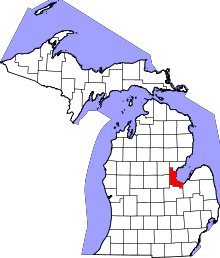 | |
| Charter townships | ||
| General law townships | ||
| Unincorporated communities |
| |
| Footnotes | ‡This populated place also has portions in an adjacent county or counties | |