Arenzville Township, Cass County, Illinois
| Arenzville Township | |
|---|---|
| Township | |
 Location in Cass County | |
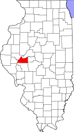 Cass County's location in Illinois | |
| Coordinates: 39°55′14″N 90°20′06″W / 39.92056°N 90.33500°WCoordinates: 39°55′14″N 90°20′06″W / 39.92056°N 90.33500°W | |
| Country | United States |
| State | Illinois |
| County | Cass |
| Established | November 6, 1923 |
| Area | |
| • Total | 36.57 sq mi (94.7 km2) |
| • Land | 36.57 sq mi (94.7 km2) |
| • Water | 0 sq mi (0 km2) 0% |
| Elevation | 581 ft (177 m) |
| Population (2010) | |
| • Total | 760 |
| • Density | 20.8/sq mi (8.0/km2) |
| Time zone | CST (UTC-6) |
| • Summer (DST) | CDT (UTC-5) |
| ZIP codes | 62611, 62618, 62691 |
| GNIS feature ID | 0428598 |
Arenzville Township is one of eleven townships in Cass County, Illinois, USA. As of the 2010 census, its population was 760 and it contained 343 housing units.[1]
Geography
According to the 2010 census, the township has a total area of 36.57 square miles (94.7 km2), all land.[1]
Cities, towns, villages
Cemeteries
The township contains these thirteen cemeteries: Arenzville City East, Arenzville City North, Buck, Green-Krohe, Huffman, James Davis, Jockisch Methodist, Krohe, Monroe, Treadway-Miller, Trinity Lutheran, Tureman and Wiggens.
School districts
- Beardstown Community Unit School District 15
- Triopia Community Unit School District 27
- Virginia Community Unit School District 64
Political districts
- Illinois' 18th congressional district
- State House District 93
- State Senate District 47
References
- "Arenzville Township, Cass County, Illinois". Geographic Names Information System. United States Geological Survey. Retrieved 2010-01-04.
- United States Census Bureau 2007 TIGER/Line Shapefiles
- United States National Atlas
- 1 2 "Population, Housing Units, Area, and Density: 2010 - County -- County Subdivision and Place -- 2010 Census Summary File 1". United States Census. Retrieved 2013-05-28.
External links
 |
Beardstown Township | Bluff Springs Township | Sangamon Valley Township | |
| Hagener Township | |
Virginia Township | ||
| ||||
| | ||||
| |
Municipalities and communities of Cass County, Illinois, United States | ||
|---|---|---|
| Cities | ||
| Villages | ||
| Townships | ||
| Unincorporated communities | ||
| Ghost towns | ||
This article is issued from Wikipedia - version of the 10/17/2016. The text is available under the Creative Commons Attribution/Share Alike but additional terms may apply for the media files.