Aquone, North Carolina
| Aquone, North Carolina | |
|---|---|
| Unincorporated community | |
 Aquone, North Carolina  Aquone, North Carolina | |
| Coordinates: 35°12′26″N 83°37′38″W / 35.20722°N 83.62722°WCoordinates: 35°12′26″N 83°37′38″W / 35.20722°N 83.62722°W | |
| Country | United States |
| State | North Carolina |
| County | Macon |
| Elevation | 3,327 ft (1,014 m) |
| Time zone | Eastern (EST) (UTC-5) |
| • Summer (DST) | EDT (UTC-4) |
| ZIP code | 28781 |
| Area code(s) | 828 |
| GNIS feature ID | 1018838[1] |
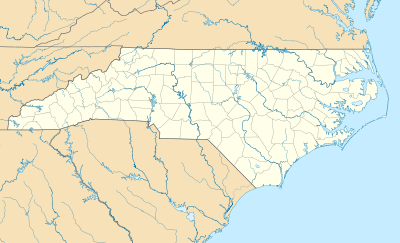
Aquone is an unincorporated community in Macon County, North Carolina, United States. Aquone is located near the Nantahala River 29 miles (47 km) west of Franklin.[1] Aquone had a post office until it closed on January 12, 1996.[2] The community's name comes from the Native American word egwanul'ti, meaning "by the river".[1]
References
- 1 2 3 "Aquone". Geographic Names Information System. United States Geological Survey.
- ↑ "Postmaster Finder - Post Offices by ZIP Code". United States Postal Service. Retrieved March 11, 2013.
Municipalities and communities of Macon County, North Carolina, United States | ||
|---|---|---|
| Towns | 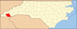 | |
| Unincorporated communities | ||
| Footnotes | ‡This populated place also has portions in an adjacent county or counties | |
This article is issued from Wikipedia - version of the 7/27/2016. The text is available under the Creative Commons Attribution/Share Alike but additional terms may apply for the media files.