Antelope Wells, New Mexico
| Antelope Wells | |
|---|---|
| Unincorporated settlement | |
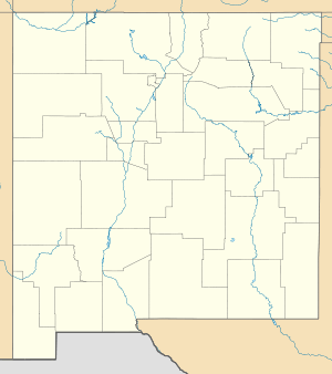 Antelope Wells Location of Antelope Wells in New Mexico | |
| Coordinates: 31°20′56.4″N 108°30′32.4″W / 31.349000°N 108.509000°WCoordinates: 31°20′56.4″N 108°30′32.4″W / 31.349000°N 108.509000°W | |
| Country | United States |
| U.S. state | New Mexico |
| County | Hidalgo |
| Elevation[1] | 4,665 ft (1,422 m) |
| Population (1981)[2] | |
| • Total | 2 |
| Time zone | Mountain Standard Time (MST) (UTC-7) |
| • Summer (DST) | Mountain Daylight Time (MDT) (UTC-6) |
| Area code(s) | 575 |
Antelope Wells is a small unincorporated community in Hidalgo County, New Mexico, United States. The community is located along the Mexico – United States border, in the New Mexico Bootheel region, located across the border from the small settlement of El Berrendo, Chihuahua, Mexico. Despite its name, there are neither antelope nor wells in the area. The name comes from an old ranch, located 2.5 miles (4.0 km) north of the current community.[3] The only inhabitants of the community are United States Customs and Border Protection employees.[3]
Antelope Wells is the southernmost settlement of New Mexico, situated in the region commonly known as the Bootheel of New Mexico.[4] It is the smallest and least-used border crossing of the 43 ports of entry along the border with Mexico. The crossing, which is open solely for non-commercial traffic, is open every day from 8:00 AM to 4:00 PM.[4]
The port was established by Ulysses S. Grant in 1872 and has been staffed since 1928.[3] In 1981 the community had a population of 2, living in trailers behind the customs station, and averaged three people entering per day.[2] In 2005 just 93 pedestrians crossed over the border in the community, which consisted of just four buildings: the port of entry building, two houses and a trailer.[3] Including domestic and international travelers, fewer than 500 buses and privately owned vehicles pass through the community each month, though traffic has been increasing as of 2006 with more international shuttle van service.[3] Despite its low usage, there is no move to close the port, which is the only port between Douglas, Arizona, and Columbus, New Mexico, and provides the most direct route from the United States to the Sierra Madre Occidental.[3]
Recreation
Antelope Wells is located on New Mexico State Highway 81, which links it with Interstate 10 and New Mexico State Road 9.[5] Antelope Wells was the official southern terminus of the 3,100-mile (5,000 km) long Continental Divide Trail until it was relocated to Crazy Cook, east of the nearby Hatchet Mountains in the mid-1990s[6] and remains the location of the 2,745-mile (4,418 km) long Great Divide Mountain Bike Route.[7]
See also
Notes
- ↑ "Antelope Wells, New Mexico NM Community Profile / Hidalgo County, NM Data". HTL, Inc. Retrieved December 8, 2010.
- 1 2 "A Big Day for Antelope Wells, N.M., Pop. 2". The New York Times. Retrieved January 24, 2007.
- 1 2 3 4 5 6 Innes, Stephanie (September 20, 2006). "Quiet N.M. road leads to least-used legal crossing". Arizona Daily Star. Retrieved July 14, 2012.
- 1 2 "Antelope Wells POE". New Mexico Border Authority. Archived from the original on 27 November 2010. Retrieved December 8, 2010.
- ↑ Google (December 8, 2010). "NM 31" (Map). Google Maps. Google. Retrieved December 8, 2010.
- ↑ http://www.continentaldividetrail.org/
- ↑ http://www.adventurecycling.org/routes-and-maps/adventure-cycling-route-network/great-divide-mountain-bike-route/
External links
- Map of port of entry on the New Mexico Border Authority website
Municipalities and communities of Hidalgo County, New Mexico, United States | ||
|---|---|---|
| City |  | |
| Village | ||
| CDPs | ||
| Other unincorporated communities | ||
| Ghost towns |
| |