Hundred of Andersfield
| Andersfield | |
|---|---|
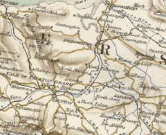 Map of the Hundred | |
| Area | |
| 10,000 acres (4,000 ha) | |
| History | |
| Status | Hundred |
| Subdivisions | |
| • Type | Parishes |
| • Units | Broomfield, Chilton Trinity, Creech St Michael, Durleigh, Enmore, Goathurst, Lyng and the Petherton limit tithing of North Petherton |
The Hundred of Andersfield is one of the 40 historical Hundreds in the ceremonial county of Somerset, England, dating from before the Norman conquest during the Anglo-Saxon era although exact dates are unknown.
Area
Andersfield covered an area of approximately 10,000 acres (4,000 ha) and had over 500 houses according to the 1851 census.[1] It contained the parishes of Broomfield, Chilton Trinity, Creech St Michael, Durleigh, Enmore, Goathurst, Lyng[2] and, from the 1670s, the Petherton limit tithing of North Petherton.[3][4]
References
- ↑ "Andersfield Hundred Housing & Acreage". A Vision of Britain Through Time. Retrieved 10 September 2011.
- ↑ "Andersfield hundred through time". A Vision of Britain Through Time. Retrieved 10 September 2011.
- ↑ R W Dunning, C R Elrington (Editors), A P Baggs, M C Siraut (1992). "North Petherton: Local government". A History of the County of Somerset: Volume 6: Andersfield, Cannington, and North Petherton Hundreds (Bridgwater and neighbouring parishes). Institute of Historical Research. Retrieved 13 October 2011.
- ↑ John Collinson; Edmund Rack (1791). The history and antiquities of the county of Somerset. R. Cruttwell. p. 71. Retrieved 30 April 2012.
External links
This article is issued from Wikipedia - version of the 11/6/2016. The text is available under the Creative Commons Attribution/Share Alike but additional terms may apply for the media files.