Sida District
| Sida สีดา | |
|---|---|
| Amphoe | |
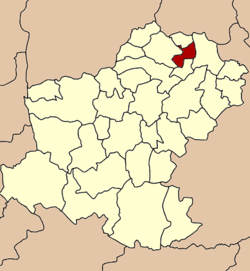 Amphoe location in Nakhon Ratchasima Province | |
| Coordinates: 15°32′33″N 102°33′57″E / 15.54250°N 102.56583°ECoordinates: 15°32′33″N 102°33′57″E / 15.54250°N 102.56583°E | |
| Country |
|
| Province | Nakhon Ratchasima |
| Seat | Sida |
| Area | |
| • Total | 170.1 km2 (65.7 sq mi) |
| Population (2000) | |
| • Total | 24,540 |
| • Density | 144.3/km2 (374/sq mi) |
| Time zone | THA (UTC+7) |
| Postal code | 30430, 30120 |
| Geocode | 3031 |
Sida (Thai: สีดา) is a district (amphoe) in the northeastern part of Nakhon Ratchasima Province, northeastern Thailand.
History
The area of Sida was separated from Bua Yai district and made a minor district on July 1, 1997.[1]
Following a decision of the Thai government on May 15, 2007, all of the 81 minor districts were to be upgraded to full districts.[2] With the publishing in the Royal Gazette on August 24 the upgrade became official.[3]
Geography
Neighboring districts are (from the north clockwise) Bua Lai, Prathai, Non Daeng and Bua Yai.
Administration
The district is subdivided into 5 subdistricts (tambon), which are further subdivided into 50 villages (muban). Sida is also the only township (thesaban tambon) and covers parts of the tambon Sida, Phon Thong and Sam Mueang.
| 1. | Sida | สีดา | |
| 2. | Phon Thong | โพนทอง | |
| 3. | Non Pradu | โนนประดู่ | |
| 4. | Sam Mueang | สามเมือง | |
| 5. | Nong Tat Yai | หนองตาดใหญ่ |
References
- ↑ ประกาศกระทรวงมหาดไทย เรื่อง แบ่งเขตท้องที่อำเภอบัวใหญ่ จังหวัดนครราชสีมา ตั้งเป็นกิ่งอำเภอสีดา (PDF). Royal Gazette (in Thai). 114 (Special 51 ง): 10. June 25, 1997.
- ↑ แถลงผลการประชุม ครม. ประจำวันที่ 15 พ.ค. 2550 (in Thai). Manager Online.
- ↑ พระราชกฤษฎีกาตั้งอำเภอฆ้องชัย...และอำเภอเหล่าเสือโก้ก พ.ศ. ๒๕๕๐ (PDF). Royal Gazette (in Thai). 124 (46 ก): 14–21. August 24, 2007.