Amboy Township, Lee County, Illinois
| Amboy Township | |
|---|---|
| Township | |
 Location in Lee County | |
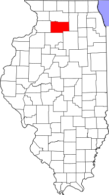 Lee County's location in Illinois | |
| Coordinates: 41°42′55″N 89°20′32″W / 41.71528°N 89.34222°WCoordinates: 41°42′55″N 89°20′32″W / 41.71528°N 89.34222°W | |
| Country |
|
| State |
|
| County | Lee |
| Established | November 6, 1849 |
| Government | |
| • Supervisor | Dennis McCoy |
| Area | |
| • Total | 35.43 sq mi (91.8 km2) |
| • Land | 35.25 sq mi (91.3 km2) |
| • Water | 0.17 sq mi (0.4 km2) 0.48% |
| Elevation | 755 ft (230 m) |
| Population (2010) | |
| • Total | 3,108 |
| • Density | 88.2/sq mi (34.1/km2) |
| Time zone | CST (UTC-6) |
| • Summer (DST) | CDT (UTC-5) |
| ZIP codes | 61021, 61310 |
| GNIS feature ID | 0428587 |
Amboy Township is one of twenty-two townships in Lee County, Illinois, USA. As of the 2010 census, its population was 3,108 and it contained 1,360 housing units.[1]
Geography
According to the 2010 census, the township has a total area of 35.43 square miles (91.8 km2), of which 35.25 square miles (91.3 km2) (or 99.49%) is land and 0.17 square miles (0.44 km2) (or 0.48%) is water.[1]
Cities, towns, villages
- Amboy (east three-quarters)
Unincorporated towns
(This list is based on USGS data and may include former settlements.)
Extinct towns
(These towns are listed as "historical" by the USGS.)
Cemeteries
The township contains these four cemeteries: Binghampton, Mormon, Prairie Repose and Saint Patrick's.
Airports and landing strips
- Taylor Airport
School districts
- Amboy Community Unit School District 272
- Ashton Community Unit School District 275
Political districts
- Illinois's 14th congressional district
- State House District 90
- State Senate District 45
References
- "Amboy Township, Lee County, Illinois". Geographic Names Information System. United States Geological Survey. Retrieved 2010-11-19.
- United States Census Bureau 2009 TIGER/Line Shapefiles
- United States National Atlas
- 1 2 "Population, Housing Units, Area, and Density: 2010 - County -- County Subdivision and Place -- 2010 Census Summary File 1". United States Census. Retrieved 2013-05-28.
External links
 |
South Dixon Township | Franklin Grove Township Nachusa Township |
Bradford Township | |
| Marion Township | |
Lee Center Township | ||
| ||||
| | ||||
| East Grove Township | May Township | Sublette Township |
Municipalities and communities of Lee County, Illinois, United States | ||
|---|---|---|
| Cities | ||
| Villages | ||
| Townships | ||
| Unincorporated communities |
| |
| Footnotes | ‡This populated place also has portions in an adjacent county or counties | |
This article is issued from Wikipedia - version of the 10/11/2016. The text is available under the Creative Commons Attribution/Share Alike but additional terms may apply for the media files.