Adin, California
| Adin | |
|---|---|
| census-designated place | |
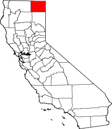
 Adin Location in California | |
| Coordinates: 41°11′38″N 120°56′43″W / 41.19389°N 120.94528°WCoordinates: 41°11′38″N 120°56′43″W / 41.19389°N 120.94528°W | |
| Country |
|
| State |
|
| County | Modoc |
| Area[1] | |
| • Total | 3.443 sq mi (8.918 km2) |
| • Land | 3.437 sq mi (8.902 km2) |
| • Water | 0.006 sq mi (0.016 km2) 0.18% |
| Elevation[2] | 4,203 ft (1,281 m) |
| Population (2010) | |
| • Total | 272 |
| • Density | 79/sq mi (31/km2) |
| Time zone | Pacific (PST) (UTC-8) |
| • Summer (DST) | PDT (UTC-7) |
| GNIS feature ID | 256119; 2582927 |
| U.S. Geological Survey Geographic Names Information System: Adin, California; U.S. Geological Survey Geographic Names Information System: Adin, California | |
Adin (formerly, Adinville and Aidenville) is a census-designated place[3] in Modoc County, California.[2] It is located 29 miles (47 km) southwest of Alturas,[4] at an elevation of 4203 feet (1281 m).[2] The population was 272 at the 2010 census.
History
Adin, the first town in Modoc County west of the Warner Mountains, was founded in 1869 by Adin McDowell as the supply point for the mining town of Hayden in northern Lassen County, and was named for him in 1870.[5][6] The Aidenville post office opened in 1871, and changed its name to Adin in 1876.[4]
A 1913 book described Adin as having a population of 200, and as the chief town of the Big Valley.[7] It became a sawmill town in the mid-1930s when the Edgerton Brothers Mill moved into town, from the Adin Mountains.[8]
The town suffered devastating fires in 1904, 1915, 1931, and finally in 1939. Following the 1939 fire, the town organized a volunteer fire brigade.[9]
Geography
According to the United States Census Bureau, the CDP covers an area of 3.4 square miles (8.9 km²), 99.82% of it land, 0.18% of it water.
Climate
This region experiences warm (but not hot) and dry summers, with no average monthly temperatures above 71.6 °F. According to the Köppen Climate Classification system, Adin has a warm-summer Mediterranean climate, abbreviated "Csb" on climate maps.[10]
Demographics
2010
The 2010 United States Census[11] reported that Adin had a population of 272. The population density was 79.0 people per square mile (30.5/km²). The racial makeup of Adin was 240 (88.2%) White, 2 (0.7%) African American, 8 (2.9%) Native American, 0 (0.0%) Asian, 0 (0.0%) Pacific Islander, 9 (3.3%) from other races, and 13 (4.8%) from two or more races. Hispanic or Latino of any race were 32 persons (11.8%).
The Census reported that 269 people (98.9% of the population) lived in households, 3 (1.1%) lived in non-institutionalized group quarters, and 0 (0%) were institutionalized.
There were 124 households, out of which 28 (22.6%) had children under the age of 18 living in them, 49 (39.5%) were opposite-sex married couples living together, 14 (11.3%) had a female householder with no husband present, 8 (6.5%) had a male householder with no wife present. There were 10 (8.1%) unmarried opposite-sex partnerships, and 0 (0%) same-sex married couples or partnerships. 45 households (36.3%) were made up of individuals and 19 (15.3%) had someone living alone who was 65 years of age or older. The average household size was 2.17. There were 71 families (57.3% of all households); the average family size was 2.82.
The population was spread out with 57 people (21.0%) under the age of 18, 19 people (7.0%) aged 18 to 24, 52 people (19.1%) aged 25 to 44, 93 people (34.2%) aged 45 to 64, and 51 people (18.8%) who were 65 years of age or older. The median age was 47.3 years. For every 100 females there were 91.5 males. For every 100 females age 18 and over, there were 85.3 males.
There were 144 housing units at an average density of 41.8 per square mile (16.1/km²), of which 77 (62.1%) were owner-occupied, and 47 (37.9%) were occupied by renters. The homeowner vacancy rate was 1.3%; the rental vacancy rate was 2.1%. 163 people (59.9% of the population) lived in owner-occupied housing units and 106 people (39.0%) lived in rental housing units.
2000
In the 2000 census, the United States did not define a census-designated place called Adin, but it did define a Zip Code Tabulation Area (ZCTA), 96006. Because Adin is contained within this ZCTA, it is possible to obtain Census data from the United States 2000 Census for the area even though data for "Adin" is unavailable. Adin is located within area code 530.
As of the census of 2000, there were 599 people, 257 households, and 178 families residing in the ZCTA of 96006. The racial makeup of the town was 93.7% White, 0.3% Black or African American, 1.5% Native American, 0.2% Asian, 2.7% from other races, and 1.7% from two or more races. 5.7% of the population were Hispanic or Latino of any race.
There are 257 households out of which 26.8% have children under the age of 18 living with them, 59.5% are married couples living together, 6.6% have a female householder with no husband present, and 30.7% are non-families. 24.9% of all households are made up of individuals and 8.6% have someone living alone who is 65 years of age or older. The average household size is 2.33 and the average family size is 2.79. Adin has a general store.
The median income for a household in the town is $32,250, and the median income for a family is $34,063. Males have a median income of $36,250 versus $30,000 for females. The per capita income for the town is $20,642. 17.2% of the population and 11.3% of families are below the poverty line. Out of the total population, 27.7% of those under the age of 18 and 7.5% of those 65 and older are living below the poverty line.
Politics
In the state legislature, Adin is in the 1st Senate District, represented by Republican Ted Gaines,[12] and the 1st Assembly District, represented by Republican Brian Dahle.[13]
Federally, Adin is in California's 1st congressional district, represented by Republican Doug LaMalfa.[14]
References
- ↑ U.S. Census Archived 2012-01-24 at WebCite
- 1 2 3 U.S. Geological Survey Geographic Names Information System: Adin, California
- ↑ U.S. Geological Survey Geographic Names Information System: Adin, California
- 1 2 Durham, David L. (1998). California's Geographic Names: A Gazetteer of Historic and Modern Names of the State. Clovis, Calif.: Word Dancer Press. p. 351. ISBN 1-884995-14-4.
- ↑ Gudde, Erwin; William Bright (2004). California Place Names (Fourth ed.). University of California Press. p. 3. ISBN 0-520-24217-3.
- ↑ Pease, Robert W. (1965). Modoc County; University of California Publications in Geography, Volume 17. Berkeley and Los Angeles: University of California Press. pp. 84–85.
- ↑ Drury, Wells; Aubrey Drury (1913). California tourist guide and handbook: authentic description of routes of travel and points of interest in California. Western guidebook company. p. 248. Retrieved 2009-06-16.
- ↑ Pease, Robert W. (1965). Modoc County; University of California Publications in Geography, Volume 17. Berkeley and Los Angeles: University of California Press. p. 127.
- ↑ Kean, David. W (1993). Wide Places in the California Road - Volume 2 of 4: The Mountain Counties. Sunnyvale, CA: Concord Press. p. 10. ISBN 1-884261-01-9.
- ↑ Climate Summary for Adin, California
- ↑ "2010 Census Interactive Population Search: CA - Adin CDP". U.S. Census Bureau. Retrieved July 12, 2014.
- ↑ "Senators". State of California. Retrieved March 10, 2013.
- ↑ "Members Assembly". State of California. Retrieved March 2, 2013.
- ↑ "California's 1st Congressional District - Representatives & District Map". Civic Impulse, LLC. Retrieved March 2, 2013.