Škocjan, Koper
| Škocjan Sveti Tomaž (until 1955), San Canziano (Italian) | |
|---|---|
| Village | |
|
1903 postcard of Škocjan | |
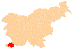
 Škocjan Location in Slovenia | |
| Coordinates: 45°31′52.7″N 13°46′30.38″E / 45.531306°N 13.7751056°ECoordinates: 45°31′52.7″N 13°46′30.38″E / 45.531306°N 13.7751056°E | |
| Country |
|
| Traditional region | Littoral |
| Statistical region | Coastal–Karst |
| Municipality | Koper |
| Area | |
| • Total | 2.65 km2 (1.02 sq mi) |
| Elevation | 48.2 m (158.1 ft) |
| Population (2002) | |
| • Total | 477 |
| [1] | |

Škocjan (pronounced [ˈʃkɔːtsjan]) is a settlement on the outskirts of Koper in the Littoral region of Slovenia.[2]
Name
The name of the settlement was changed from Sveti Tomaž (literally, 'Saint Thomas') to Škocjan in 1955. The name was changed on the basis of the 1948 Law on Names of Settlements and Designations of Squares, Streets, and Buildings as part of efforts by Slovenia's postwar communist government to remove religious elements from toponyms.[3][4][5]
References
- ↑ Statistical Office of the Republic of Slovenia
- ↑ Koper municipal site
- ↑ Spremembe naselij 1948–95. 1996. Database. Ljubljana: Geografski inštitut ZRC SAZU, DZS.
- ↑ Premk, F. 2004. Slovenska versko-krščanska terminologija v zemljepisnih imenih in spremembe za čas 1921–1967/68. Besedoslovne lastnosti slovenskega jezika: slovenska zemljepisna imena. Ljubljana: Slavistično društvo Slovenije, pp. 113–132.
- ↑ Urbanc, Mimi, & Matej Gabrovec. 2005. Krajevna imena: poligon za dokazovanje moči in odraz lokalne identitete. Geografski vestnik 77(2): 25–43.
External links

This article is issued from Wikipedia - version of the 11/19/2015. The text is available under the Creative Commons Attribution/Share Alike but additional terms may apply for the media files.