Ølfjellet
| Ølfjellet | |
|---|---|
| Uvbágájsse | |
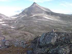 Ølfjellet from Addjektinden ridge | |
| Highest point | |
| Elevation | 1,751 m (5,745 ft) |
| Prominence | 1,073 m (3,520 ft) [1] |
| Coordinates | 66°47′20″N 15°15′04″E / 66.78889°N 15.25111°ECoordinates: 66°47′20″N 15°15′04″E / 66.78889°N 15.25111°E |
| Geography | |
 Ølfjellet Location in Nordland | |
| Location | Saltdal, Nordland, Norway |
| Parent range | Saltfjellet |
| Topo map | 2128 IV Junkerdal (north) and 2128 III Lønsdal (south) |
Ølfjellet (Lule Sami: Uvbágájsse) is the highest mountain in the Saltfjellet mountain range in Nordland county, Norway. It is located in the municipality of Saltdal roughly halfway between the lakes Nordre Bjøllåvatnet and Kjemåvatnet. The village of Lønsdal lies about 1.6 kilometres (0.99 mi) southeast of the mountain.
The mountain has two peaks, the highest being 1,751 metres (5,745 ft). Approximately 1.5 kilometres (0.93 mi) north of the highest peak is the other peak with height of 1,651 metres (5,417 ft).
Name
The first element is øl which means "haze" (not "beer"), and the last element is the finite form of fjell which means "mountain".
References
This article is issued from Wikipedia - version of the 5/30/2015. The text is available under the Creative Commons Attribution/Share Alike but additional terms may apply for the media files.