Águas Mornas
| Águas Mornas | |||
|---|---|---|---|
| municipality | |||
|
Church of Águas Mornas and town square Evaldo Carlos Lehmkuhl | |||
| |||
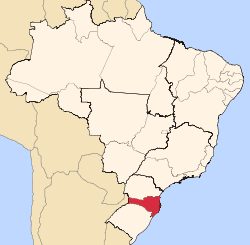
 Location of Águas Mornas | |||
 Águas Mornas Location of Águas Mornas | |||
| Coordinates: 27°41′38″S 48°49′26″W / 27.69389°S 48.82389°WCoordinates: 27°41′38″S 48°49′26″W / 27.69389°S 48.82389°W | |||
| Country |
| ||
| Region | South | ||
| State |
| ||
| Founded | December 29, 1961 | ||
| Government | |||
| • Mayor | Elmar Antônio Thiesen (PFL) | ||
| Area | |||
| • Total | 360.757 km2 (139.289 sq mi) | ||
| Elevation | 70 m (230 ft) | ||
| Population (2009) | |||
| • Total | 4,503 | ||
| • Density | 12.4/km2 (32/sq mi) | ||
| Time zone | UTC-3 (UTC-3) | ||
| • Summer (DST) | UTC-2 (UTC-2) | ||
| HDI (2000) | 0.783 | ||
| Website | www.aguasmornas.sc.gov.br | ||


Águas Mornas is a Brazilian municipality in the state of Santa Catarina.
The municipality contains part of the Rio das Lontras Private Natural Heritage Reserve, a fully protected area of montane rainforest in the Atlantic Forest biome.[1] It also contains part of the 84,130 hectares (207,900 acres) Serra do Tabuleiro State Park, a protected area created in 1975. The lushly-forested park protects the sources of the Vargem do Braço, Cubatão and D'Una rivers, which supply most of the drinking water for greater Florianópolis and the south coast region.[2]
References
- ↑ RPPN Reserve Ecologica Rio das Lontras (in Portuguese), Associação dos Proprietários de Reservas Particulares do Patrimônio Natural de Santa Catarina, retrieved 2016-05-18
- ↑ Parque Estadual da Serra do Tabuleiro (in Portuguese), FATMA: Fundação do meio Ambiente, retrieved 2016-06-11
| |
| Florianópolis | |
| Tabuleiro | |
| Tijucas | |
Capital: Florianópolis | |||||||||||||||
| Grande Florianópolis |
|  | |||||||||||||
| Norte Catarinense |
| ||||||||||||||
| Oeste Catarinense | |||||||||||||||
| Serrana |
| ||||||||||||||
| Sul Catarinense |
| ||||||||||||||
| Vale do Itajai |
| ||||||||||||||
This article is issued from Wikipedia - version of the 6/11/2016. The text is available under the Creative Commons Attribution/Share Alike but additional terms may apply for the media files.